Propeller A single, cloud-powered map that brings your plans, data, and team together Map Measure + manage
DirtMate Real-time machine guidance for precise, efficient earthmoving AeroPoints High-accuracy ground points for faster, reliable surveys Hardware integrations Connect Propeller with your existing tools seamlessly
Propeller PPK Survey-grade positioning for trusted drone measurements Photogrammetry Turn aerial images into detailed 3D maps LiDAR Capture precise, high-density data for any terrain
Propeller A single, cloud-powered map that brings your plans, data, and team together
Construction Mining Aggregates Waste management Survey + engineering
Site checks + analytics Volume calculations Progress tracking Machine telematics Field communication + collaboration Subcontractor management Machine productivity
Community Training + support
Blog Knowledge Base
Careers About Us
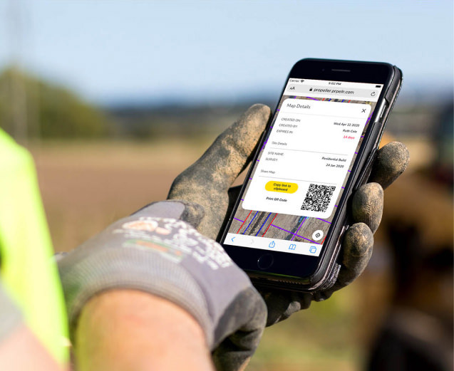
There are two ways you can do it. You can either click the link below, or wait for an email to appear in your inbox and go from there. It’s that easy.