
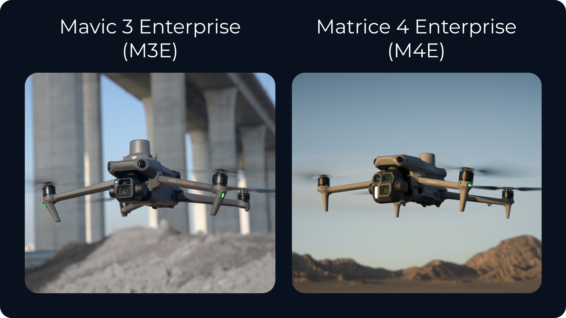
When you’re investing in a drone for site surveys and mapping, the right choice comes down to one thing: how well it fits your workflow. Whether you’re a seasoned surveyor or just starting with drone data, that decision often comes down to the Mavic 3 Enterprise (M3E) or the Matrice 4 Enterprise (M4E).
Both drones are built for geospatial data capture and work well with platforms like Propeller. But depending on the size and complexity of your site, the differences between them could have a big impact on your daily operations.
This breakdown will help you weigh the tradeoffs and choose the drone that’s right for your work.
What they have in common
- Survey-grade accuracy
Capture crisp, reliable imagery with a 20MP mechanical shutter camera that pairs seamlessly with ground control or PPK for high-accuracy results. - Portability and quick deployment
These aren’t bulky, complex rigs. They come ready for transport in a hard-shell case and can be airborne in just a few minutes. - Propeller PPK compatibility
Both the M3E and M4E pair seamlessly with Propeller’s PPK workflow f and platform. Capture high-accuracy surveys and then analyze them on the map.
Where the M4E takes it further
While the M3E covers the essentials, the M4E delivers added performance, which makes it especially useful for teams flying larger or more complex worksites.
- Dual-camera system
The M4E includes a secondary 48MP telephoto camera with up to 16x zoom. While not used for mapping, this camera adds real value for inspection work and tight site documentation, helping you capture detail from a safe distance. - Longer flight time
The M4E can stay in the air for up to 35 minutes, compared to the M3E’s 27 minutes. That difference can help you complete sections of your site without landing, swapping batteries, and re-plotting your flight path. - Faster top speed
With a top speed of 21 m/s versus the M3E’s 15 m/s, the M4E is noticeably quicker. If you’re surveying large areas, that speed helps reduce time in the air without compromising coverage. - Improved AI and automation
The M4E features smarter onboard AI with the new RC Plus controller, which improves flight path optimization and enables more advanced autonomous capture routines. It’s designed to reduce manual input and increase repeatability across flights.
What about limitations?
Neither drone is waterproof. You’ll still need to plan around the weather. And while the M4E outperforms the M3E in several areas, it’s still not a fully modular platform like the Matrice 300/350 series. If your work requires payload flexibility or lidar, those heavy-duty drones remain your best bet.
So, which one fits your site?
 Choose the M3E if:
You’re flying straightforward mapping missions, smaller-scale surveys, or routine inspection flights. It’s a dependable, cost-effective choice for teams that don’t need extended time in the air.
 Choose the M4E if:
You’re managing larger, more complex sites or want the ability to fly longer and rely more on automated capture. It’s a strong upgrade when your work demands greater speed, detail, and autonomy without stepping up to an industrial-class drone.
Bottom line
The M3E is a solid workhorse for survey teams focused on simplicity and efficiency. The M4E brings more precision to sites where time, distance, and detail matter more.
At Propeller, we’ve helped thousands of teams turn drone flights into decision-ready site maps. If you’re unsure which drone is the right fit, we’re happy to help you find the best match for your crew, your workflow, and your site demands.


