Beyond mapping tools: Why earthwork teams need a production command center
There’s a widespread assumption in earthwork that better aerial data means better project control. It’s understandable but it’s also wrong.
Mapping and production intelligence aren’t the same discipline. One tells you what the ground looks like. The other tells you whether the work is on track, where it’s slipping, and what it’s going to cost you if you don’t act today.
Most teams don’t realize they’re missing the second one until a milestone slips or a payment gets disputed.
What mapping tools are built for
Great for documentation. Not built for production.
Let’s be clear: tools like DroneDeploy and Pix4D are genuinely capable. They’re well-engineered, widely adopted, and they do exactly what they were designed to do.
They’re just not built around the earthwork production cycle.
Here’s what they do well:
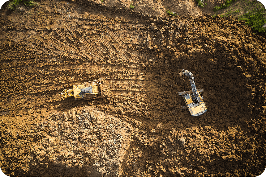
- High-quality aerial imagery and orthophoto outputs
- Point cloud generation and 3D model visualization
- General site documentation for planning, reporting, and compliance
Where mapping stops and production intelligence starts
The questions that actually drive earthwork.
A project manager running an active earthwork site isn’t asking “what does this site look like?” They’re asking a different set of questions entirely, and they’re asking them every day:
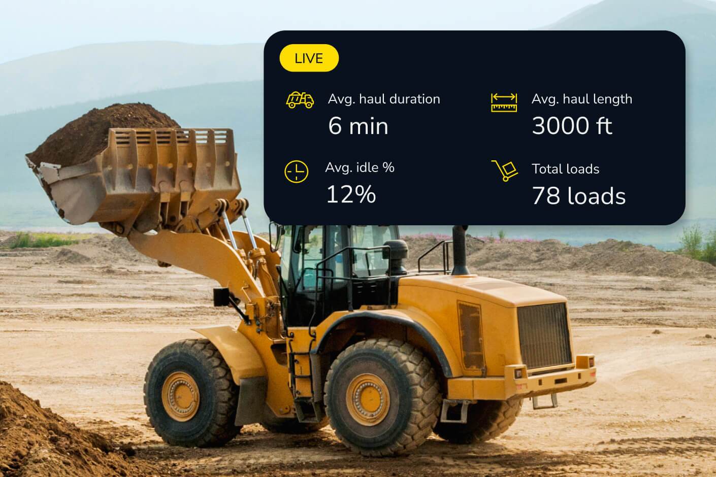
- How much material moved today, and are we on track against the schedule?
- Where is production slipping, and which machines are underutilized?
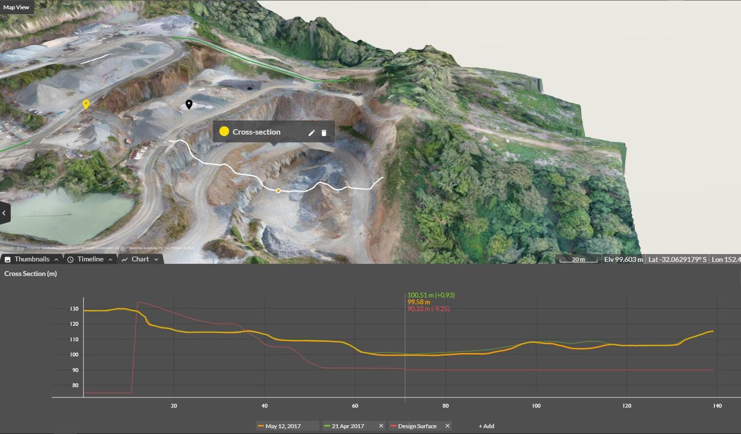
- Does the current surface match the design, and by how much?
- Can I verify subcontractor progress before releasing payment?
These aren’t edge-case questions. They’re the questions that determine whether a project finishes on time, on budget, and without a legal headache.
The production intelligence difference
Built for the earthwork production cycle.
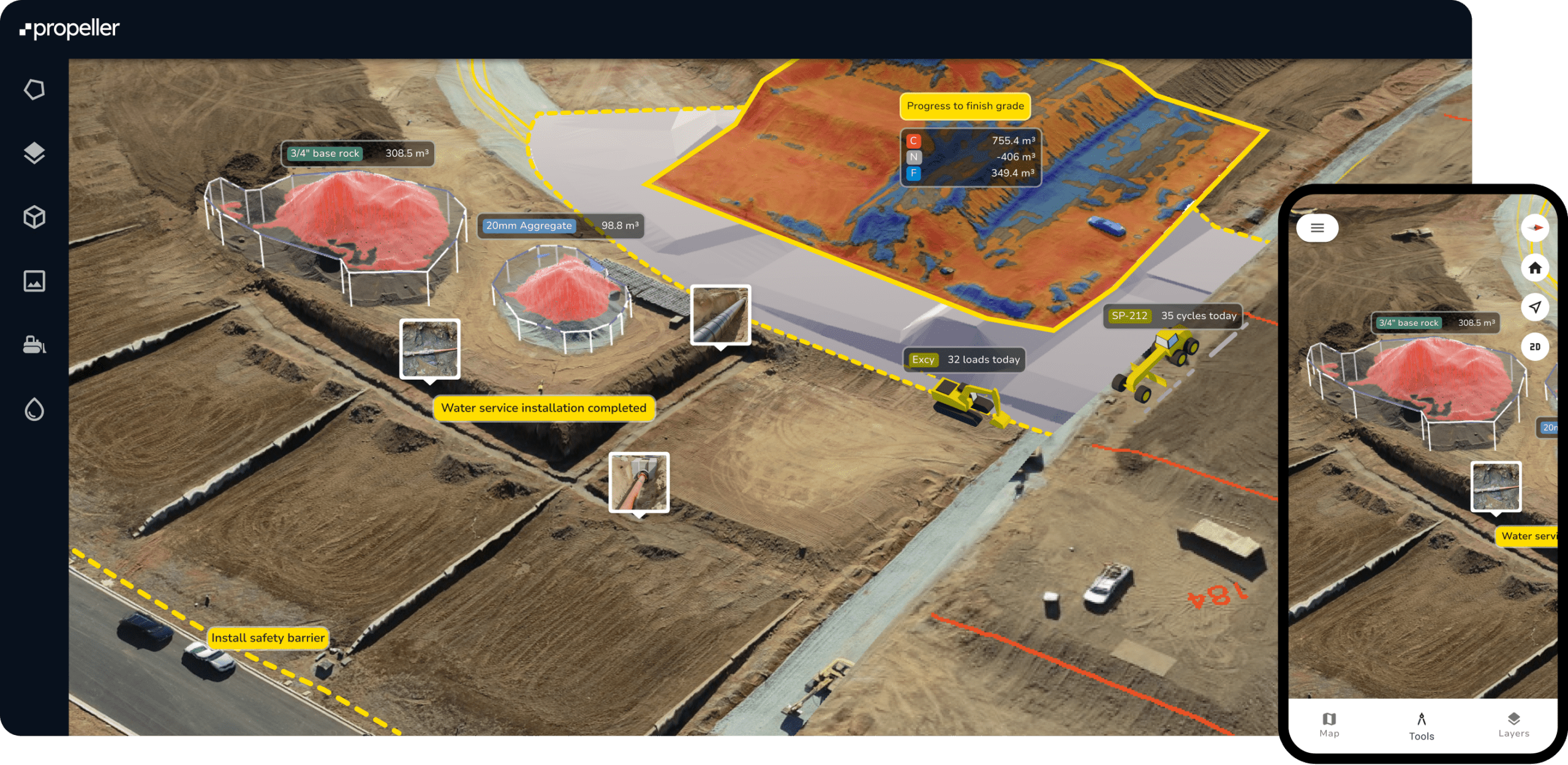
Propeller is designed from the ground up for the earthwork production cycle. That means every capability on the platform is oriented around one thing: helping teams make faster, more confident decisions about work in progress.
Here’s what that looks like in practice:
- Cut/fill tracking against design: Compare current surface to design in real time to catch issues early.
- Machine telematics on the same map: See machine activity and survey data together for full visibility.
- Daily surface updates between flights: Maintain continuous visibility even between drone captures.
- Verifiable record for dispute resolution: Track timestamped surface changes for accountability.
- Reporting built for daily standups: Automated reports deliver production insights without manual work.
The right tool for the job
Documentation vs production.
This isn’t about which mapping tool is better. It’s about whether you’re using a mapping tool when what you actually need is something different.
- Built for documentation: aerial imagery, point clouds, general site capture
- Built for production: cut/fill tracking, telematics, daily updates, automated reporting
One map. Total confidence.
A live command center for earthwork.
The earthwork teams moving fastest right now aren’t the ones with the most data. They’re the ones whose data actually answers the questions that drive daily decisions.
Propeller brings machine telematics, survey data, and site maps together in one place so that project managers, survey teams, and crews can always work from the same truth.
Not a snapshot. Not a model. A live, continuously updated command center for everything happening on site.
The question was never which mapping tool to use. The question is whether your team has what it needs to prove progress, protect margins, and stay ahead, every single day.
TL;DR: Why teams need a production command center
- Mapping shows what the site looks like, not how work is progressing
- Production intelligence answers daily questions about schedule, cost, and risk
- Track cut and fill against design in real time
- See machine activity and surface data on one map
- Maintain visibility between drone flights with continuous updates
- Use timestamped records to verify progress and protect margins