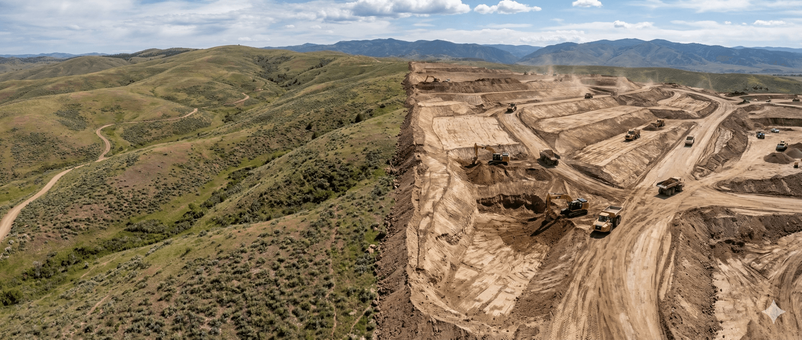
You’ve won the bid, the machines on-site, and dirt is finally moving. For many project managers, the “original ground” survey is a checked box. A Day 1 task that’s quickly buried under daily production targets and shift handovers.
Original ground, or existing ground, doesn’t stop mattering once the first scraper passes. If your baseline is off by even a few inches, every progress report, daily volume count, and “final” quantity you submit is built on a foundation of bad math. At Propeller, we call this the compounding error problem, and it’s the primary reason earthwork teams find themselves fighting over pay quantities at the end of a job.
Why quantity disputes don’t start at the end of the job
Many contractors think a quantity dispute is a “closeout problem.” In reality, those fights are usually baked in from Day 0. When you rely on an unverified pre-bid topo or a sparse engineer’s survey, you’re operating on assumptions.
If the owner’s data says the existing ground is higher than it actually is, you’re essentially “giving away” the first few inches of every cut. By the time you reach the final walkthrough, those missing inches have turned into thousands of cubic yards of unbilled work. Because you didn’t verify the baseline before work began, you’ve lost your leverage to argue for those quantities.
The compounding error problem
In earthworks, errors don’t stay small; they stack. Think of your baseline as the “zero” on a scale. If the scale is off by two pounds, every item you weigh afterward will be off by two pounds.
- A small miss adds up: A 3-inch discrepancy across a 20-acre site might seem negligible, but it represents over 8,000 cubic yards of material
- Cut and fill swings: When your baseline is wrong, your cut volumes look lower than they are, and your fill needs look higher (or vice versa)
- Resource drain: You might find yourself importing material you didn’t budget for because your “balanced” site was never actually balanced
Production tracking without a trusted baseline is misleading
It’s easy to feel confident when your weekly progress reports show a clean 10,000 yards moved. But if those numbers are anchored to a flawed original ground model, that “progress” is an illusion.
The biggest blind spot is trusting high-precision production data that is built on low-precision assumptions. You might have the best machine telematics in the world, but if the “before” map is wrong, the “after” calculation will never be right.
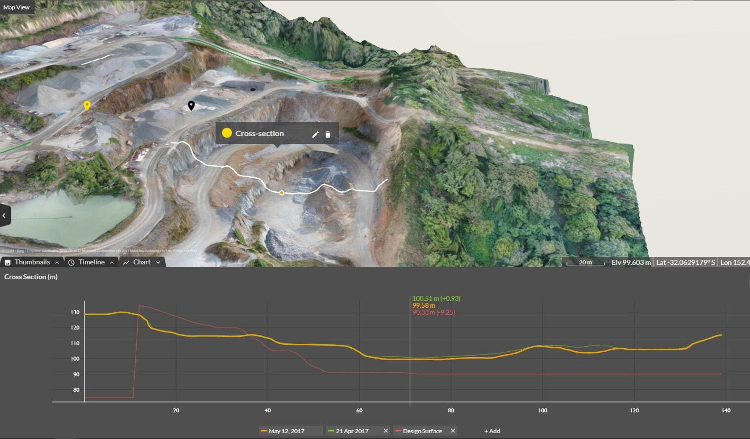
How verified existing ground anchors every volume calculation
At Propeller, we believe the map is the hub where decisions happen. When you use a high-precision capture to verify original ground through vegetation before clearing, you create a permanent, timestamped record of the truth.
This verified baseline anchors every part of the lifecycle:
Import/Export: Know exactly how much material is crossing the gate based on reality, not a bid estimate
Subcontractor billing: Pay for what was actually moved, and protect yourself from over-billing
Final reconciliation: Trace every yard of dirt back to that first, verified source of truth
Using one shared map to maintain leverage
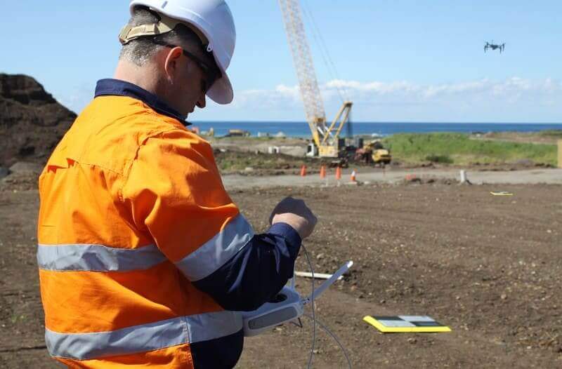
The most successful project managers stay in control by working from the same map as the owner and the general contractor. When everyone is looking at the same high-precision data, the conversation shifts from “I think we moved this much” to “Here is the data that proves what happened”.
By maintaining a single, trusted map from first survey to final quantities, you aren’t just tracking dirt, you’re protecting your margin. You have the defensible data needed to back up change orders, justify billing, and close out the job with total confidence.
From first survey to final quantities: Closing the loop
Earthwork isn’t just about moving dirt; it’s about moving it profitably. Verifying your existing ground is the only way to ensure that the work you do on Day 50 is reflected accurately in your paycheck on Day 500.
Don’t let your hard-earned margin evaporate into the “gap” between bid assumptions and site reality. Start with a verified baseline, track against it daily, and close the loop with defensible final quantities.
Protect margin from first topo to final quantities
Ready to see how the Propeller platform helps you maintain one trusted map from bid to closeout?