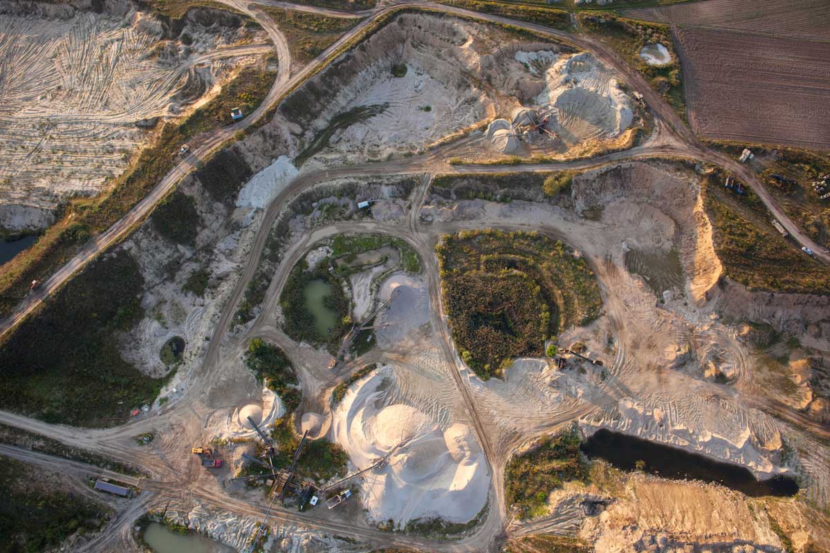
There’s a version of site management that too many project managers know well: flying blind between survey snapshots, making decisions based on data that’s already a week old, and spending Friday afternoons trying to reconcile what the foreman said was moved with what the numbers actually show.
Weekly or bi-weekly surveys were once the standard. On a lot of sites, they still are. But in an industry where daily yardage targets directly affect project margins, working from stale data isn’t just inconvenient, it’s also pretty expensive.
The shift to daily production monitoring is changing how earthwork projects get managed. Here’s what that shift looks like in practice, and why it matters for the teams driving it.
The problem with weekly snapshots
When your only visibility into site production comes from periodic survey captures, you’re always reacting. By the time a crew deviation, over-excavation issue, or grade miss shows up in a weekly report, the damage is already done. Material has moved. Machines have burned fuel. And the window to course-correct without rework has closed.
Project managers in civil construction know this problem well. Ground-truth data arrives late, gets interpreted manually, and filters through to decisions days after the fact. The site keeps moving while the office waits for numbers.
For earthwork teams managing cut/fill targets, haul efficiency, and design compliance simultaneously, that lag compounds. Small deviations become larger ones. A material overage that was catchable on day two becomes a costly scope change by day seven.
What real-time production reporting actually means
Current, high-precision site data without the wait
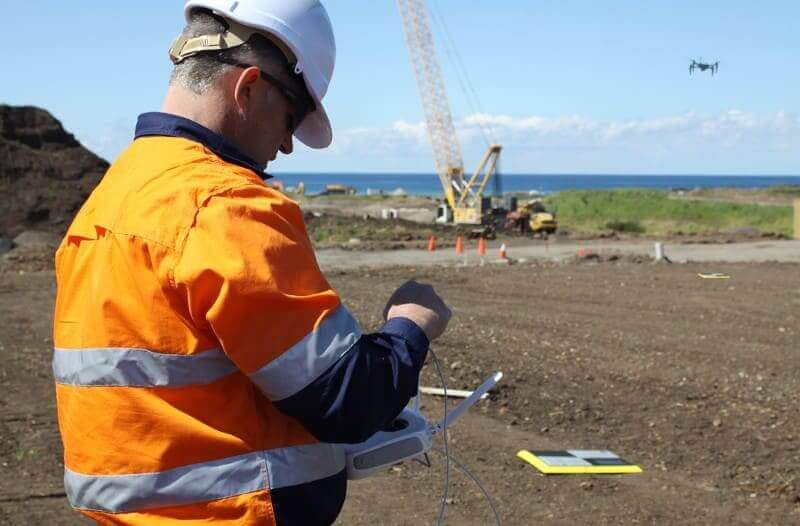
Daily production monitoring closes the gap between what’s happening in the field and what the office can see. Instead of a weekly flyover and a report that lands on Tuesday afternoon, project managers get timestamped, high-precision data that tracks site activity as it happens.
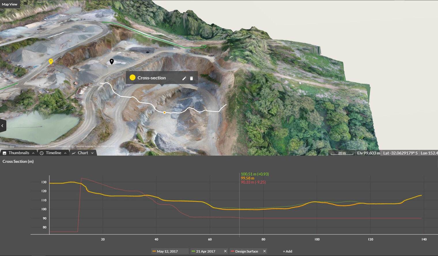
With Propeller’s platform, teams can fly a drone in the morning and have accurate cut/fill data and volume calculations ready for the afternoon standup. That’s not just a faster version of the old workflow, it’s a fundamentally different level of operational control.
Volume calculations that once required a dedicated survey crew and a two-day turnaround can now be completed on-site, on demand, in a fraction of the time. Compare any surface to your design, pull stockpile volumes, and see exactly where you stand against daily yardage targets — all without waiting on external data.
Progress tracking gives the whole team a shared view of where the project is relative to schedule. Milestones become measurable. Deviations become visible before they become expensive.
Protecting margins with daily yardage visibility
More than a map. A decision-making tool.
There’s a direct line between daily production monitoring and margin protection. When a project manager can see their cut/fill status every day, they can make better decisions about crew deployment, material hauls, and schedule adjustments before those decisions start costing money.
Catching overruns early. With cut/fill to design comparisons updated daily, teams can identify excavation deviations while there’s still time to adjust.
Validating daily yardage targets. Hitting production targets requires knowing where you stand. Daily volume data gives project managers a running total they can trust, built from high-precision aerial captures rather than manual estimates.
Reducing rework costs. Rework is one of the most significant cost drivers on earthwork projects. When issues are caught daily instead of weekly, the window for correction is shorter and the cost is lower.
Supporting accurate billing and subcontractor management. Verified volume data creates a defensible paper trail for progress billing, subcontractor reconciliations, and dispute resolution.
From field to office, on the same map
A habit, not an event
One of the most overlooked benefits of moving to daily production monitoring is what it does for team alignment. When field and office teams are working from different data at different points in time, misalignment is inevitable. Decisions get made in isolation. Assumptions get baked in.
Propeller’s field collaboration tools put everyone on the same map. The same surface data that the office uses for progress reporting is the same data the site team uses to verify grades and validate machine output. There’s no version confusion, no reconciliation lag, and no gap between what was planned and what’s being measured.
For project managers who are accountable to owners and executives for schedule and cost performance, that alignment is what turns data into confidence.
The shift from reactive to proactive management
The difference between weekly snapshots and daily production monitoring isn’t just frequency. It’s the whole posture of site management.
Weekly data creates a reactive environment. Problems surface late. Adjustments are expensive. Reporting is backward-looking.
Daily data enables something different: proactive management. PMs can use daily reporting and progress tracking to get ahead of schedule risks, optimize crew deployment, and demonstrate verified production to stakeholders without waiting for the end-of-week summary.
For earthwork projects where margins are tight and schedules are unforgiving, the move from opacity to clarity isn’t a nice-to-have. It’s the difference between protecting your margins and watching them erode one stale dataset at a time.
Daily production monitoring is already standard practice for the teams running the most efficient sites in civil construction. The tools to make it work across your entire operation are available now. The question isn’t whether the data is worth having. It’s whether you can afford to keep working without it.