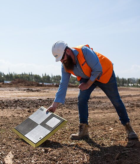
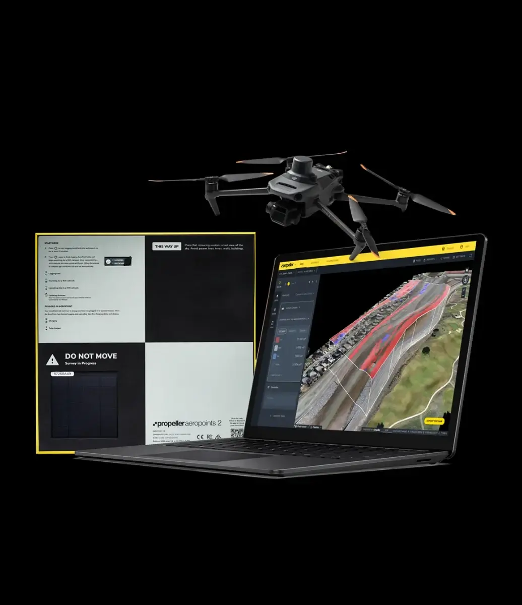
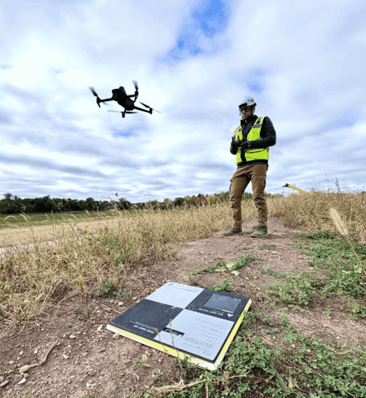
“It’s the accuracy of the AeroPoints that works for us. Some companies rely on RTK, but we want reliable, accurate results. Fixed ground control doesn’t work for construction due to there always being material moved.”
Drone Manager
Helsinki, Finland
Get precise stockpile volumes without stepping foot on-site.
Turn drone data into precise volume calculations and professional inventory reports in 24 hours. Reduce write-downs, improve safety, and manage your site from a single source of truth.
Join 4,000+ worksites that have traded manual surveying for Propeller’s automated drone platform. Faster than a base-and-rover, more accurate than a visual estimate, and safer for your team.
Traditional base-and-rover surveying is slow, dangerous, and leaves too much room for error. When your inventory numbers are off, your bottom line suffers.
Eliminate safety risks: Keep your team off the stockpiles and out of harm’s way.
Reduce processing bottlenecks: No more manual data crunching. Upload your drone flights and let us do the heavy lifting.
Prevent end-of-year write-downs: Accurate, frequent surveys mean monthly reconciliations are a breeze, not a surprise.
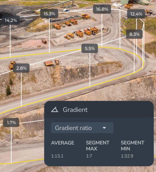
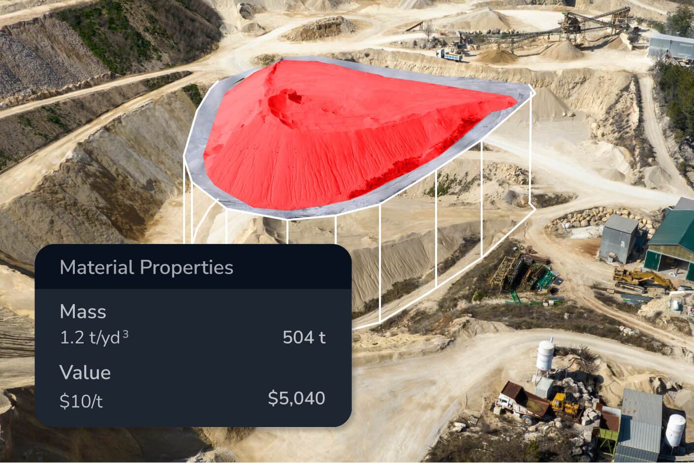
Point-and-click volumetrics: Calculate volumes in seconds by simply drawing a boundary around your pile.
Smart base mapping: Handle complex piles with ease—whether they are against a wall, in a bin, or on uneven terrain.
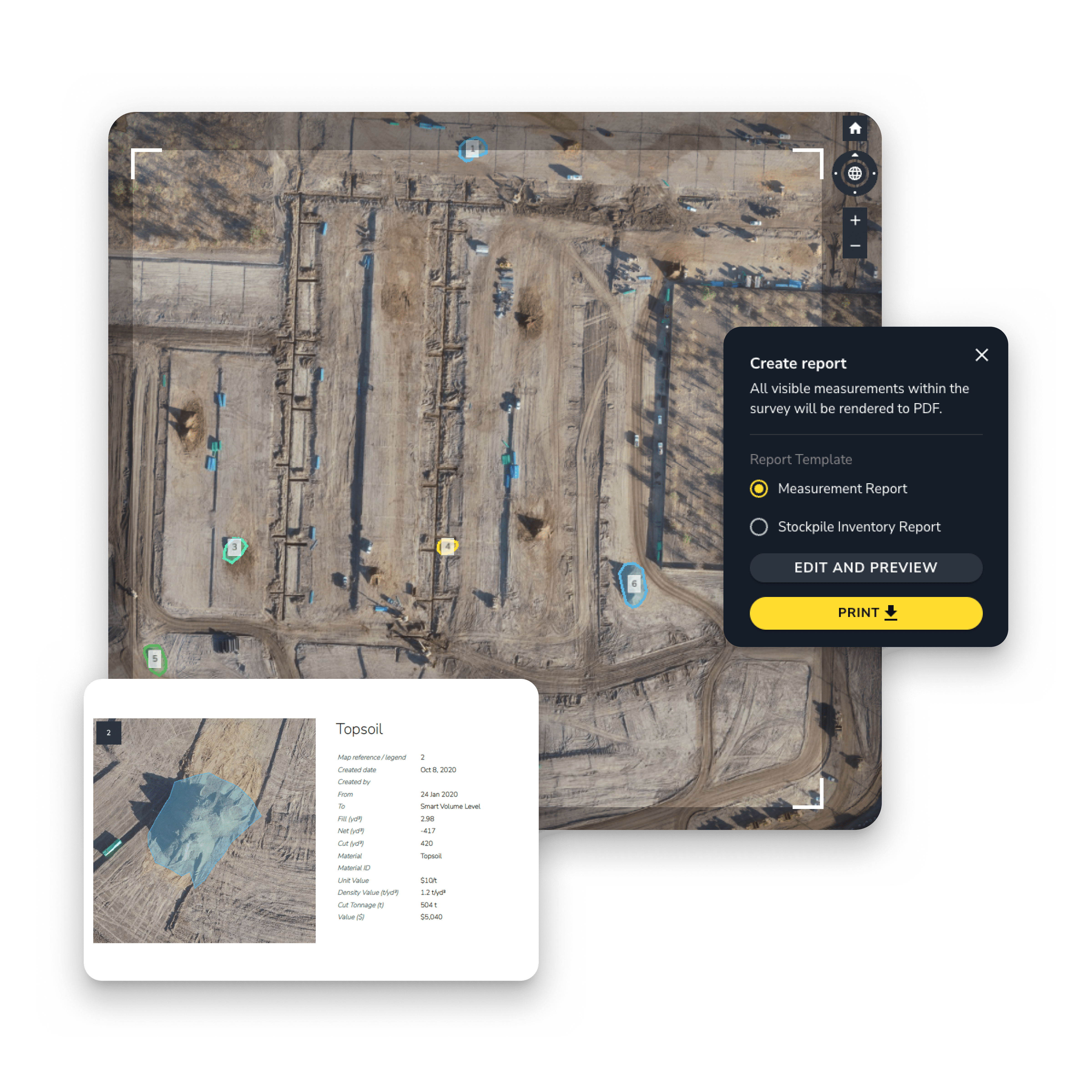
24-Hour data turnaround: Get survey-grade 3D maps and volume reports back within one business day.
Custom inventory reporting: Generate PDF or CSV reports for auditors and site managers with a single click.
Historical timeline: Compare current volumes against previous surveys or design surfaces to track production trends over time.
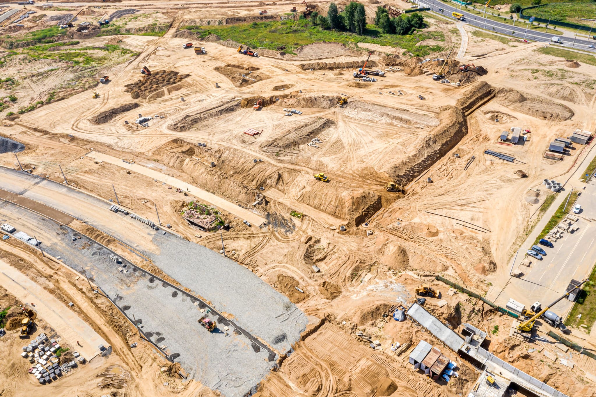
Aggregates & mining: Track production rates and ensure you never run out of high-demand material.
Civil construction: Verify cut/fill quantities and track material movement across the entire project lifecycle.
Waste management: Monitor airspace and landfill capacity with precision.
“It’s the accuracy of the AeroPoints that works for us. Some companies rely on RTK, but we want reliable, accurate results. Fixed ground control doesn’t work for construction due to there always being material moved.”
“Propeller has changed the way our site department does business, and we have tried multiple platforms and drones. The Propeller PPK workflow changed the game for us.”
“Once you’ve used Propeller, you don’t want to use anything else again. It’s so easy!”
“I don’t know of a platform out there that is as good and as accurate as what Propeller can do.”