High-precision drone mapping software for earthwork

Transform drone data into a real-time command center. Move faster, reduce rework, and protect your margins with survey-grade insights delivered to any device.


We combine easy-to-use drone mapping software with reliable hardware to help you track stockpile volumes, verify earthwork progress, and keep your entire team aligned on a single source of truth.

1K
Worksites powered by Propeller
1K
Users collaborating on the map
1K
People powered by Propeller
Machine trails and surface comparisons visualized in Propeller

Why choose Propeller?

Cut operating costs with confidence

  • Get accurate cut/fill volumes in clicks, not hours.
  • Identify inefficiencies before they impact your budget.


Prove progress and protect margins

  • Use timestamped, high-precision data to end disputes and back your billing.
  • Verify work remotely to reduce risk and costly site visits.


Keep the whole team on the same map

  • Align the office, field, and clients around a single source of truth.
  • Share interactive 3D maps without the need for specialized CAD training.

Featured Capabilities

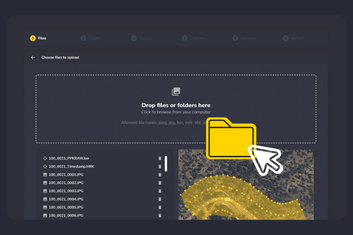
Capture: Handle complex processing automatically. We take care of the PPK correction and QA/QC so you don’t have to.

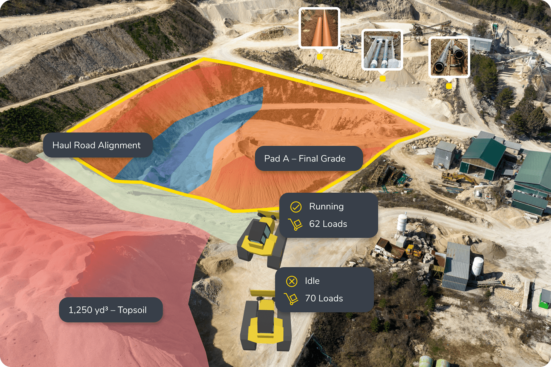
Measure: Track stockpile volumes, road grades, and elevation changes with a few clicks.

Plan ahead: Use live design overlays to spot errors early and prevent expensive rework.

Automated data processing: Upload your drone data and let us do the heavy lifting. Our team of photogrammetry experts handles the PPK correction and noise removal, delivering high-precision maps and volumes.

Design-to-terrain comparisons: Upload your design files to view live surface-to-design heatmaps that highlight exactly where you’re high or low, helping you catch grade errors in hours and stay on track with your project timeline.

Propeller PPK processing upload resized

Close the communication gap between office and field

Stop relying on phone calls and text photos to track site progress. Propeller provides a high-precision, interactive 3D map that everyone from the site super to the project manager can access from any device. When everyone sees the same data at the same time, disputes vanish and collaboration happens in real-time.

Shareable links: Send a 3D view of a specific area to a subcontractor or client in seconds.

Permissions control: Ensure the right people see the right data with customizable view-only or editor access.

Simplified workflows for busy teams

You don’t need to be a GIS expert or a photogrammetrist to get survey-grade results. Our platform is designed to fit into your existing workflow, not disrupt it. From flight to finish, we’ve automated the technical hurdles so you can focus on moving dirt, not managing files.

Hardware agnostic: We work with the drones you already own, including DJI and Autel.

Seamless exports: Move your data directly into CAD, Civil 3D, or Trimble Business Center without the need for manual file conversion.

subcontractor management

Join thousands of pros mapping the way and try Propeller now

REQUEST A DEMO