Drone-based aerial survey inspections of industrial structures are poised to save time, money, reduce downtime, and, importantly, keep site personnel safe. But those who are using drones for inspections today are probably working with the captured data in one of the following ways:
-
- Watch hours of high-def video
- Scroll through a Dropbox of images
- Rely on a 3D model which is littered with artefacts and issues
A simple and reliable workflow for aerial survey inspections will let drones do their best work saving lives, so we’d like to share how our inspection customers are using the Propeller Platform to achieve exactly this today:
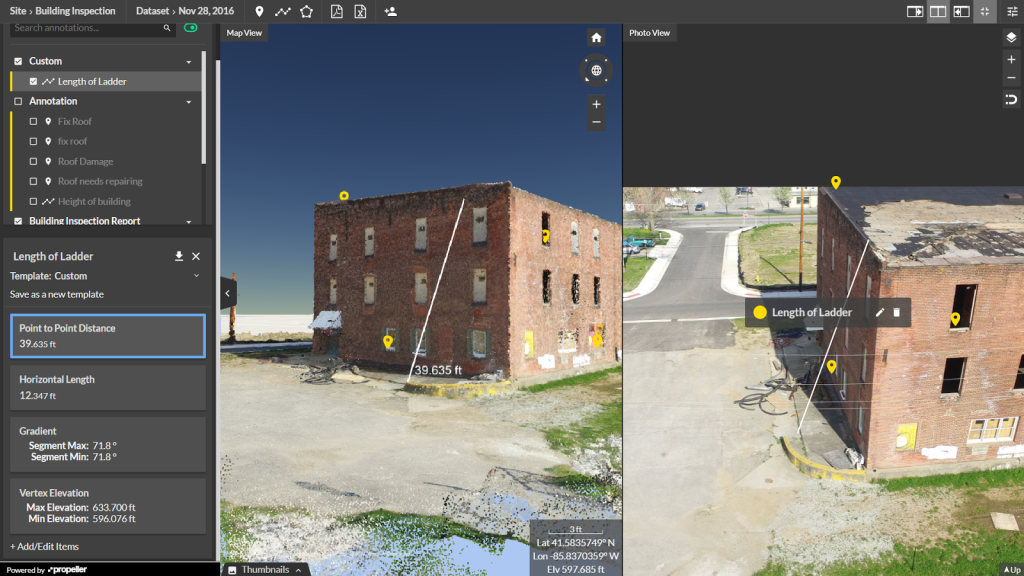
You can easily navigate using the point cloud and inspect assets in full resolution:
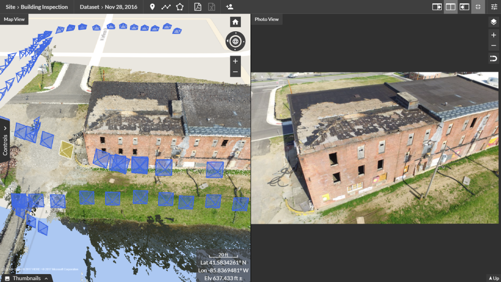
On the lefthand side, you can see where the images have been captured (blue icons) around the full point cloud, and then on the righthand side you have the full resolution image for your inspection. Navigation is intuitive and simple regardless of your skill level.
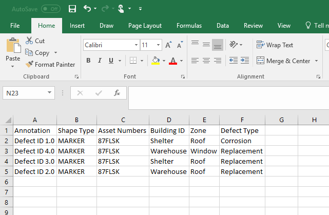
You can report to your requirements using custom reporting templates:
Every company has different requirements when it comes to asset inspections and what information needs to be recorded. Propeller allows for total flexibility here where different measurement types or annotation fields can be dragged in by the user then saved for future reference. All these items are then exportable as a Measurement Report (PDF) or as a CSV for use in other reporting software.
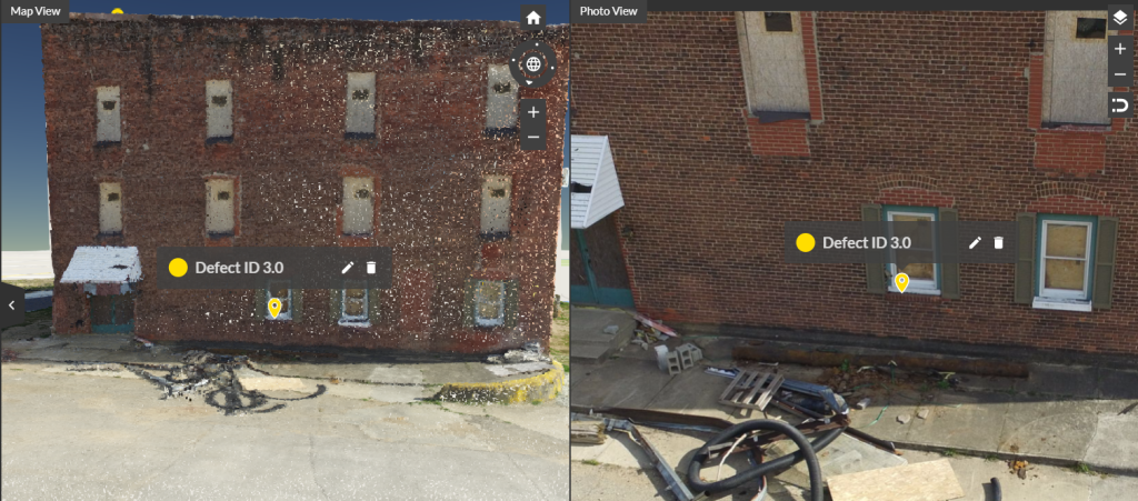
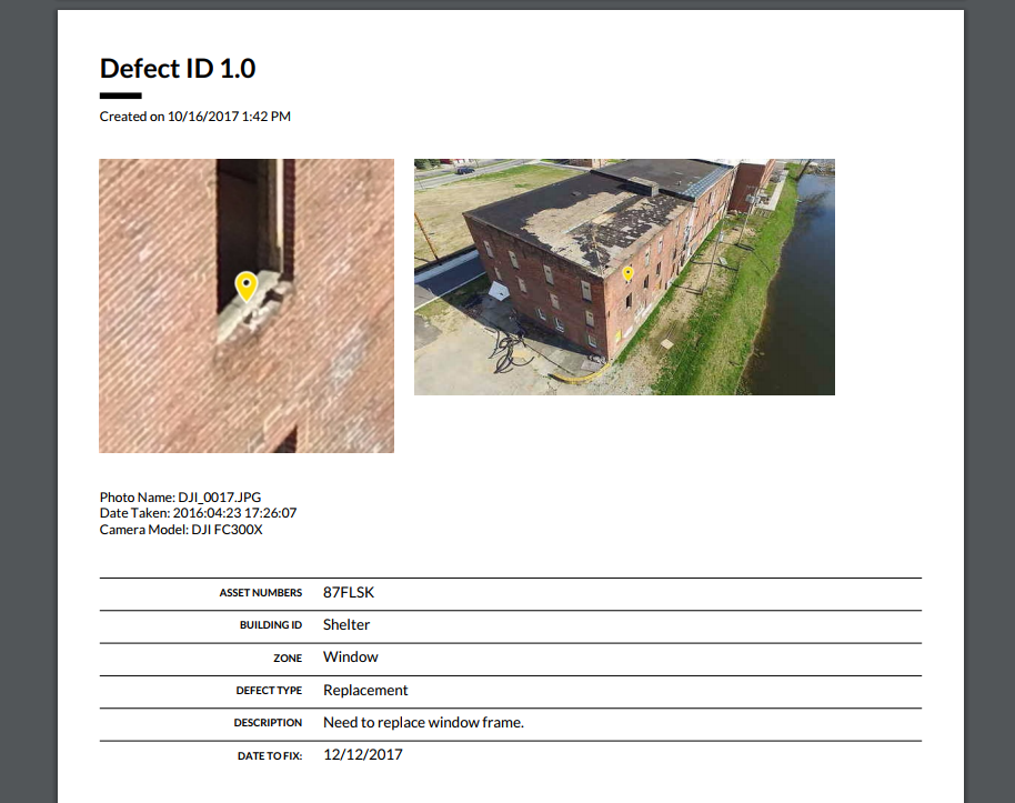
You can tag defects in either the images or the model:
The images bring absolute confidence to your inspection with no chance of processing glitches while the point cloud allows for understanding the asset in 3D from different perspectives. In cell tower inspections for example, where most photogrammetry solutions struggle to produce a clean model, you are able to work directly off the images.
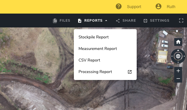
You can generate one-click Measurement Reports (PDF) and CSV Reports:
All your inspection details are captured and able to be exported with a single click.
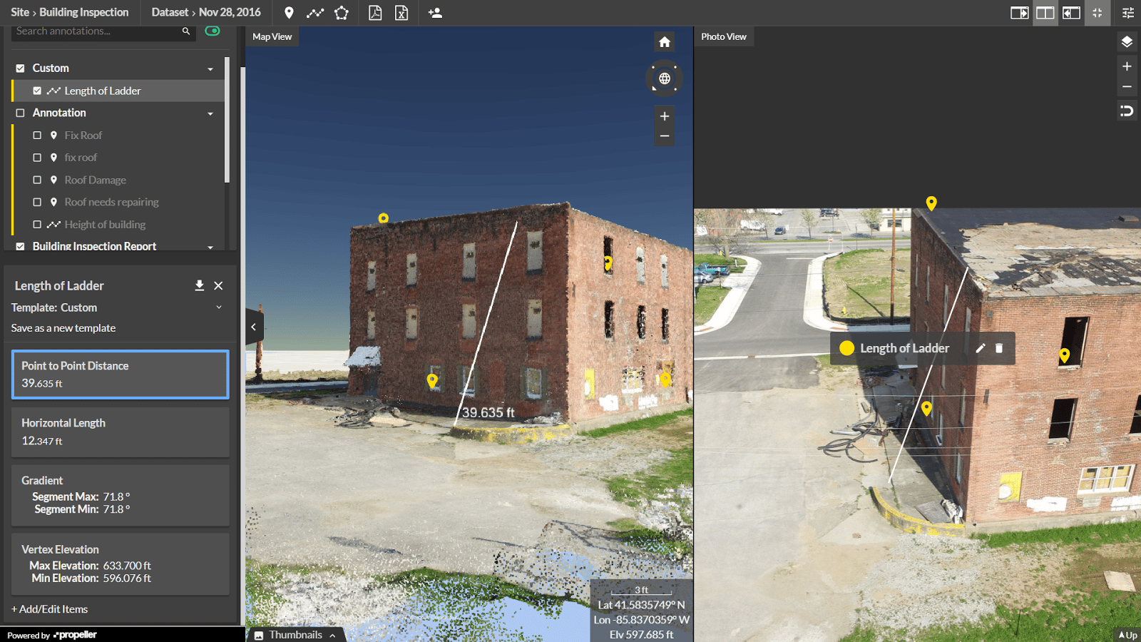
And you can also measure:
Horizontal and surface length, point-to-point distances (in the point cloud), gradients and height differences all from a single line. In the example below we are calculating the length of a latter required to climb this building, and we are also capturing the angle of that ladder and the distance the feet will be from the building edge.
If you are inspecting buildings, cell towers, bridges, dams, or other structures you now have a simple online workflow to capture the asset, perform an inspection, and then have the results safely stored online until you fly the site again in three, six, or twelve months’ time.


