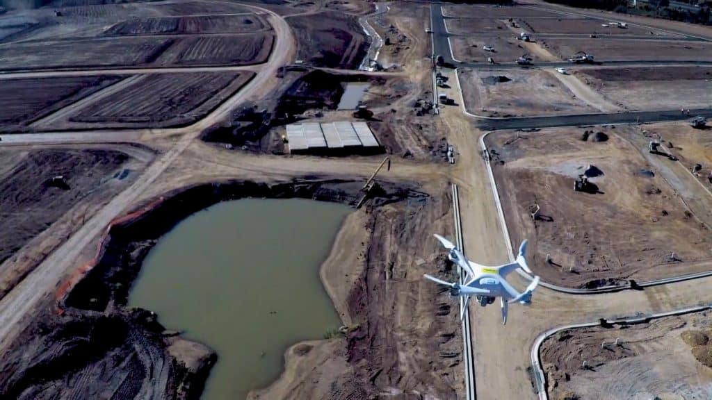
Whether you’re in the civil construction/earthworks, waste management, mining, or aggregates industries, accurate data generated from aerial drone surveys unlocks efficiencies; promotes safety and sustainability; enables better project bidding; and offers many other benefits for your day-to-day workflows.
However, before starting your drone surveying program, you’ll need to complete a few simple steps. To help, here’s a guide on what you need to know and do before flying a drone on your jobsite.
Understand the commercial drone regulations in your location
Companies intending to use drones for commercial purposes first need to be aware of the common laws and certifications required by local governments. Countries around the world have implemented regulations for safe drone operation. Here’s a summary of what’s required in Australia, the European Union, and the United States:
- Australia: To fly a drone in Australia under two kilograms for business, pilots require either an RPA operator accreditation or a Remote Pilot License (RePL). Pilots with a valid RePL do not need to obtain the RPA operator accreditation. The RePL can be obtained by taking the official course and assessment. Also, all drones for your business projects must be registered with CASA under an “organization” Aviation Reference Number (ARN), not an “individual” one, and registration is valid for 12 months.
- EU: In 27 EU member countries, as well as Iceland, Switzerland, Lichtenstein, and Norway, drone operations are categorized as either Open, Specific, or Certified. Drone surveying generally falls under the “Open A2” category, which is generally regarded as “low-risk.” Individual drone pilots must pass an aeronautical knowledge test, and be registered. If you’re flying your drone at higher altitudes, beyond the line of sight, or near populated areas, these situations fall under the “Specific” category and pilots must pass a Specific Operational Risk Assessment (SORA) before flying their job site. Remember to comply with all member states’ specific EU Aviation Safety Agency (EASA) regulations as well.
- U.S.: Commercial drone pilots in the U.S. need to obtain a Part 107, or Remote Pilot Certification, before taking to the skies. The process is simple—all your pilots have to do is pass the Federal Aviation Administration (FAA) Part 107 exam that tests a pilot’s knowledge of sectional charts, METARs (Meteorological Terminal Air Report, a routine aviation weather report), and radio communication protocol. Pilots also must comply with FAA regulations, such as flying during daylight hours, within the line of sight, below 400 feet and at speeds of less than 100 mph. Surveying teams can apply for a Part 107 waiver, which allows them to bypass these strict requirements, giving them greater flexibility in terms of how and when they use their equipment.
Implementing a drone survey program for your business
Once you’ve made sure the pilots on your team are following all commercial drone regulations in place in the area where you’re flying, you should make the transition from traditional land surveying to drone surveying as smooth as possible for them. These tips will help streamline your process and align your team:
- Introduce your team to the new technology. Whether you’re investing in a single drone or an entire fleet, get your team on board with the transition as quickly as possible, especially your team leads. This will allow them to decide how they’ll use the drones within their daily workflows.
- Conduct training sessions. After acquiring your first drone, schedule weekly informational sessions and demonstrations of the technology for your team. These sessions will give them an opportunity to practice flying the drone, allowing them to build the skills they’ll need to apply for licenses and certifications. Make sure all current and future pilots are familiar with the specific make and model of your drone and its capabilities, so they can promptly fly once they’re certified.
- Provide consistent support. As you integrate drone surveys in your day-to-day operations, offer ongoing tech support for your pilots. One way you can do this is by establishing a specialized drone department with staff that can handle all aspects of technical support and troubleshooting.
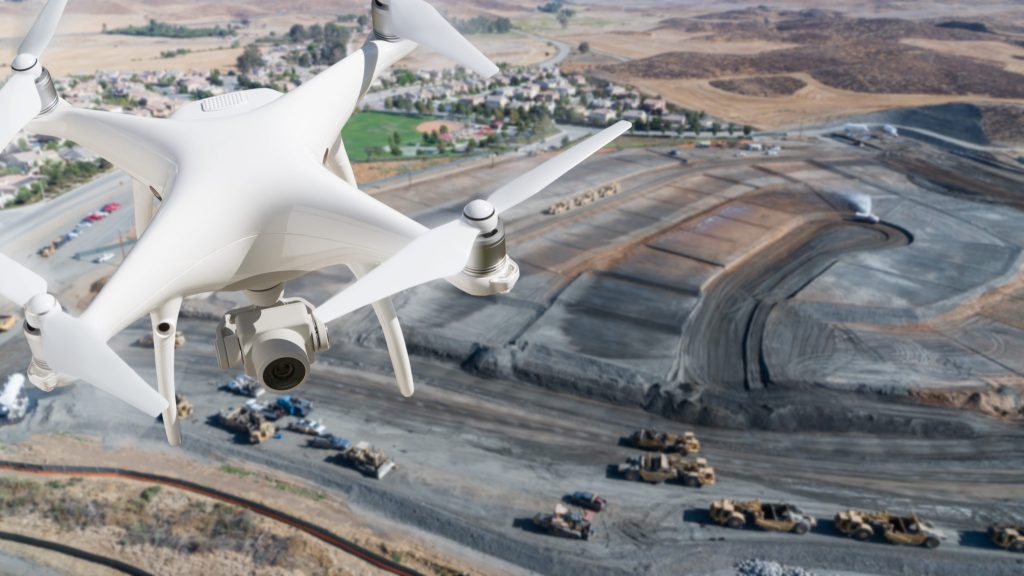
Start drone surveying at your jobsite today
Construction, waste management, aggregate, and mining companies are constantly uncovering new efficiencies within their operations thanks to advances in drone survey technology. In addition to the steps discussed above, you’ll need to select the right software to process the data you collect when flying your drone. All-in-one drone data processing solutions like the Propeller Platform can handle all the heavy lifting for you—just fly your site, upload your data to the cloud, and obtain timely access to 3D maps of your projects that will help keep you on track and on budget.


