Aerial alchemy: How Propeller’s processing turns drone data into pure gold
Processing drone survey data in-house is a common pain point for surveyors. It requires expensive hardware, specialized training, and long processing timelines that put even the most patient teams to the test.
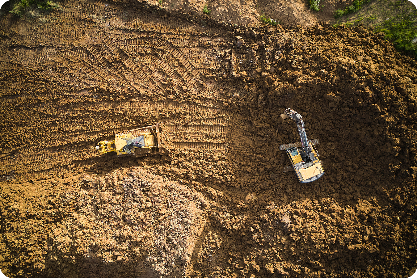
Outsourced photogrammetry and LiDAR processing offers an alternative. Imagine: you fly your drone, upload the raw data to Propeller . . . and that’s it—you’re done. The next day, that data will have magically become a survey-grade interactive 3D map of your worksite.
But what happens between your raw data upload and this insight-packed paradise? In this post, we’ll explore the behind-the-scenes workflows at Propeller that make outsourced data processing seem like magic.
What is data processing?
Data processing transforms aerial surveys into actionable, high-accuracy 3D models for earthworks sites worldwide. The process involves a combination of automated data processing for quick turnarounds and human QA to ensure high accuracy.
Those humans are Propeller’s hand-picked team of geospatial experts—a brilliant group of folks with backgrounds in geodetic engineering or geospatial science, so you can rest assured that your survey data is in good hands.

What happens after raw data is uploaded to Propeller?
Let’s get back to the journey from a raw jumble of data points to organized, usable insights. After a drone flight, you upload your images and raw data files to the Propeller platform. Here’s what happens next:
- Validation: Your data passes through a series of validation checks to verify accuracy with the coordinate system, drone and camera settings, geotags, flight altitude, etc. Any incongruencies are flagged and manually checked by our team.
- Image stitching: Next, the data from your navigation system and camera are combined to form a point cloud, creating a 3D model of your worksite.
- Georeferencing: From there, we tie your point cloud model to your ground control via georeferencing, which ensures 2/10 ft vertical accuracy for LiDAR and 1/10 ft accuracy for photogrammetry. We do this by correcting any spatial errors from the aerial GPS device.
- Completeness check: Your 3D model is then checked for completeness and correctness. We ensure there are no holes, gaps, or warped surfaces.
- Orthophoto: Once the 3D point cloud has been georeferenced and validated, we use it to generate surface and elevation models alongside a complete site orthophoto.
- QA check: Lastly, we perform a complete quality assurance check to ensure site model and surface accuracy. If your site has been surveyed more than once, we also verify consistency between surveys.
Is Propeller’s data processing automated or human?
We use both automation and expert human insight to provide the most seamless and accurate data processing workflow.
If surveys are completed using our PPK workflow and pass all of our data validations, the process is automated and extremely fast. So fast, in fact, that you might be looking at a processed dataset within a few hours of upload.
For surveys with custom ground control or data that failed our upload validations, our geospatial experts step in to perform additional georeferencing and QA steps.

How to ensure high data accuracy
Accuracy comes in a few different forms, so when we’re talking about survey accuracy, it pays to be—well, accurate.
- Absolute accuracy is how close a measured value is to a known absolute true value. In surveying, data with high absolute accuracy is accurate in relation to its true known position on the earth’s surface.
- Relative or internal accuracy means that points are accurate relative to other points within the same model, allowing for precise measurements within a single survey.
- Repeatable accuracy refers to consistent accuracy between surveys.
To achieve consistently high internal and absolute accuracy, high-quality ground control points are non-negotiable. While manual ground control does the job, we highly recommend using AeroPoints, which are far easier and quicker to use. As a bonus, they also help prevent some of the most common mistakes that can negatively impact accuracy.
How can you tell if your drone survey data is accurate?
At Propeller, we conduct three levels of accuracy checks. We first look for any shifts or misalignment in images, holes or warping in the 3D point cloud model, or unexpected surface differences (internal accuracy). We also look at horizontal and vertical ground control alignment (absolute accuracy). And, when you’ve done more than one overlapping survey, we check for consistency over time (repeatable accuracy).
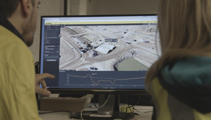
To give your team insight into the process, we generate a quality assurance report for every survey dataset we process. This report includes:
- Ground control summary, including RMS errors
- Camera locations and quality analysis (ISO, motion blur, noise, aspect, distortion, etc.) for photogrammetry
- Digital Elevation Model (DEM) surface analysis and checkpoints summary
- Filter results analysis, if a surface filter was applied (e.g., to remove buildings or vehicles)
If we uncover any quality or accuracy issues, our geospatial experts will find the source of the errors and improve the data quality if they can.

How long does data processing take?
We return processed data to our customers within 24 hours for 90% of surveys—a timeline that’s often much shorter at only a few hours. For larger fixed-wing surveys, that turnaround time can be a bit longer (generally within 48 hours).
That said, a few things can slow down data processing. Our team spends a lot of time searching through images for poorly placed or hard-to-see ground control points. We also correct user-input errors (like coordinate systems or missing GPS files) and resolve issues caused by poor collection practices, including short flights, insufficient photo overlap, or incorrect drone camera settings.
Here’s how to get the best speed and accuracy from your drone data:
- Use a Propeller-recommended or supported drone
- Include high-accuracy geotags on all images
- Use highly visible and accurately recorded ground control (such as AeroPoints)
- Follow best practices for data collection
- Use the Propeller PPK workflow
Photogrammetry data processing vs LiDAR: what’s the difference?
Our processing workflow and timelines look almost identical whether you’re outsourcing processing of a photogrammetry or a LiDAR drone survey. Depending on your drone and sensor hardware, there are different types of output GPS files, but raw drone data is always processed the same way.
At Propeller, we’re committed to turning your aerial survey data into an accurate 3D model with both speed and precision. Our process, which blends advanced technology with expert oversight, ensures the best results for every survey.
Ready to transform your raw drone data into easy-to-read insights? Request a demo today.