
Drones for Good: Propeller Helps Charity Organization in Kenya Survey New Development Site
One of Propeller’s customers has recently proven that drones are not only delivering numerous commercial…
From point clouds to orthophotos, bring your data together and prepare to make informed and impactful decisions.
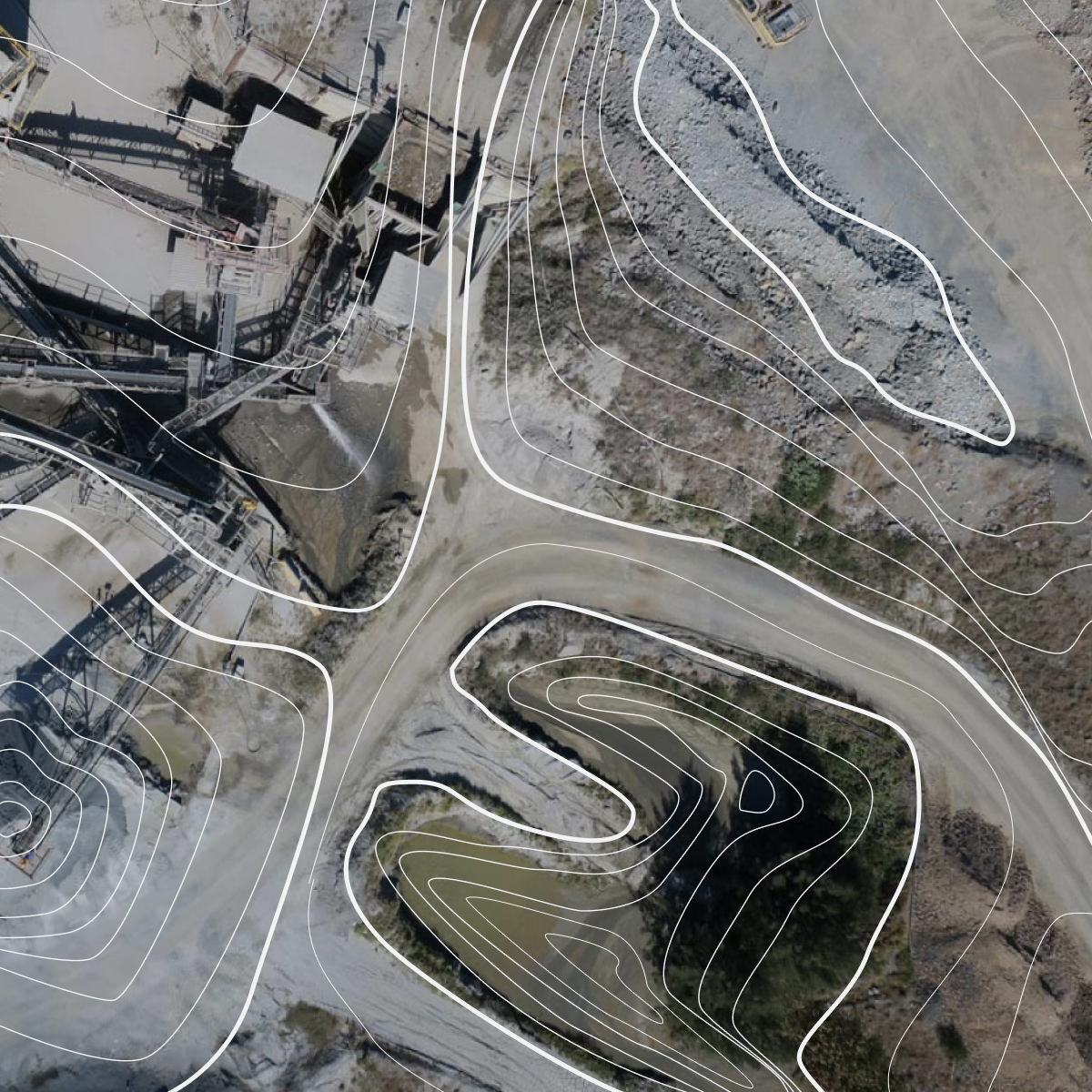
Propeller turns raw survey data into clear, actionable insights. Whether you’re using drone-captured data, machine maps, or precise measurements, transform it into deliverables like 3D models, topographic maps, and orthophotos.
Your team can visualize data in real time, run map comparisons, and make decisions faster through more effective site analysis.
Our survey deliverables are designed to improve workflow, enhance accuracy, and deliver insights faster – letting you take a step back to look at the bigger picture.
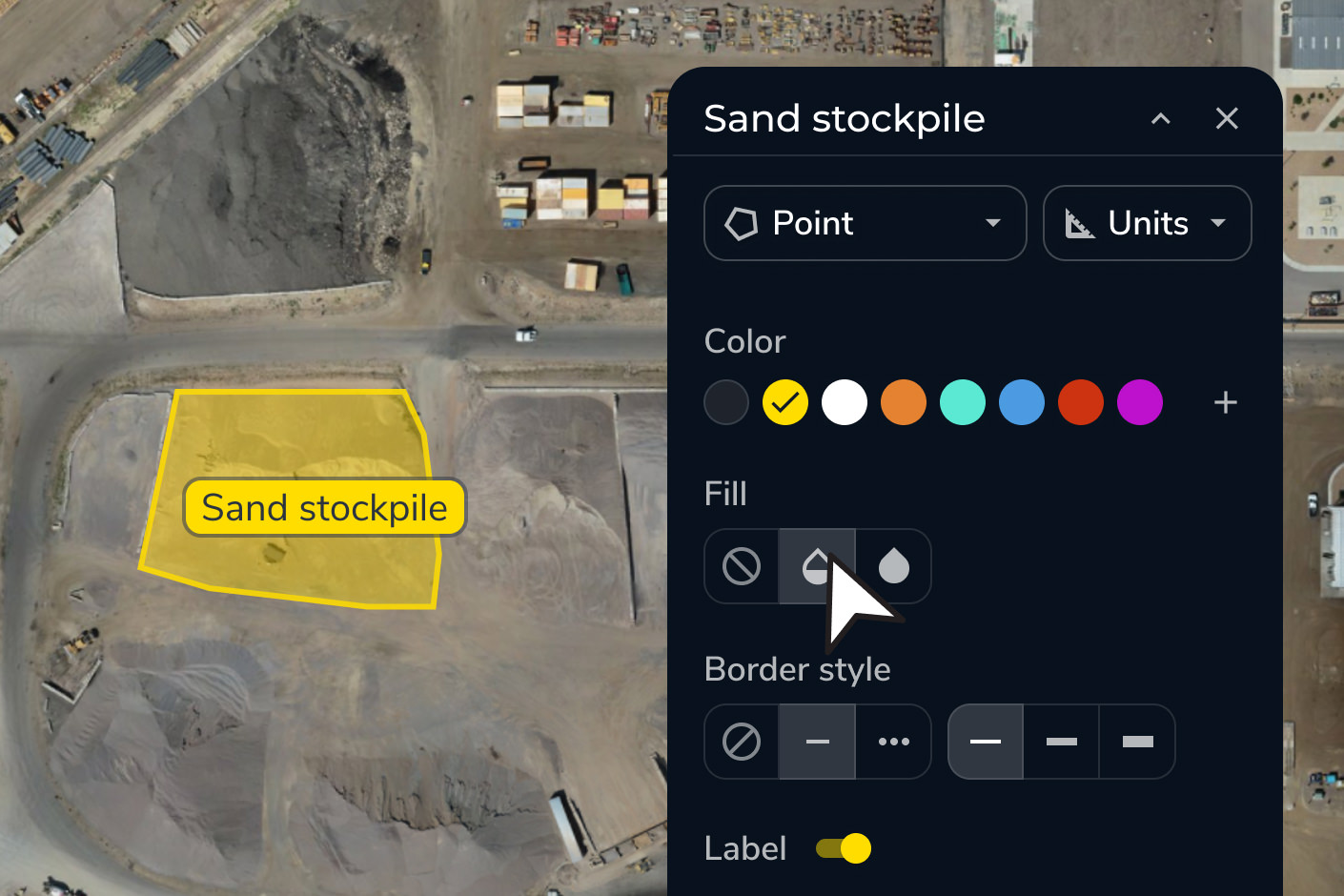
Eliminate manual processes and reduce errors with standardized data processing and survey deliverables in one platform.
Simplify collaboration across teams, empowering everyone to work with the most up-to-date data visualizations.
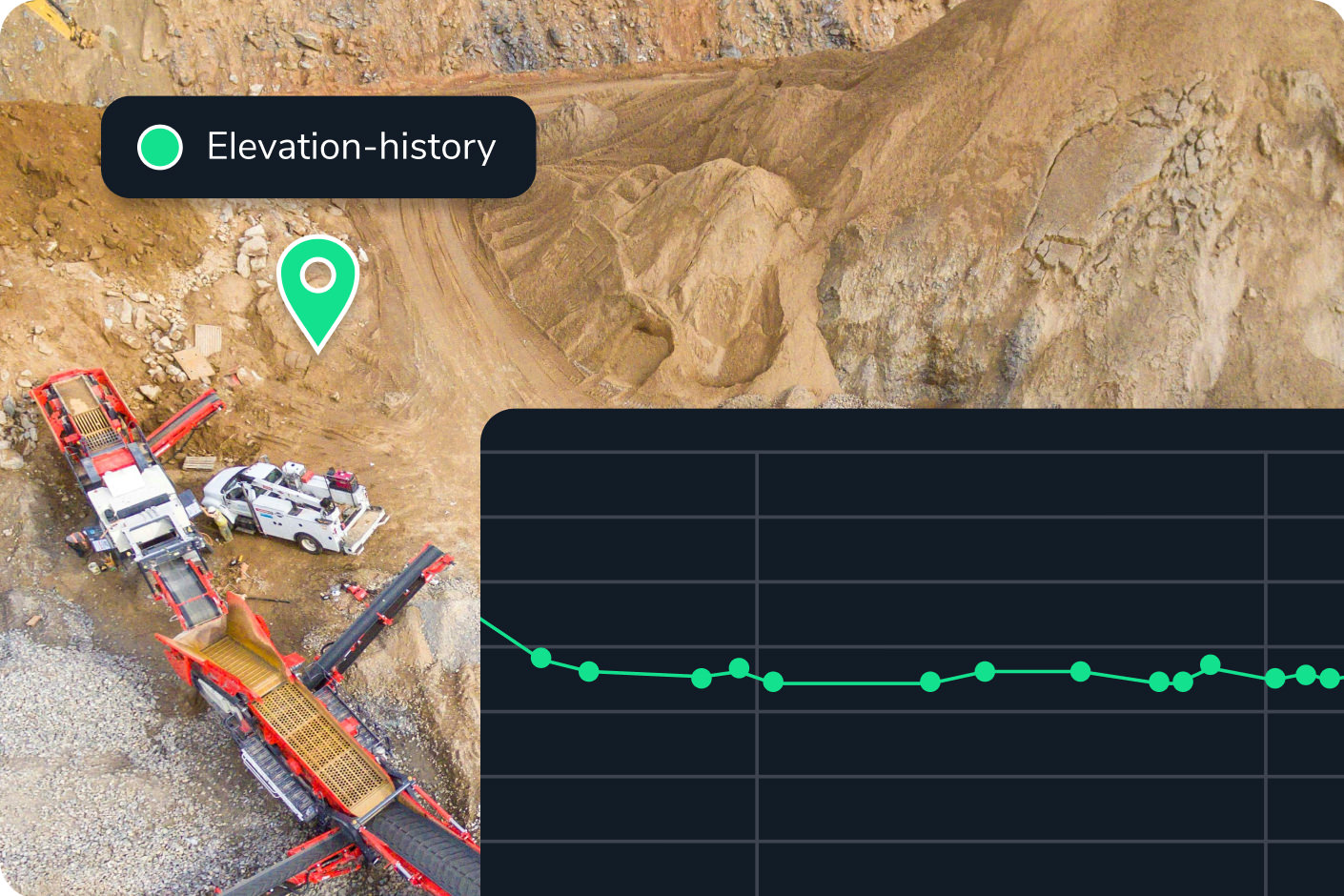
Speed up timelines with real-time data processing, helping you stay on track and enhance site analysis.

“What I’m most happy about with Propeller is the ease of use with custom coordinate systems because I’ve spent so many hours of my life trying to figure out how to put custom coordinate systems into our other mining software.”
– Hayden Taylor, Quarry Manager at Lehigh Hanson


Deliver precise survey deliverables with streamlined workflows. Work in your preferred coordinate system with ease, and enable confident site analysis at every step.