Part Two: Bare Earth With Significant Elevation Change
In the Part One of this series, we covered the basics of effectively capturing bare earth sites. One of the main factors we looked at was altitude—a.k.a. the distance the drone is flying from the ground. But what happens when the ground significantly changes elevation?
Some examples of this would be:
- Earthwork sites with hills, cliffs, or large retaining walls
- Mining/quarrying pits
- Large sand dunes
Large elevation changes can affect your drone survey
Significant changes in elevation raise some obvious concerns like crashing the drone into obstacles, but they also affect your ground sampling distance (GSD) and overlap. To keep your survey to spec, you need to minimize these variations.
In this article, we’ll cover how to tackle the added complexity of these elevation changes.
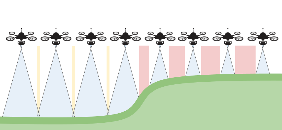
How elevation changes affect image overlap
As you can see on the left of the image below, there is some overlap (yellow) on the lower section of the terrain, but as we go to the right we end up with no overlap (red).
Images without overlap pose serious issues for photogrammetry, and can make parts of your survey unusable.
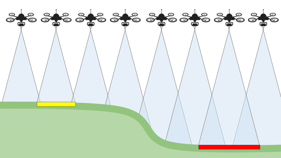
Elevation changes also affect GSD
Conversely, if you start flying over higher ground and move to lower ground, your overlap will still be fine, but your GSD will increase, thus reducing the detail and accuracy of your survey.
If we pretend that our drone only has a one pixel sensor, take a look at the size of that pixel on the ground at each elevation.
Balancing GSD and overlap needs in your drone survey
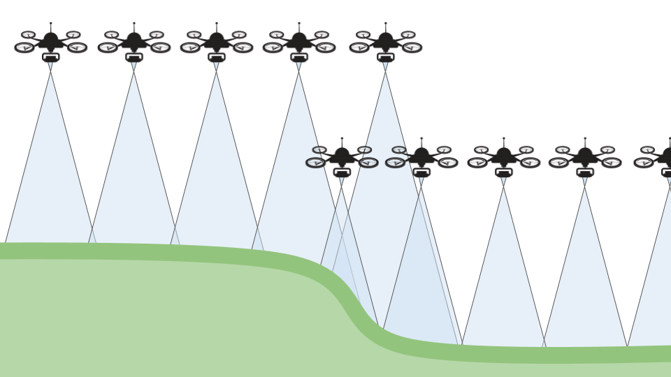
You can often pick an altitude that will give you reasonable overlap and GSD across your whole site. To do this, calculate the overlap at the lowest distance from ground and calculate the GSD at the highest distance from ground. If you can find an altitude that passes both of these tests, you’re in luck.
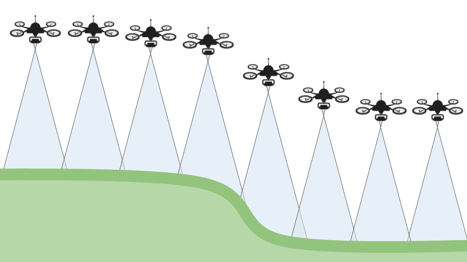
Sometimes there is no single altitude that will cover your whole site to spec, and in these instances, you can run multiple patterns at different altitudes as seen below (note that they overlap).

Using flight planning apps for large elevation changes
Some flight planning apps have terrain information available for some areas. These terrains are generally built by using satellite imagery and photogrammetry, which means they are low resolution, low accuracy and probably a few years out of date.
So, if the terrain you’re working with has been fairly static over the last few years and doesn’t have any large structures in it, you may be able to get your flight planning app to follow the terrain. Note that this wouldn’t work for frequently changing areas like mines and quarries.