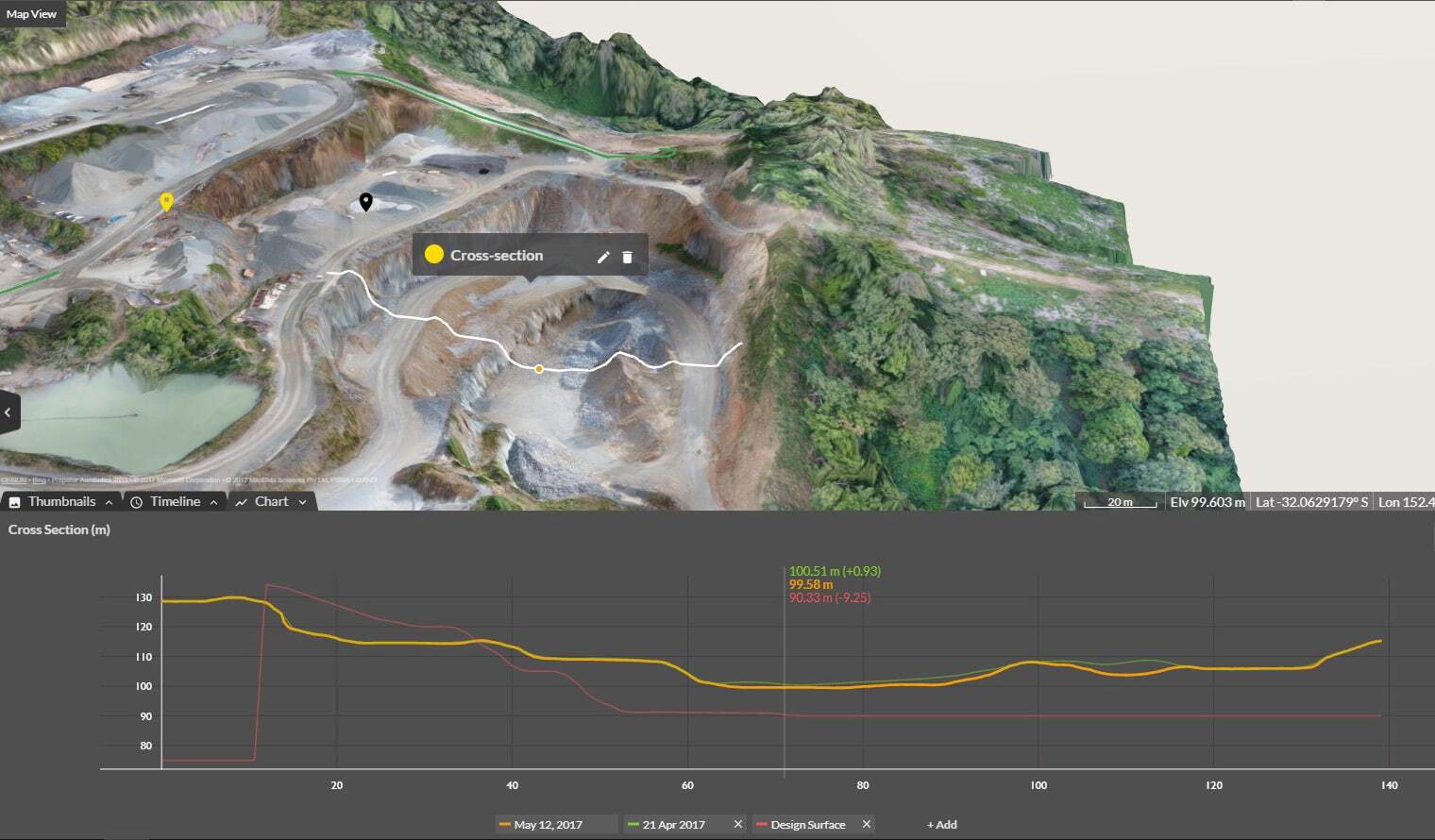
Cross Section Survey in a Matter of Minutes Using Drone Data
With the power of drone-captured data and the Propeller Platform, surveying cross sections becomes as…
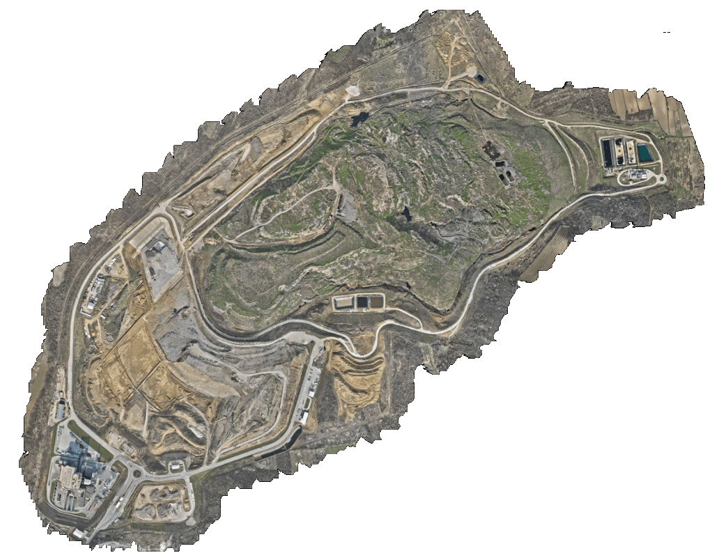
Beo Čista Energija isn’t just managing a landfill, they’re running complex construction, underground utilities, and energy operations across 130 hectares in Vinča-Belgrade, Serbia. Historically, monitoring progress, tracking materials, and ensuring safety on a site of this scale would have required a huge team of surveyors and constant field checks.
With Propeller, the BČE team now surveys the entire site bi-weekly, uploads the data, and has actionable insights available to project management, operator and supervision.
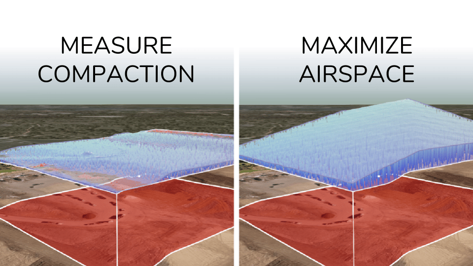
Before Propeller, calculating volumes, redesigning plans, and creating reports required geodesic experts and countless hours of manual effort. Now, BČE can:
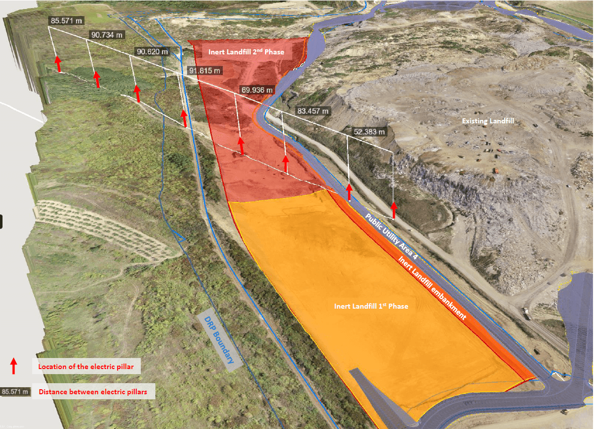
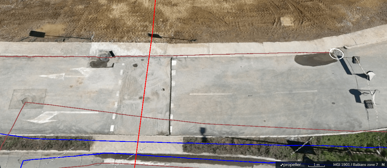
During the construction of the Inert Landfill, the route of existing power line pillars ran very close to the edge of Phase 1. Using Propeller’s boundary and distance tools, BČE accurately identified the pillar locations and defined the working zones, confirming that construction could proceed safely and without interference.
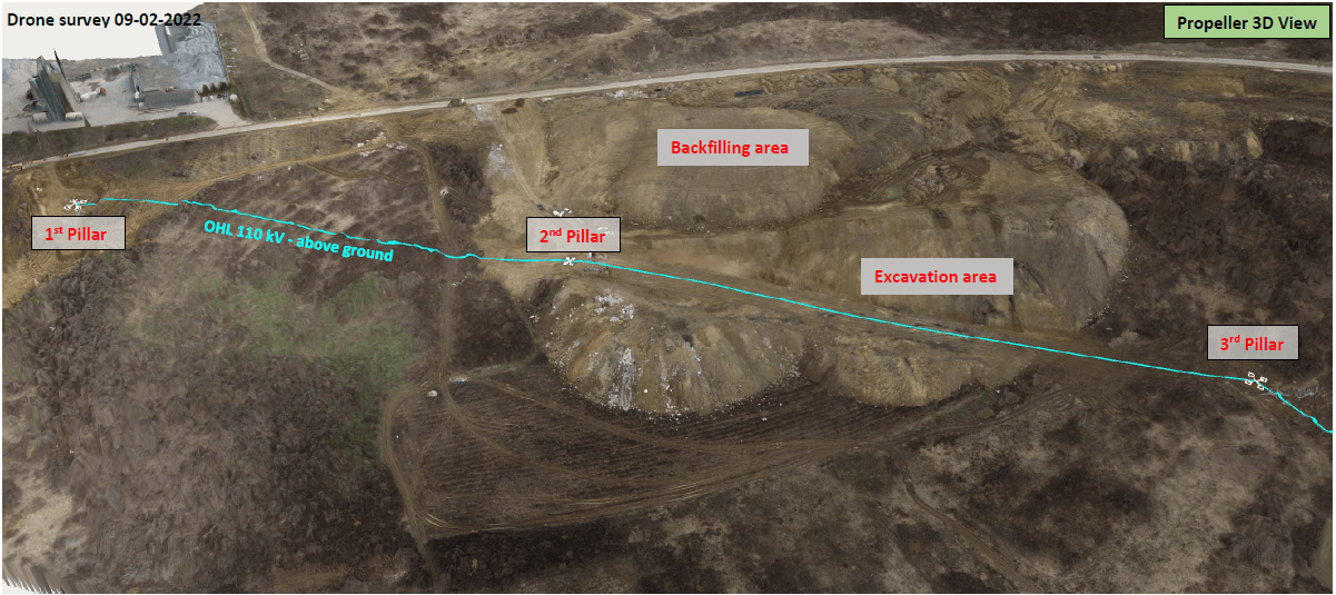
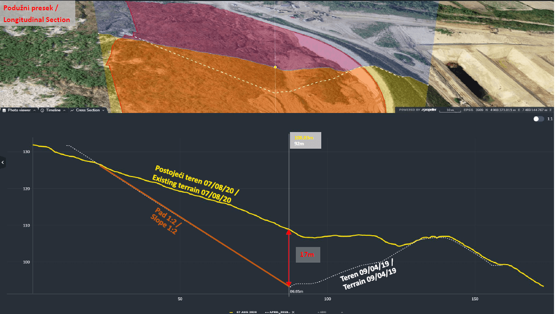
Material had been dumped near a transmission line, threatening power supply. With Propeller’s volumetric tools, BČE calculated that 96,000 m³ of material needed removal to prevent disruption—allowing the responsible party to act quickly and avoid energy outages.
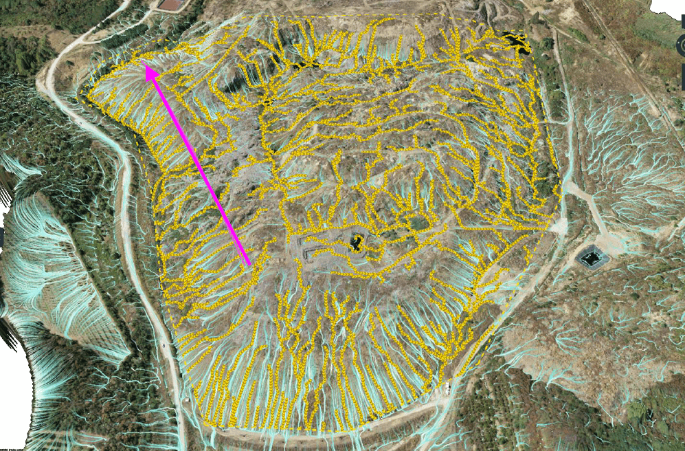
Using Propeller’s hydraulic tools — including rain simulation, flow direction, and catchment area analysis – BČE was able to foresee potential water accumulation zones and surface flow paths across the landfill. Combined with cross-section analysis, the team evaluated elevation profiles and confirmed that the initial drainage channel design was not sustainable and required adjustments.
By combining underground utility mapping with hydrological analysis, BČE restored a deformed asphalt road and improved pipe stability. Propeller helped identify drainage points, target erosion-prone slopes, and strategically place manholes for long-term maintenance.
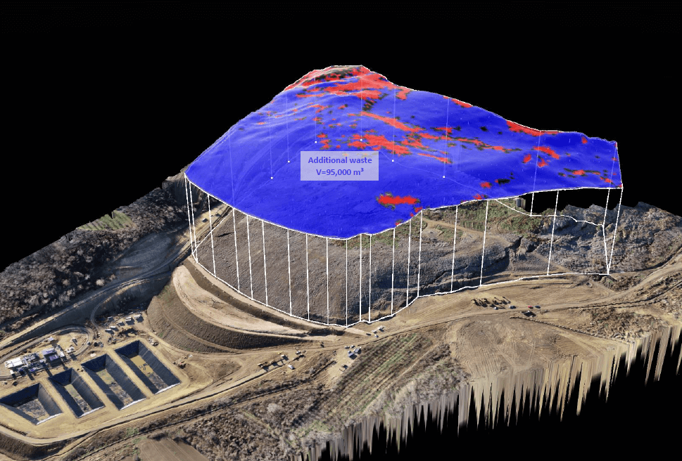
Facing a landfill waste sliding toward a dam, BČE used Propeller’s polygon and volumetric tools to refine third-party estimates. Avoiding miscalculation, enabling accurate planning and cost reduction.
When a section of the old landfill collapsed and waste spilled, BČE used Propeller to define the pre-collapse boundary, clearly proving to authorities what the conditions were before the incident. Historical survey data now lets them track progress, validate designs, and document changes for government compliance with precision and confidence.
Learn more about Propeller’s products, pricing, and how to get started on your site.