How Beo Čista Energija manages a 130-hectare landfill safely and efficiently with Propeller
About the project
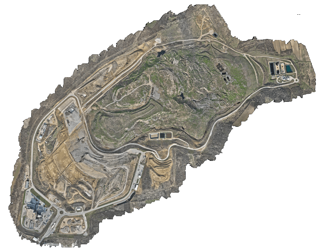
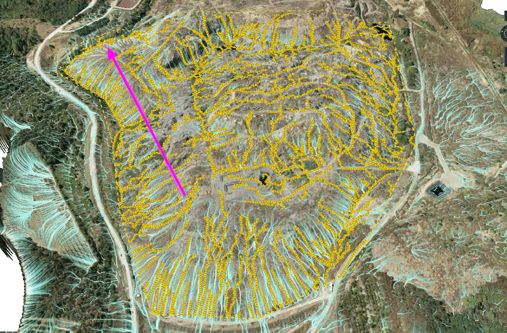
Beo Čista Energija isn’t just managing a landfill, they’re running complex construction, underground utilities, and energy operations across 130 hectares in Vinča-Belgrade, Serbia. Historically, monitoring progress, tracking materials, and ensuring safety on a site of this scale would have required a huge team of surveyors and constant field checks.
With Propeller, the BČE team now surveys the entire site bi-weekly, uploads the data, and has actionable insights available to project management, operator and supervision.
Leaner, faster, smarter workflows
Before Propeller, calculating volumes, redesigning plans, and creating reports required geodesic experts and countless hours of manual effort. Now, BČE can:
- Measure and track volumes, landfill slopes, elevations and settlements
- Analyze material movements and plan future construction phases
- Share visual data with city representatives, supervisors, contractors and all other stakeholders
- Generate reports quickly to comply with government regulations
Solving complex problems before they become costly
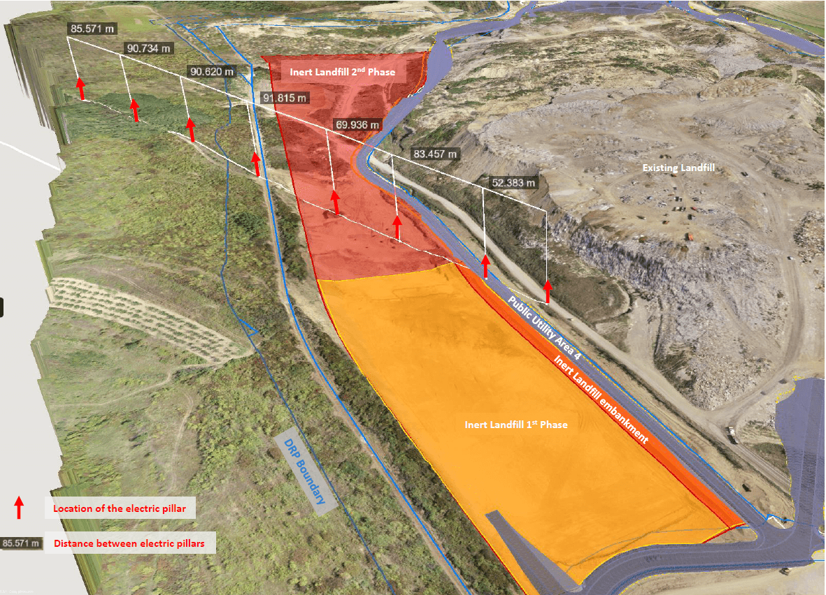
Planning around obstacles
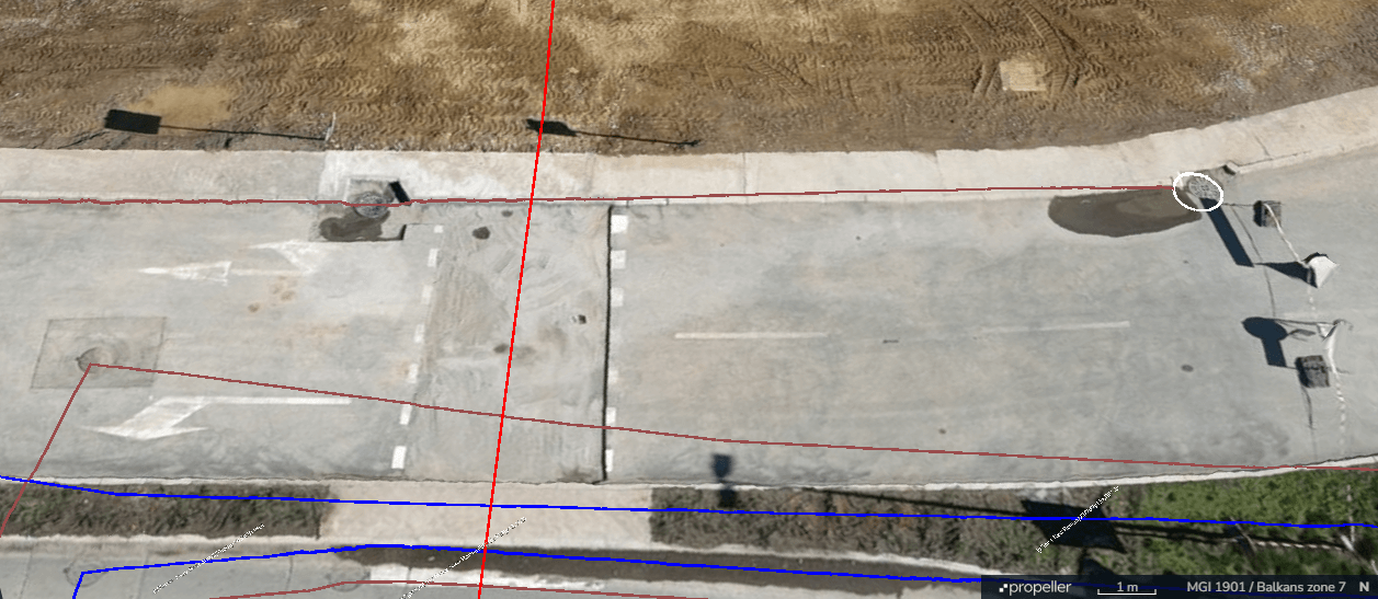
During the construction of the Inert Landfill, the route of existing power line pillars ran very close to the edge of Phase 1. Using Propeller’s boundary and distance tools, BČE accurately identified the pillar locations and defined the working zones, confirming that construction could proceed safely and without interference.
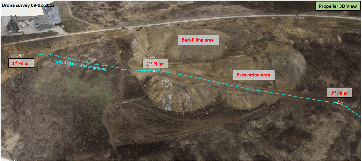
Mitigating energy risk
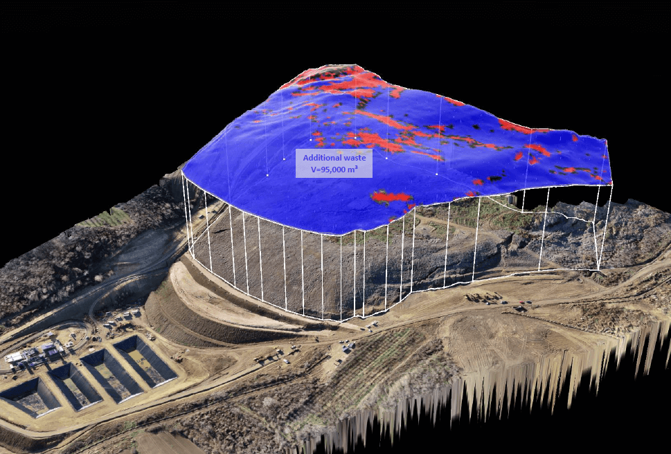
Material had been dumped near a transmission line, threatening power supply. With Propeller’s volumetric tools, BČE calculated that 96,000 m³ of material needed removal to prevent disruption—allowing the responsible party to act quickly and avoid energy outages.
Preventing design mistakes
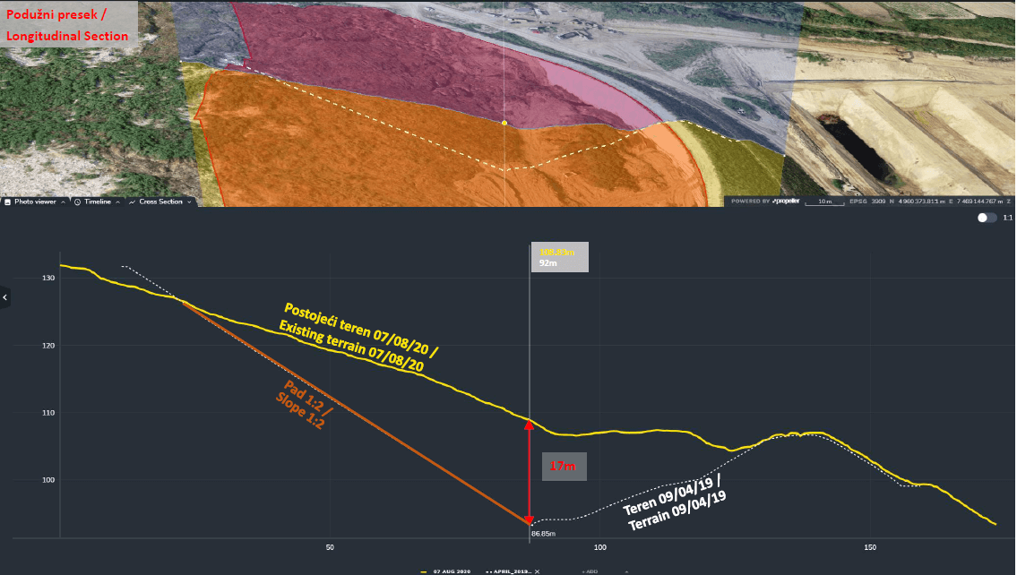
Using Propeller’s hydraulic tools — including rain simulation, flow direction, and catchment area analysis – BČE was able to foresee potential water accumulation zones and surface flow paths across the landfill. Combined with cross-section analysis, the team evaluated elevation profiles and confirmed that the initial drainage channel design was not sustainable and required adjustments.
Managing infrastructure and erosion
By combining underground utility mapping with hydrological analysis, BČE restored a deformed asphalt road and improved pipe stability. Propeller helped identify drainage points, target erosion-prone slopes, and strategically place manholes for long-term maintenance.
Refining cost estimates
Facing a landfill waste sliding toward a dam, BČE used Propeller’s polygon and volumetric tools to refine third-party estimates. Avoiding miscalculation, enabling accurate planning and cost reduction.
Tools that turned BČE’s data into decisions
Volume & polygon tools
- Problem: Misestimation of material movements and project costs
- Solution: Calculates accurate volumes for landfills, stockpiles, and slopes
- Impact: Refined planning, avoided overestimates, and reduced project risk
Boundary & distance tools
- Problem: Risk of conflicts with existing infrastructure (electrical pillars, underground utilities)
- Solution: Measures distances and marks boundaries directly on the site map
- Impact: Ensures safe operations and prevents construction errors
Cross-section & elevation analysis
- Problem: Impossible or unsafe design plans
- Solution: Visualizes slopes, channels, and terrain in 2D/3D
- Impact: Avoids mistakes and informs design corrections early
Orthophoto exports & CAD interoperability
- Problem: Disconnect between survey data and engineering plans
- Solution: Exports imagery and topography directly into Civil 3D/CAD and other platforms
- Impact: Design team works remotely with full context, reducing unnecessary site visits
Hydrology & erosion monitoring tools
- Problem: Erosion and drainage affecting landfill stability
- Solution: Tracks water flow and slope changes over time
- Impact: Targeted restoration and prevention of long-term environmental issues
Reporting & sharing tools
- Problem: Manual reporting is slow and inconsistent
- Solution: Generates reports and visualizations for internal teams and government bodies
- Impact: Transparent, quick, and easy reporting to all stakeholders
Full site visibility on mobile
- Problem: Field teams need context without walking dangerous areas
- Solution: Access full site data via Propeller’s mobile app
- Impact: Safer and faster on-site decision-making
Data they can trust and prove
When a section of the old landfill collapsed and waste spilled, BČE used Propeller to define the pre-collapse boundary, clearly proving to authorities what the conditions were before the incident. Historical survey data now lets them track progress, validate designs, and document changes for government compliance with precision and confidence.
Want to know how Propeller can help you?
Learn more about Propeller’s products, pricing, and how to get started on your site.
You might also like

Cross Section Survey in a Matter of Minutes Using Drone Data

How to Use Drone Data to Improve Landfill Performance
