
As drones become more commonplace in construction surveying workflows–and as they become more accessible to small- and medium-sized civil construction and earthworks businesses–understanding topics like coordinate reference systems, map projections, and local grids is becoming more important for a variety of roles responsible for managing site work.
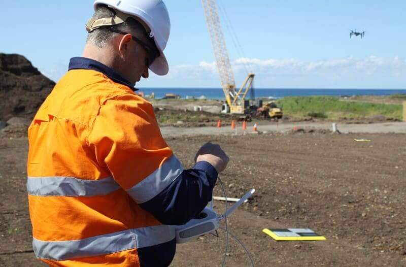
Drone surveying is straightforward to grasp with some hands-on experience and training. Learning to fly the Phantom 4 RTK takes a relatively short amount of time, and obtaining your Part 107 license is easier than you may think. Furthermore, operating smart ground control points (GCPs) like AeroPoints only requires the push of a button.
But tackling geographic coordinate systems and map projections, can be a little more complicated.
To help you understand, we’ll explain the difference between coordinate systems and map projections, the difference between projected and geographic coordinate systems, and other topics that will help you obtain accurate, actionable survey measurements for your jobsite.
Plus, we’ll explain the importance of why transforming between different coordinate systems is necessary– and how to make it easier.
What is a coordinate system?
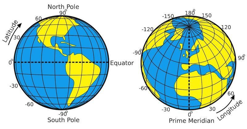
When you see the term coordinate system, it’s referring to what’s more precisely called a coordinate reference system. It’s a system that defines the location of a point on a plane or sphere.
Think of it this way: coordinate systems provide X, Y, Z, locations for all points on a land surface. Knowing this information lets you determine where you (or your worksite) are on the earth.
Projected vs. geographic coordinate systems
Technically, there are two classes of coordinate reference systems: geographic and projected coordinate systems.
Geographic coordinate systems are three-dimensional grids, while projected systems use map projections to view the world as a two dimensional map. National and local grids are examples of projected coordinate systems.
Projected coordinate systems can be more useful for worksites over geographic coordinate systems because they have less local distortion. For example, a local grid can be as small as the size of a single site, which reduces projection distortion considerably. Distortion can happen within an angle, area, direction, or distance because it’s impossible to completely flatten a spherical surface (like the earth’s terrain).
How coordinate systems are chosen for a worksite?
Many geographic and projected coordinate systems are used around the world. Surveyors setting up a work site will chose the best coordinate system to use for the worksite’s location, before any building is started. Once it’s set, all work must be done within the chose coordinate system for the duration of the project.
What is a map projection?
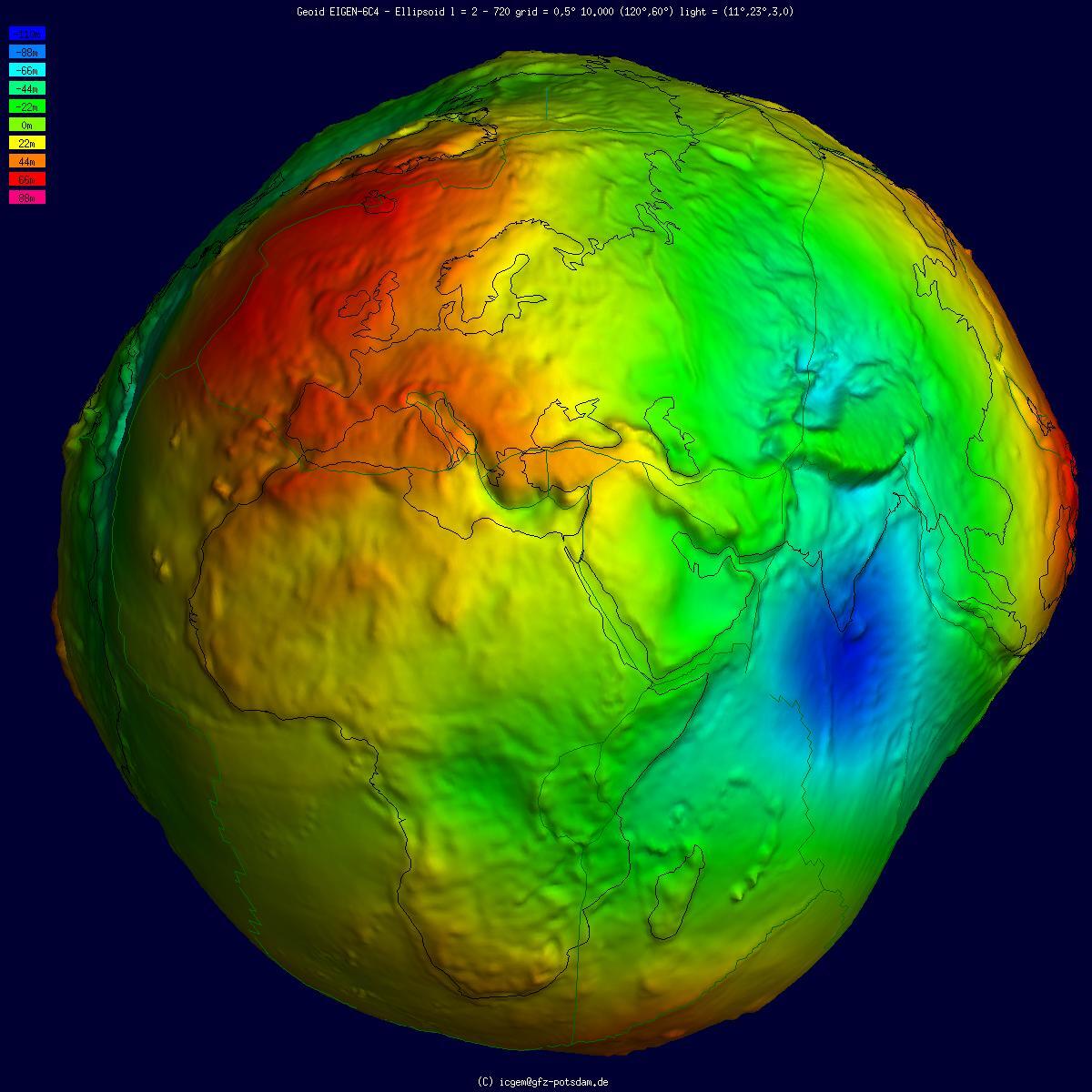
A map projection is defined as a systematic transformation of the coordinates (latitude and longitude) on the surface of a sphere (or ellipsoid) into plane coordinates on a flat surface (x, y).
Earth is spherical, existing in three dimensions. So, to represent our 3D earth with an accurate scale on 2D paper (or screen), map projections are used.
The cost of this transformation means some map projections are distorted. In fact, all 2D world maps are wrong to some degree (In fact, a sphere’s surface cannot be represented on a flat surface without distortion.)

One distortion seen on common world maps is the relative scale of land masses.
Why the world uses many coordinate systems?
The reason many coordinate systems exist is to ensure accuracy around the globe. Due to the uneven sphere of the earth, shifting continents, and more, a single coordinate system won’t work for producing accurate maps. (For a deep-dive into why coordinate systems matter, read our post.)
This means surveyors setting up worksites choose among different published coordinate systems, depending on their location, or they use a local grid system.
Getting drone data collected in the geographic coordinate reference system WGS84 to align with the local coordinate system you use on your jobsite means you have to transform between the two different coordinate systems. GPS-based survey tools return data in geographic coordinate systems. This makes converting your data from one system to another mandatory. Understanding these transformations is very important when creating accurate surveys.

Transformation is a complex and complicated mathematical process that not everyone has the knowledge to do. However, there are a number of different software programs that help.
Part of Propeller’s mission is to make using your site survey data easier, and we have built a handy coordinate converter to use whenever you need it. It doesn’t require advanced training to operate and will save you time, so you can focus on your earthmoving project.
