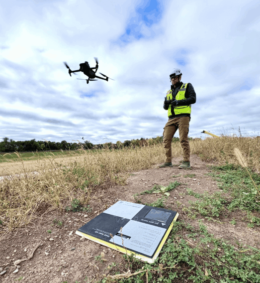
“It’s the accuracy of the AeroPoints that works for us. Some companies rely on RTK, but we want reliable, accurate results. Fixed ground control doesn’t work for construction due to there always being material moved.”
Drone Manager
Helsinki, Finland

Your map should power decisions, not just display layers. Propeller transforms high precision survey, machine telematics, and field updates into one live operating picture for every team and every workflow. Act on real time data today instead of waiting for reports tomorrow.
Key wins:
Monitor elevation, run and idle time, and load cycles in real time.
Automate reporting and verify progress daily.
Reduce mistakes, risk, and rework with consistent, high fidelity data.
Keep the entire team aligned in one live map.
With Propeller, every team member sees the same high-precision information in real time.
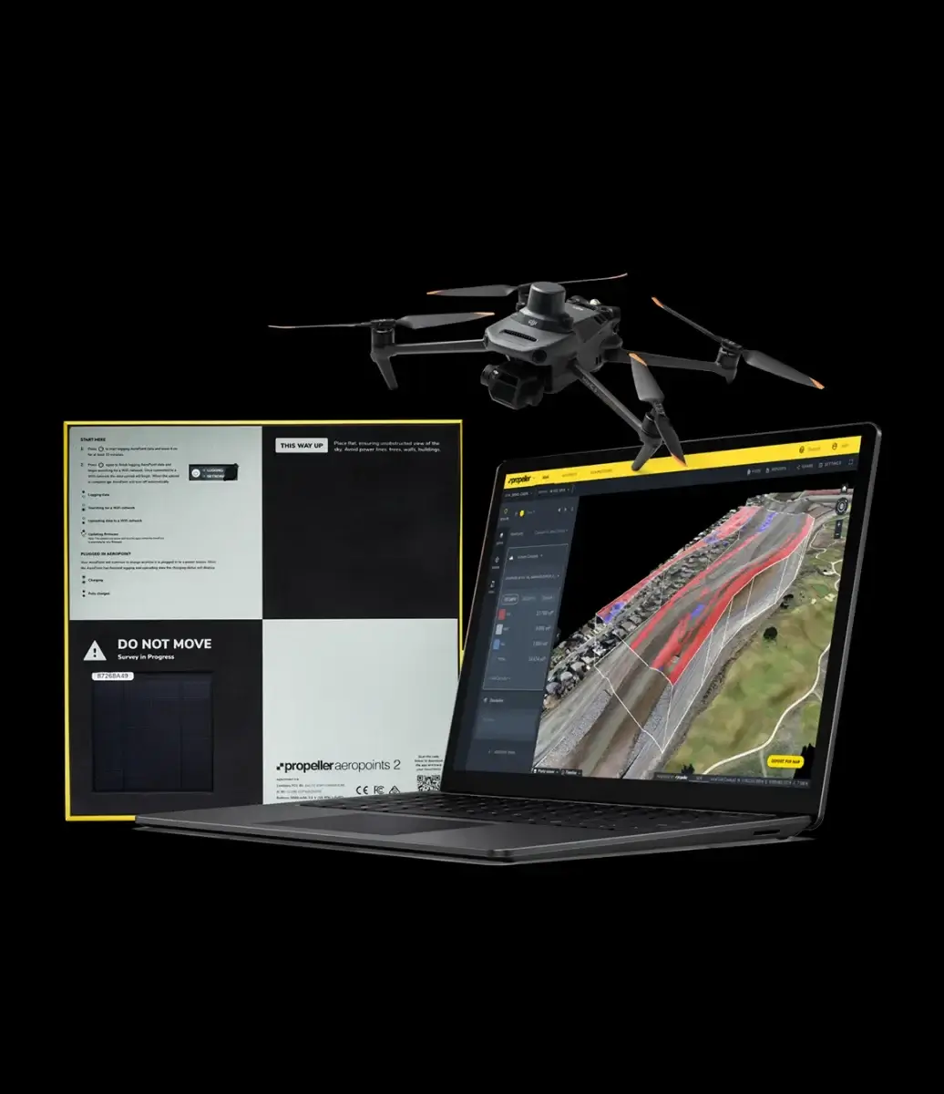
Your maps, models, and measurements live in one secure GIS online platform that works in any browser. Field and office teams can view, annotate, and collaborate on the same real time information, so planning, adjusting, and reporting all happen from a shared understanding of the jobsite.
Propeller turns your survey data, machine telematics, and field updates into a dependable source of truth that teams trust daily. We process your data for you with real people behind every upload, ensuring high precision results you can act on with confidence.
Propeller’s approach turns maps into actionable intelligence. Avoid static maps hiding delays and inefficiencies, manual reporting and disconnected data.
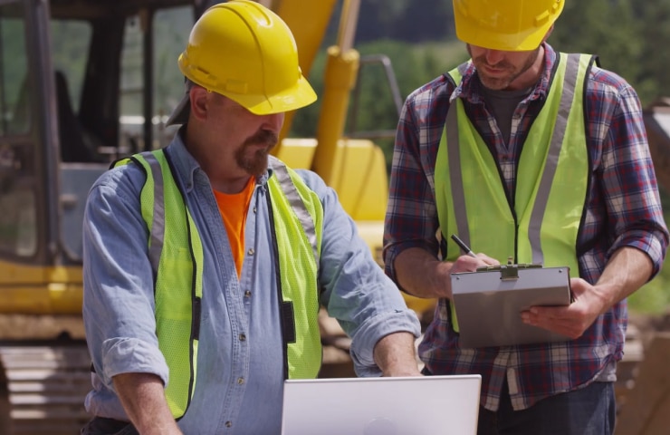
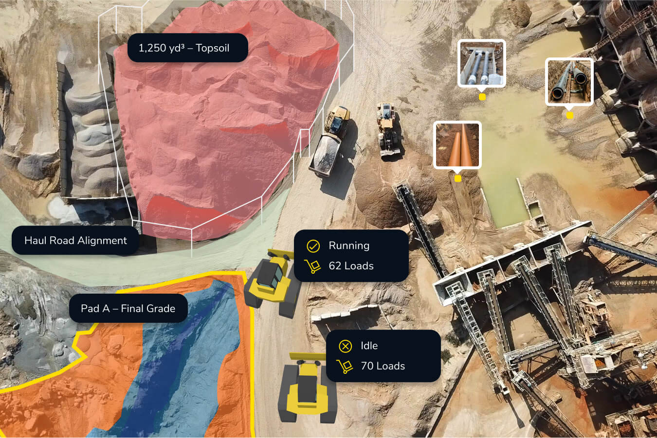
Foremen, operators, and office staff start each day aligned on the same high-precision map. Changes are tracked instantly, run and idle times are monitored automatically, and reports are generated without extra work. Issues are flagged before they escalate, and teams focus on action, not chasing data.

“It’s the accuracy of the AeroPoints that works for us. Some companies rely on RTK, but we want reliable, accurate results. Fixed ground control doesn’t work for construction due to there always being material moved.”
“Propeller has changed the way our site department does business, and we have tried multiple platforms and drones. The Propeller PPK workflow changed the game for us.”
“Once you’ve used Propeller, you don’t want to use anything else again. It’s so easy!”
“I don’t know of a platform out there that is as good and as accurate as what Propeller can do.”
Turn site data into visual insights. Build accurate maps that unify different data sources and document your work from planning to closeout.
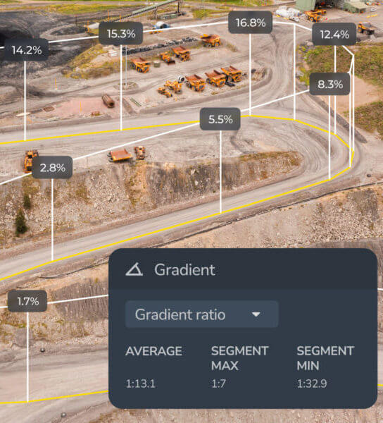
Get precise measurements across your site. From distances and volumes to heights and grades, measure exactly what matters.
Monitor progress and know your position. See trends, identify issues, and ensure your projects stay on track.
Streamline your workflows. Keep projects tidy, permissions secure, and data easy to access when and where you need it.
Stay ahead of site challenges. Analyze flow, elevation, and runoff to predict outcomes and make smarter decisions.
Bring your teams together. Share data, reports, and visuals that connect the field to the office, keeping everyone aligned.