“I think the datasets speak for themselves. It’s nothing that you have to bring anyone onboard with. It’s data that’s intrinsically and obviously valuable.”

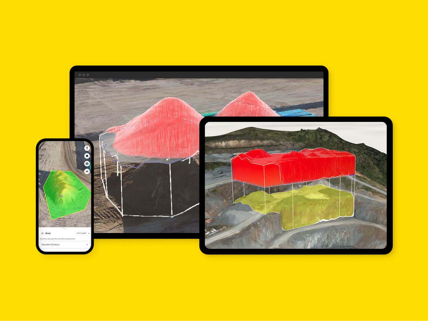
Instantly perform cut-fill calculations with an interactive 3D map, enabling real-time progress tracking against design plans. This minimises rework, boosts team collaboration, and keeps your production schedule on track.
Explore how to optimise drone surveying for earthmoving, tailored to your project’s unique demands. Discover the key features of Propeller for calculating earthwork volumes and conducting accurate cut and fill analysis.
Master best practices for precise earthwork measurements. Seamlessly integrate drone survey data with your project management tools and utilise Propeller’s features to minimise errors and enhance the accuracy of your earthwork estimates.
“I think the datasets speak for themselves. It’s nothing that you have to bring anyone onboard with. It’s data that’s intrinsically and obviously valuable.”
“Propeller’s outsourced processing gets us data back much faster, and the accuracy is great. The whole process is so easy, I could almost have my kid do it”.
Make the map a meeting ground where your project teams can access critical insights on their own.
Manage AeroPoints usage, monitor hardware health, and run accuracy diagnostics from a personalized dashboard.
Scale up at your own pace, without adding resources. Just drag and drop your dataset into Propeller, and we’ll send back a high-accuracy 3D map in return.
Production teams use the DirtMate Dashboard to track daily volumes and access productivity insights.
We’ve broken down our entire Propeller offering into three easy-to-follow modules.
Drone setup
AeroPoints overview
Flight checklist
Data capture workflow
Platform overview
Measuring with survey data
Managing your site
Files + collaboration
Reporting