What Is Drone LiDAR Surveying?
Drone LiDAR surveying uses laser pulses emitted from a sensor mounted on a drone to measure distances between the aircraft and the ground. By calculating the time it takes for each pulse to return, LiDAR systems generate dense, georeferenced point clouds used for terrain modeling and bare earth mapping.
How LiDAR drone surveying works
LiDAR was introduced to the market for commercial use about 20 years ago. Since then, it’s proved to be a powerful addition to the surveyor’s toolbox.
While LiDAR has historically been a more expensive worksite surveying solution than photogrammetry, it can also make all the difference for surveying, progress tracking, and modeling on vegetated sites.
As the cost of LiDAR sensors continues to decrease, more and more worksites are getting in on the LiDAR action, and to great effect.
This article explains LiDAR drone surveying: what it is, how it works, and how it stacks up against photogrammetry.
What is LiDAR?
LiDAR stands for “Light Detection and Ranging.” It measures distance by emitting laser pulses toward a surface and calculating the time it takes for those pulses to return to the sensor. Think terrain, trees, or cliff faces, and measuring the reflected pulses with a sensor to gauge distances.
If that description makes you think of modern 3D printing technology, you won’t be surprised to learn that LiDAR is sometimes also called 3D laser scanning. But you probably will be surprised to learn that it’s been around since the 1960s!
Using a bit of trigonometry, trained professionals have used LiDAR for decades to calculate distances with a high degree of accuracy. Thanks to LiDAR drone hardware and processing platforms like Propeller, you can now capture millions of reflection points to reconstruct a point-based model of vegetated terrain.
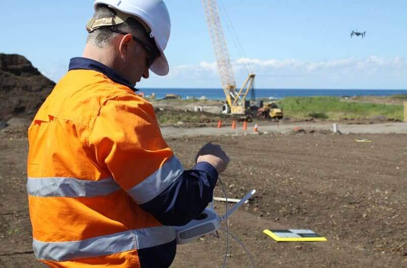
How Drone LiDAR Surveys Are Conducted
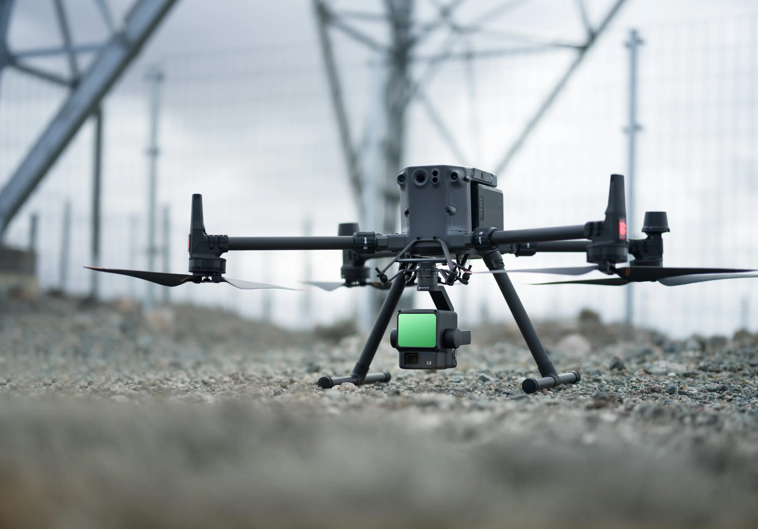
A typical drone LiDAR workflow begins with flight planning and base station setup to ensure accurate positioning. Once airborne, the LiDAR sensor emits hundreds of thousands to millions of laser pulses per second, recording multiple returns from surfaces such as tree canopy, buildings, and ground.
After the flight, LiDAR survey processing begins. The raw point cloud is georeferenced, classified, and filtered to separate vegetation, structures, and bare earth points. The resulting dataset can then be used for digital terrain modeling, contour generation, and earthworks analysis.
LiDAR is often compared to sonar or radar, which use sound and radio waves respectively to map surfaces and detect objects. In most cases, LiDAR uses infrared light in a very similar way.
The necessary laser and camera hardware can be mounted on a plane, tripod, automobile . . . or drone.
How to survey with LiDAR on your worksite
The first step to conducting any aerial survey is to make sure you have all the licenses and regulations sorted out before you fly. (If you opt to use a tripod instead of a drone, make sure you set up in a safe place on-site, out of the way of equipment and busy working areas.)
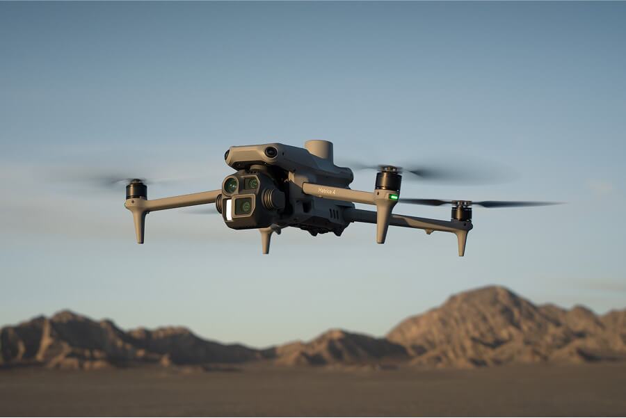
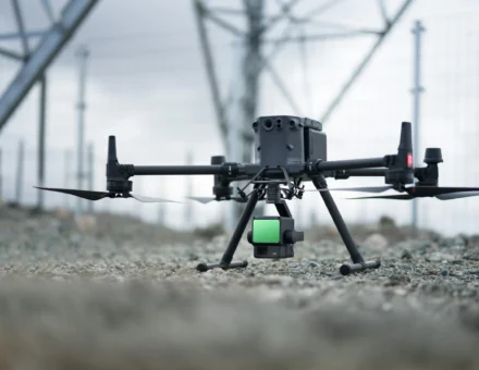
LiDAR drone surveying works a lot like photogrammetry—especially if you attach DJI’s Zenmuse L1/L2 sensor to an M300 or M350 RTK drone.
While your mileage may vary, a typical LiDAR drone surveying workflow will look familiar to anyone who flies photogrammetry drones today:
- Plan flight and set up base station
- Launch and fly drone
- Land and upload data
LiDAR vs Photogrammetry for Drone Mapping
Now that the basics are out of the way, let’s tackle the big question: what’s the difference between LiDAR and photogrammetry, and which is best for your worksite? There are a few key differences in how these capture methods work and the visual outputs you get from each.
One technology isn’t inherently better than the other, and there is no one-size-fits-all solution. Each approach has its strengths, and the solution that’s best for you boils down to your needs. You might even need both at different stages of a single project.
It all comes down to what you want to accomplish. Do you want to peek through dense vegetation? Create a photorealistic 3D map? Fly at night (where regulations allow)?
Your answers will guide you toward the right solution for your worksite. Let’s explore how LiDAR and photogrammetry differ, and when each one really shines.
Weather and lighting conditions
Both LiDAR and photogrammetry drone surveys need friendly skies to fly, which means safe weather conditions without much moisture, wind, or extreme temperatures. Photogrammetry requires sunlight to capture detailed images, while LiDAR isn’t fussed about lighting.
However, flying drones at night requires a special waiver, no matter the tech. If you want to survey with LiDAR in low light or at night, it can be easier to use a tripod-mounted system and avoid the hassle of filing for a waiver.
Visual outputs
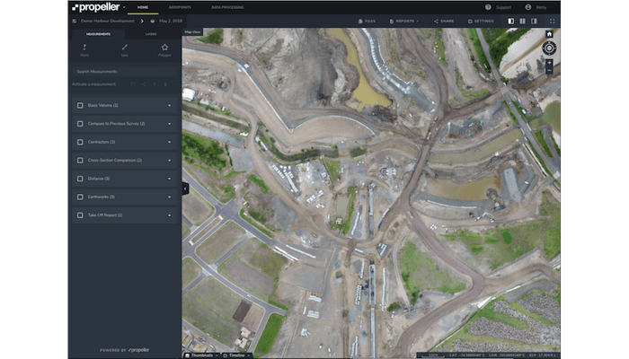
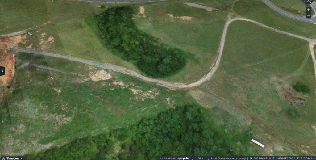
The most visible difference between LiDAR and photogrammetry is the end result—the 3D map. Because photogrammetry uses actual photos to construct a model, you get visuals of the site that mirror reality, like the kind you see in Google Earth.
LiDAR, on the other hand, uses light pulses instead of a conventional camera. The output is a 3D point cloud model, which has less visual detail and no photorealism at all.
 Photogrammetry
 LiDAR
LiDAR
Vegetation and “seeing below the canopy”
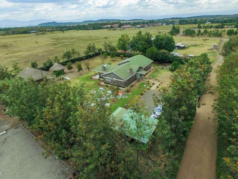
Vegetation is probably the biggest differentiator in how LiDAR performs. While LiDAR is weaker than photogrammetry at rendering a realistic 3D image of a cleared worksite, it’s far better suited for surveying densely vegetated areas such as forests, thickets, or tall grasses.
Because LiDAR sends out millions of light pulses into the environment, it can often penetrate leaves and grasses to get a “look” at the ground and take measurements accordingly.
Under good conditions, LiDAR can penetrate areas with up to 90% vegetation cover, compared to photogrammetry at closer to 60%. While Propeller does offer filtering tools to help you see what’s at ground level with photogrammetry, LiDAR is generally your best bet for accurate measurements on an uncleared site.
Is LiDAR like X-ray vision?
No—LiDAR actually doesn’t work that way. It can’t “see through” foliage, trees, and other flora. It can only penetrate the spaces between them.
LiDAR sensors have a wide range of points per second (PPS)—anywhere from 200,000 to three million. The more points that get produced and returned to the sensor, the more bare-earth points you get back. For areas with dense tree canopy or very thick grasses and shrubbery, you need a high PPS to create a more accurate terrain model.
Even with LiDAR, sites with extremely dense vegetation may still need a surveyor to manually shoot a few points under the canopy.
LiDAR is best for:
- Distinguishing features and measurements through dense vegetation
- Measuring tall structures
- Flying at night (where regulations allow)
Photogrammetry is best for:
- Creating a photorealistic 3D map
- Cleared sites
- Daytime flying
Survey accuracy and data processing
Neither LiDAR nor photogrammetry has an edge when it comes to drone survey accuracy. Whichever survey type you choose, the accuracy of any aerial survey is affected by the movement of the drone, not just the sensor hardware.
This means that whether you’re using LiDAR or photogrammetry, you still need to use a base station for ground control and run the same data correction workflows. With a photogrammetric workflow like Propeller PPK, you can get accuracy up to 1/10ft. A comparable process for LiDAR yields vertical accuracy up to 2/10ft.
Bare Earth Drone LiDAR Mapping
One of the primary advantages of drone LiDAR is its ability to generate accurate bare earth models in vegetated environments. During LiDAR survey processing, classification algorithms separate ground returns from vegetation and structures. The resulting digital terrain model provides reliable elevation data for grading, drainage design, and infrastructure planning.
Want to know why we recommend PPK over RTK?
Processing LiDAR data works in much the same way as photogrammetry. While most solutions are desktop-based and require labor-intensive processing in-house, Propeller’s team of experts is ready to handle all that processing for you.
Just like with a photogrammetric survey, you can simply fly your drone and come back the next day to a processed and QA’d dataset. You’ll receive a classified point cloud for bare ground detail and an orthophoto for more precise existing ground conditions.
Whether you choose LiDAR or photogrammetry, you’ll still get a 3D point cloud of your site. While a point cloud doesn’t have the photorealism of a photogrammetric map, you can still use it to measure volumes, track gradients, and keep on top of progress toward design.
Conclusion
LiDAR has different strengths than photogrammetry. It’s the preferred solution for surveying uncleared sites with dense vegetation at high levels of accuracy. Once a site has been cleared, you can even use the same DJI drone to complete photogrammetric surveys and create photorealistic 3D maps.
Both LiDAR and photogrammetry are important survey and progress-tracking tools for worksite management, no matter your industry.
Ready to see how Propeller can power your worksite? Request a demo now.
Frequently Asked Questions
What is drone LiDAR used for?
Drone LiDAR is used for terrain modeling, bare earth mapping, vegetation analysis, and infrastructure measurement. It is especially effective on heavily vegetated or uncleared sites.
How is LiDAR survey processing performed?
LiDAR survey processing includes georeferencing raw point data, classifying ground and non-ground returns, filtering noise, and generating terrain models or contour maps for analysis.
What is bare earth drone LiDAR mapping?
Bare earth mapping refers to isolating ground elevation points from vegetation and structures during LiDAR processing. The resulting dataset forms a digital terrain model used for grading and design.
Is drone LiDAR more accurate than photogrammetry?
Both methods can achieve high accuracy when supported by proper positioning systems and processing workflows. The choice depends more on site conditions than inherent sensor precision.
When should I use LiDAR instead of photogrammetry?
LiDAR is typically preferred for densely vegetated sites or when bare earth modeling is required before clearing. Photogrammetry is often ideal for cleared sites that require photorealistic visual models.