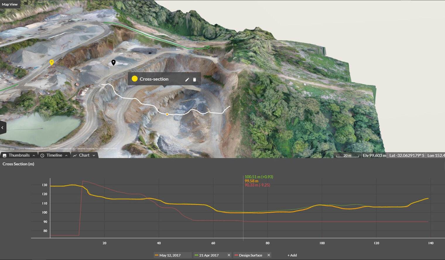
Cross Section Survey in a Matter of Minutes Using Drone Data
With the power of drone-captured data and the Propeller Platform, surveying cross sections becomes as…
Steax is an earthworks surveying and project management company founded in 2021 by Robin Stenström. As a building engineer with over seven years of experience, Robin saw a distinct industry-wide need for improved efficiency.
“I knew I could help municipal clients and earthwork contractors avoid unnecessary work,” he said. So he struck out on his own and started his own company Steax.
For a very small business like Steax, investing in a drone survey workflow came with significant risk. The licensing cost represented about 10% of their annual revenue, but the gamble has paid off significantly. Read on to learn how Steax’s investment in Propeller, has transformed the company’s efficiency and project outcomes, from faster surveys to seamless client collaboration.
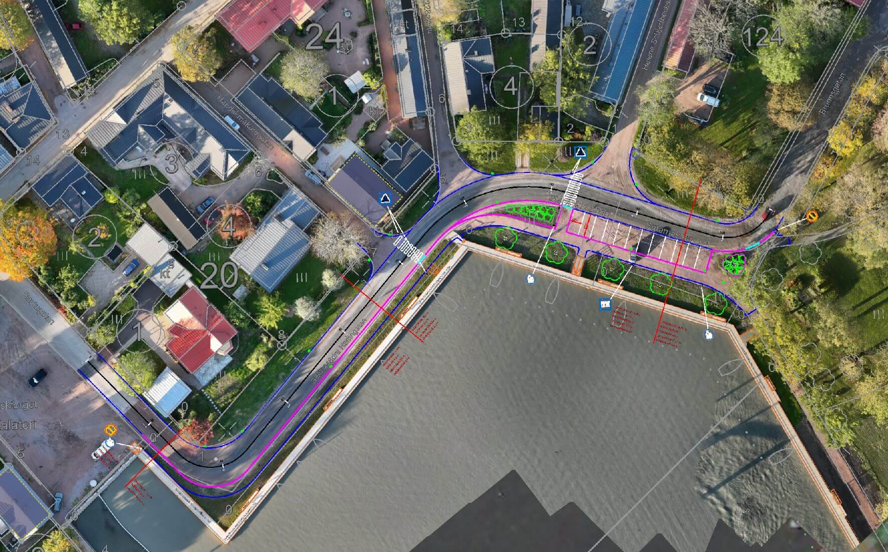
In his work with municipal clients, it didn’t take Robin long to see that traditional surveying techniques often fell short when integrating new plans with existing infrastructure. “When someone else is doing the planning and you have to create around existing infrastructure, things don’t always go together smoothly,” he told us.
With a GNSS receiver in tow, Robin faced several challenges that hindered his overall efficiency:
When the city of Raseborg asked Robin to help with some road planning projects, he knew he needed a better solution.
“I’m always interested in new and exciting technologies. That’s why I got into Propeller.”
Before implementing Propeller, Robin had no experience with drone surveying. “I hadn’t even owned a drone,” he said.
For a very small business like Steax, investing in Propeller came with significant risk. The licensing cost represented about 10% of Robin’s annual revenue, but his gamble has paid off significantly. “It’s been a big success,” Robin said.
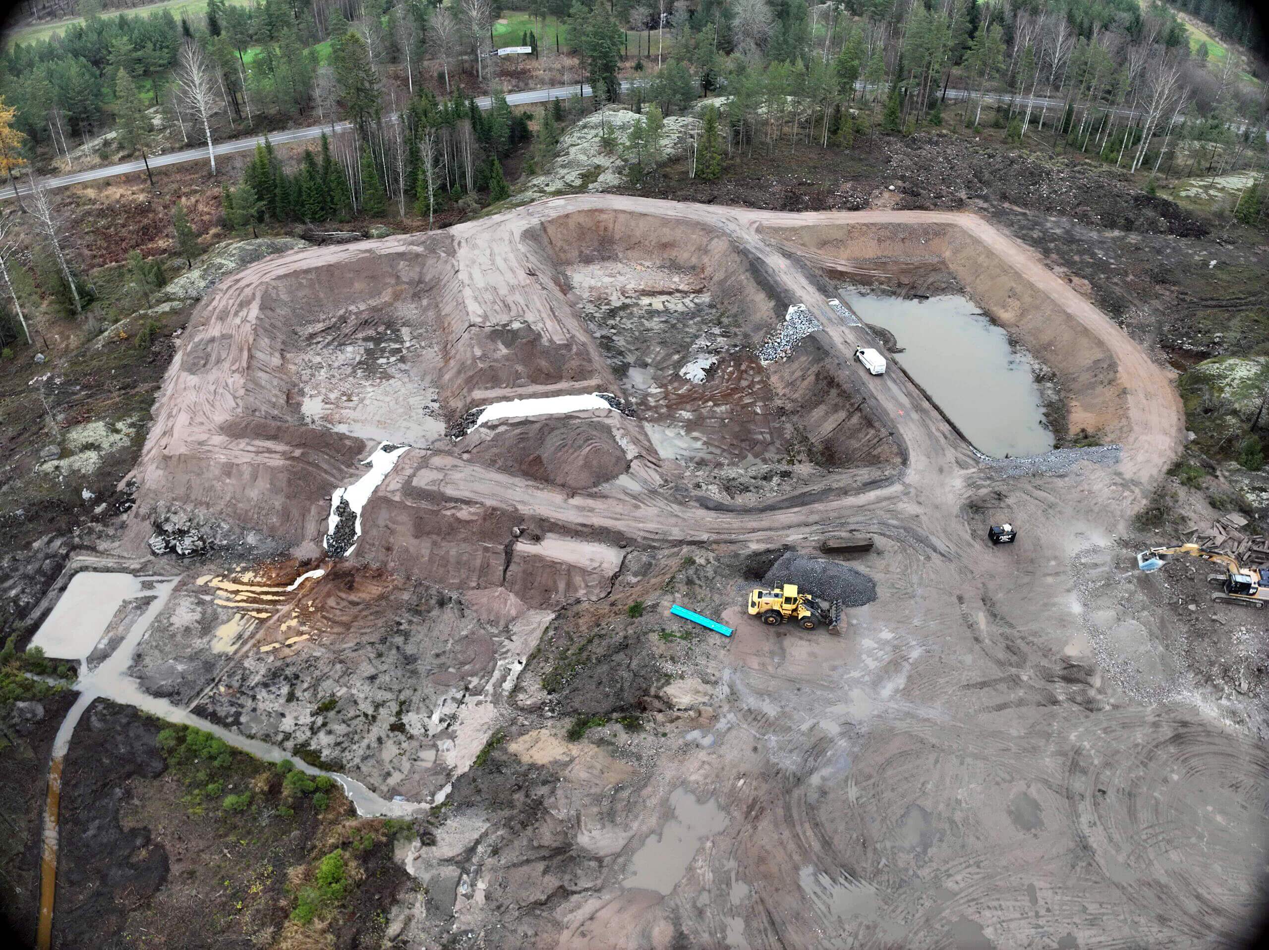
A harbor renovation project for the city of Raseborg presented an early win. Project teams needed a way to verify the volume of clay that was dug out of the harbor. They also needed to know how much space was left on their deposit site before it filled.
Using Propeller, Robin helped the city move the heavy harbor clay effectively while ensuring billing accuracy. He’s flown many surveys for them since.
Propeller is great in so many ways. Just go for it and try it for yourself! Every client has different needs, and there’s something for everyone.
Robin can upload design files to Propeller and compare them to drone surveys. Where comparing as-builts with new designs was once a painful process, Propeller provides a georeferenced picture of the area, including elevations. “With Propeller, we can join the new with the existing quite easily,” Robin said.
Steax’s clients get direct access to their site data so they can view, measure, and download it whenever they want. “Propeller is really easy to use, so they can guide themselves around the platform easily,” he told us.
Clients can upload photos to specific georeferenced points on the 3D map, allowing everyone to see exactly where images were captured.
Robin can make accurate measurements within the map without having to export a point cloud and analyze it in another program, saving valuable time.
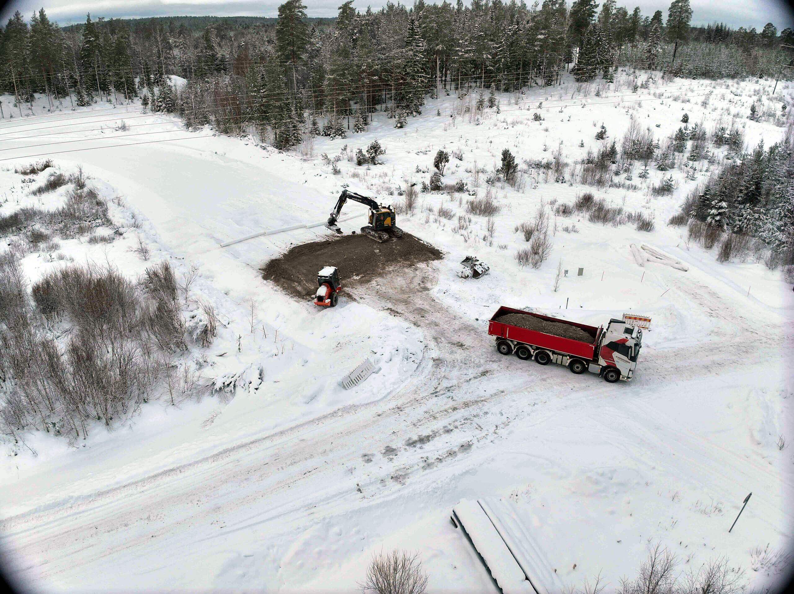
The DJI drone Robin flies performs well in Finland’s harsh winter conditions. He’s flown in temperatures as low as -20 Celsius without any performance issues.
For a one-man operation like Steax, the time Robin saves with Propeller has been a game-changer. Today, he can survey a ten-hectare site in ten minutes, where traditional surveys once took hours or even days to complete.
“You get so much data in ten minutes that you could never get with traditional surveying,” Robin said.
On one pipeline infrastructure project, Robin used Propeller to identify the wells and pipeline covers on the roads. “With traditional surveying, that would not have been possible,” he said. “But after flying, we just adjusted those points using Propeller images and updated the pipeline cover right in Propeller.”
The benefits of improved visibility and collaboration even have a downstream impact on Steax’s clients, some of whom share 3D maps with their own clients as proof of work.
Once you’ve used Propeller, you don’t want to use anything else again. It’s so easy!
Learn more about Propeller’s products, pricing, and how to get started on your site.