Dive into Propeller’s Hydrology Tools: Simulate + Manage Rainfall Events

Watch the Global webinar with Jack Nachazel, Clay Morrin, and Jordan Koeh

Watch the APAC webinar with Kevin Smith

Propeller’s hydrology tools can help you effectively prepare for rainfall or water events, simulating how water might flow given the current surface of your worksite. In this webinar, we’ll walk through:

🌧️ Flood to Level Analysis: Show the potential impact of a flood at specified water levels.
🌧️ Surface Runoff Simulation: Simulate the path of water flow across a site in response to rainfall or spills. Simply draw a polygon boundary to run a simulation for a select area of your site.
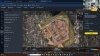
🌧️ Catchment/Watershed Analysis: Generate breached stream networks in any region of your site, helping you to visualize where water will flow to and from and the catchment areas.
🌧️ Direct Rainfall Simulation: Simulate and visualize the effects of rainfall over time within a specified area.

Watch the recording here:

Watch the recording for a deep-dive into our most recent updates to our hydrology tool that will help you better manage your worksite.

Related Webinars

Mapping magic: An inside look at how Propeller processes your data

Ever wondered how our geospatial specialists process your data? Here’s your chance to take a…

Progress Tracking with Menai Civil Contractors

How does your team know exactly how much they’ve gotten done—and how much is left…
RTK, PPK, and levelling up workflows

RTK, PPK, and leveling up workflows: Exploring the accuracy of your drone surveys

How can you be sure you’re getting the highest level of accuracy from your drone…

Meet our speakers

Kevin Smith

Kevin Smith

APAC Regional Sales Manager, Propeller

Jack Nachazel

Jack Nachazel

Product Researcher, Propeller

Clay Morin

Clay Morin

GPS/Survey Technician, Tindol Construction

Jordan Koehn

Jordan Koehn

Technical Operations Manager, Tindol Construction

Related Webinars

Mapping magic: An inside look at how Propeller processes your data

Ever wondered how our geospatial specialists process your data? Here’s your chance to take a…

Progress Tracking with Menai Civil Contractors

How does your team know exactly how much they’ve gotten done—and how much is left…
RTK, PPK, and levelling up workflows

RTK, PPK, and leveling up workflows: Exploring the accuracy of your drone surveys

How can you be sure you’re getting the highest level of accuracy from your drone…

Subscribe to our webinars

Join the Propeller community for first access to upcoming sessions and on-demand replays. We bring the experts; you bring the curiosity.