Ground control is an important aspect of any aerial surveying project because it helps ensure data accuracy. While RTK- or PPK-enabled drones are well equipped to capture imagery from the air, their accuracy does not automatically translate to accuracy on the ground. This is where ground control points (GCPs) come in. GCPs are points on the ground with known coordinates that a surveyor can precisely pinpoint, and with these, is able to accurately map large areas with a drone.
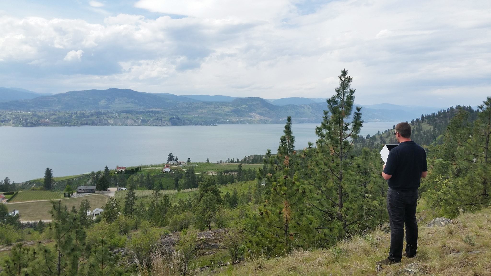
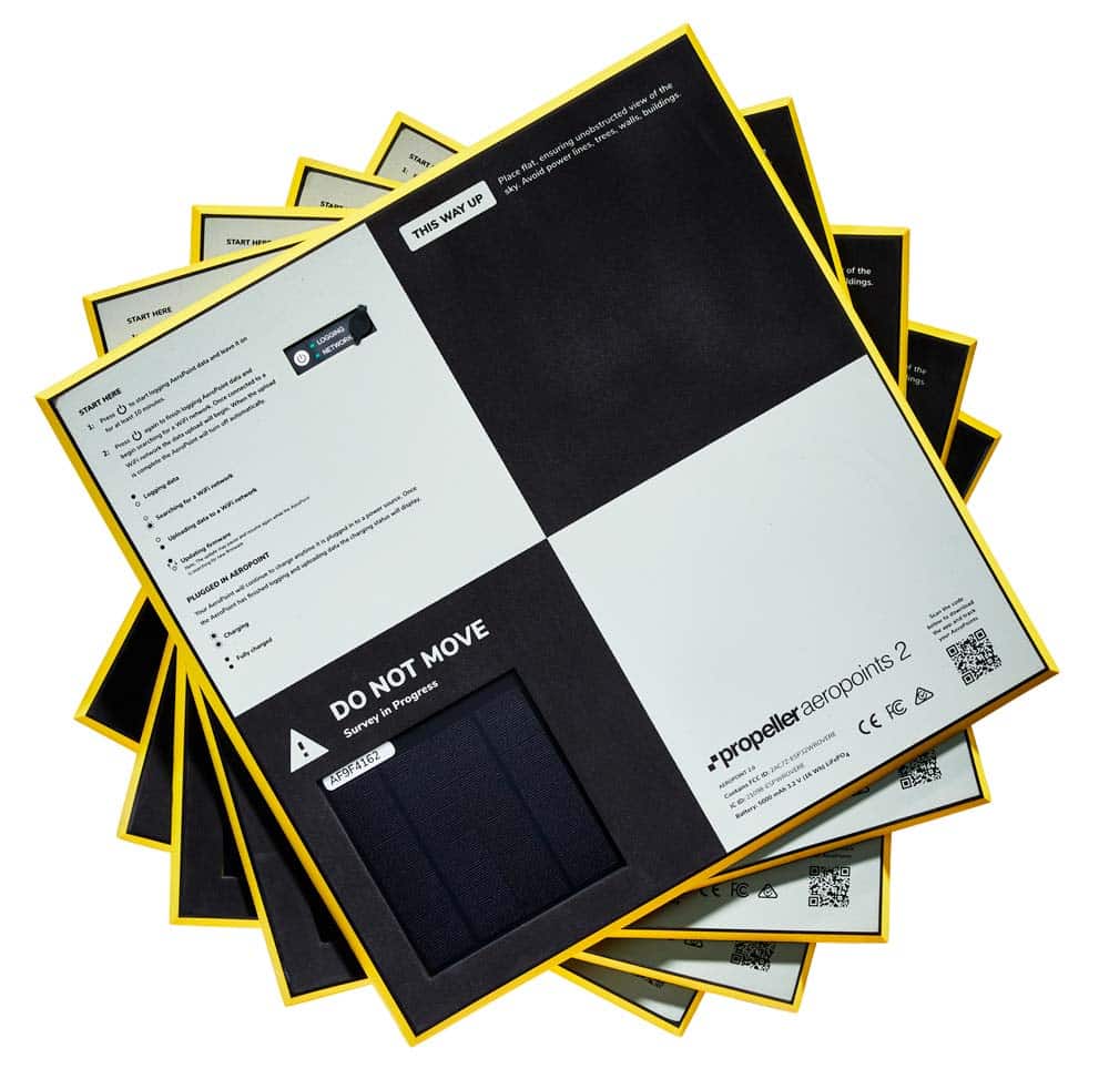
Propeller’s AeroPoints are GPS-enabled “smart” ground control points that reduce the margin of survey error from a scale of meters to centimeters in far less time and work hours than traditional ground control. Instead of manually marking GCPs with a base and rover, you can simply place an AeroPoint on the ground anywhere within range of your drone flight (1 AeroPoint covers 100 acres with Propeller PPK processing).
Ian Gowing is the service center manager for a remote sensing data collection application system called AggieAir based out of the Utah Water Research Laboratory department at Utah State University in Logan, Utah. Beginning in 2006, Ian and his team identified an emerging need for a scientific, low-cost data collection application from which their operation, AggieAir, grew.
Professors at Utah State and other government agencies seek out Ian’s knowledge and expertise in aerial imagery. AggieAir manages research projects, including one with the California Almond Board where they survey almond orchards and use the drone aerial photos they collect to assess the water consumption within the orchards. They also conduct research looking at fish habitats and assessing water reservoir capacities.
Streamlining survey operations with AeroPoints for ground control
All of these various survey projects require good ground control placement to ensure accurate data that AggieAir can upload to their agricultural technology platform. Ian explained how much of a time saver AeroPoints are for his work, compared with manually creating and placing traditional ground control points, which they used to do prior to adopting AeroPoints.
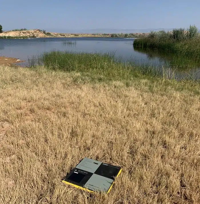
“I’ve been using AeroPoints for three to four years now, and they’re a lifesaver,” Ian shared. “I don’t know what we would do without them. Before, we’d be setting up an RTK base station and waiting eight hours for the data to collect. But with AeroPoints, it’s a seamless process. We leave them out typically for an hour [ed. note: AeroPoints 2 have a minimum capture time of 10 minutes], or up to 8 hours, and then we do our flights, which typically last about 20 minutes. Or we can be out flying all day if we need to, depending on the acreage of the type of area that we’re covering. They’re fantastic.”
Ian also commented on the large knowledge base that was required to satisfactorily use a GPS-RTK base station for ground control. With AeroPoints, the team simply turns them on and lays them out, and they start collecting data within 10 minutes. “I can give engineering students working on my projects a 10-minute introduction to Propeller AeroPoints, and ask them to place the targets in predefined locations. This has really streamlined AggieAir’s processing of digital imagery from what we previously had to do.”
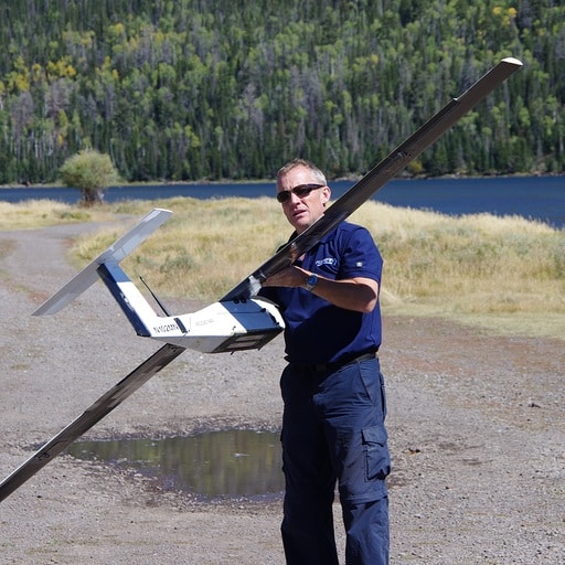
With the large surveys they conduct (sometimes up to 1000 acres), AggieAir uses a vertical take off and landing (VTOL) fixed wing drone that may fly up to five separate flights. Using AeroPoints as ground control across the entire site, they are able to take the aerial imagery from all flights and seamlessly combine them into one, precise map of the site.
Faster data processing time
For their research projects, Ian’s team uses Agisoft for post processing their aerial data. He commented on how well AeroPoints integrate with his workflow. “It’s so streamlined,” Ian shared. “We upload our AeroPoint data to the Propeller Corrections Network, and that data is then available for us within 24 hours, if not sooner. We then transform the GPS data into the required coordinate system we need, and then we’ll upload that data into Agisoft.”
Keeping costs in check
Working for the university, Ian is always striving for the best, easiest, and most efficient way of spending his time and money on the research contracts he obtains. So, not having to spend a whole day just laying ground control for a survey flight, not only saves time, but also reduces costs.
“If there’s anything that I can do to not only reduce the cost but increase the accuracy, that’s a no brainer for me. And that’s what AeroPoints have done—they’ve given us accuracy that would have taken us hours before, where now we can get our data back much quicker. Previously, I would have one person spend a week collecting and processing the data. If we had one flight of 100 acres I would suddenly have to send one person to go out and collect the data to process it. With your AeroPoints, now I’ve cut that cost down to 1/5 of what I was spending before, if not more.”