
The earthworks project bidding process has traditionally been a complicated balancing act between submitting a competitive bid that wins the project and ensuring that bid allows the company to remain profitable. Accurate data is incredibly important in the bidding process, especially in the case of large-scale earthworks projects.
Although bids traditionally have been proposed based on the overseeing engineer’s final design and data regarding current conditions on the ground, drone survey data is now rising in popularity to validate the design and ensure accurate estimates not only at the start of a project, but throughout as well. Survey teams are able to gain an incredibly accurate measurement of material quantities on worksites, helping teams check bids and generate a reliable estimate of costs and requirements that are necessary to get the job done. Drone surveys remain useful for the entire duration of an earthworks project, helping teams monitor progress and maintain accountability to clients.
Drone surveys provide valuable pre-construction insights for bids and project management
Many construction firms are using drones before ever breaking ground on a project, capturing crucial preliminary information that allows them to measure cut, net, and fill quantities at a given site. The information collected during the drone survey is used to create a digital representation of the site as quickly as possible, giving contractors an idea of exact volumes that will need to be moved based on the final design for the project. Flying a drone before making a final bid allows contractors to avoid underbidding, which can lead to a net loss on the project, while also avoiding overbidding, which can lead to a client choosing a competing firm. In short, drone surveying helps firms craft competitive bids while maximizing their profit margins.
Drone surveys provide regular progress tracking
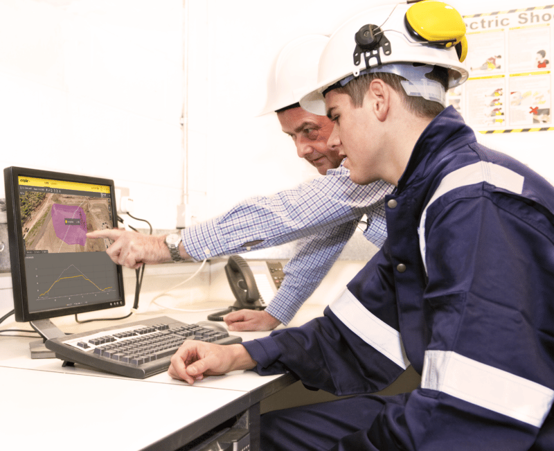
Using drone technology early in any earthworks project and continuing to use it throughout the project for progress tracking, gives earthworks crews several distinct advantages, and it keeps clients satisfied throughout the duration of the project, too. Using drone analytics software, like Propeller, to create 3D topographical maps of a worksite allows contractors to create regular progress reports and maintain a centralized system of record for the project. Progress reports keep clients apprised of up-to-date information of work completed on site, providing the data and visuals need to verify that the project is staying on track and on budget.
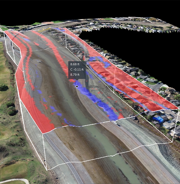
By leveraging advanced drone data analytics and 3D mapping software, contractors can quickly identify areas of risk, inefficiency, or delay much sooner than they could with traditional surveying methods. This allows teams to have not only greater visibility into the site operation, but also enhanced communication and collaboration, and ability to adapt to changes quickly, as needed.
Drone data analytics software offers key benefits throughout the earthworks process: from bid to completion
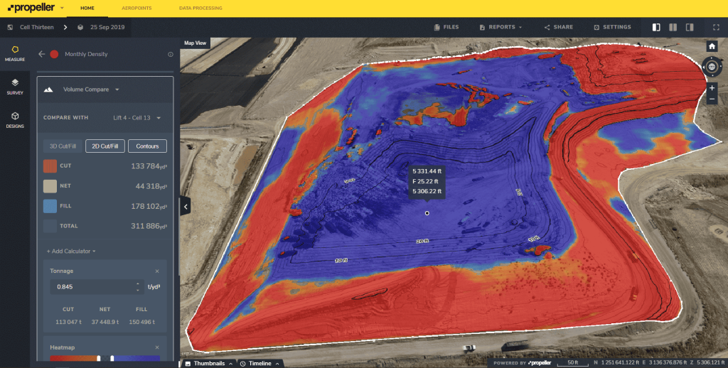
Throughout every earthworks project, site managers need a clear picture of how much earth has been moved and how much still needs to be moved. Data collected through regular site surveys shows you how work is progressing toward the final design. With Propeller’s innovative timeline tool, teams can easily compare surveys collected at various dates. Propeller’s software also provides other distinct advantages throughout the entire earthworks process of a project, including:
- Reducing costs: Drone surveying on an earthworks site is a cost-effective solution, allowing survey teams to quickly fly their site more frequently and generate an accurate 3D model of the site much faster than with traditional methods. Moreover, regular surveys keep work on track so key stakeholders and crews working on the ground can identify minor issues before they turn into major ones. In terms of large-scale infrastructure projects like highways or dams, where delays of even a single day can cost thousands or even hundreds of thousands of dollars, up-to-date information is invaluable.
- Improving safety and mitigating risk Drone technology and analytics software helps teams decrease or even eliminate the need for in-person surveys and inspections, thereby reducing the safety risk associated with physically walking a site. With Propeller, teams can quickly measure haul roads to make sure they conform to safety standards and with accurate views of conditions on the ground, teams also can better facilitate safe traffic management. Beyond physical safety, drone technology also can reduce risk associated with budget, timelines, efficiency, staffing, cost overruns, and more.
- Protecting the environment: Many earthworks projects require compliance with more than just the typical restrictions as crews often need to contend with environmental boundaries and no-go zones. Propeller’s software helps teams highlight protected areas of a site, and data can easily be shared with the entire crew to highlight specific areas where extra care needs to be taken.
Drones are quickly becoming almost as common a sight on earthworks projects as backhoes and excavators. Armed with a drone and an end-to-end solution for processing drone survey data, contractors can generate competitive bids that maximize profit margins. Continued use throughout the project keeps progress on-track and provides stakeholders with frequent updates, all at a fraction of the cost of traditional surveying practices.


