A successful drone program can provide your mine with accurate, up-to-date information on progress and productivity, and information you can use to ensure high-quality work and minimize operational risks and costs. But unlike traditional surveyor equipment, special training and advanced degrees aren’t necessary.
Collecting and processing data is only half the story. Web based platforms can act as translators and make your raw data readable. Take our own: it transforms drone imagery and ground control data into a 3D survey of your mine. Fully navigable and fully measurable in 3D.
Check your local aviation regulations
Different countries and regions regulate drones differently. So do your research. What kind of airspace is your site located in? Is it restricted in some way? Do you need a special license?
Some websites catalogue regulations by country, like Global Drone Regulations Database, or there are apps, like the B4YouFly app for the US that give you information based on your location. Usually, all unmanned aerial vehicles (UAVs) are overseen by the country’s transportation administration, so check out your country’s website if you’re not finding information elsewhere.
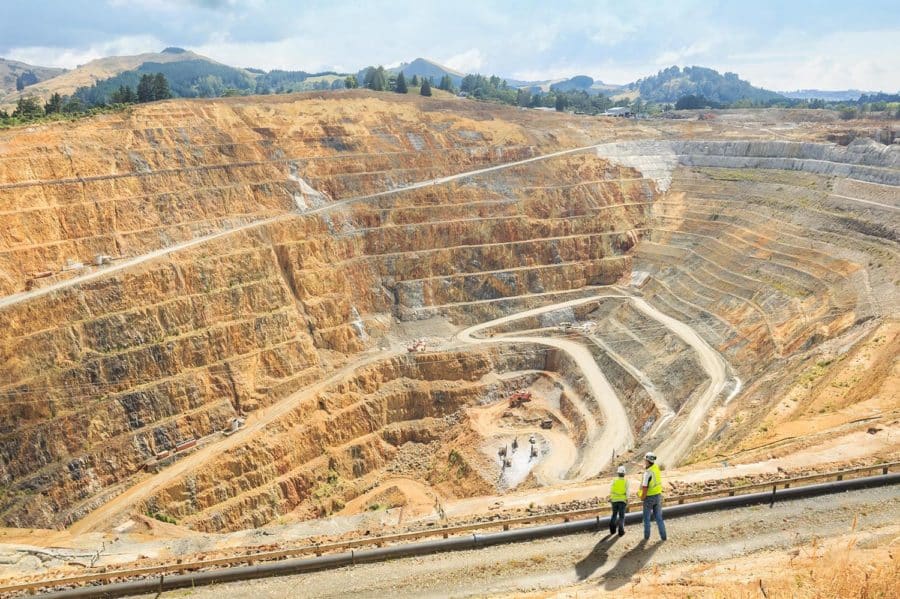
What’s the best hardware for your mine?
If your mine is 200 hectares (500 acres) or less, it can be surveyed comfortably with a multicopter. If it’s larger, you may want to consider either more than one multicopter or a fixed-wing UAV.
Budget
Multicopters (especially those made by DJI) are mass produced and can be purchased easily and cheaply. While fixed-wing UAVs are still made in limited quantities, meaning units are more pricey—sometimes up to a hundred times more expensive.
Availability and ease of maintenance
Along with sticker price, keep in mind the added cost of maintenance and the availability of parts and replacements. It’s best to stick with simple options that are available at local stores.
A great example of the value of availability comes from what would usually be a dreaded event: crashing your drone. One of our partners was recently flying a site and crashed his drone, due high winds and operator failure. But because he was flying a DJI drone, he was able to purchase a replacement at a local store and picked up where he left off two hours later.
Camera
A good camera for surveying purposes should have a 20MP sensor (or better). Avoid interchangeable lenses unless you’re sure you need them. Make sure you have a larger sensor and a 35mm-equivalent focal length. This lets you get more detail about any point and increases your image contrast for better 3D renderings and point clouds.
Unsurprisingly, camera specs can get pretty detailed. If you want more information on this topic, check out our article on what makes a good camera for drone surveys and inspections.
DJI Phantom 4 Pro is ideal for they majority of mines
With the exception of some edge cases related to site size, DJI’s Phantom 4 Pro is an ideal craft for most surveys. But the drone itself is just a starting point, a tool serving a greater use. To learn more, check out our blog on the topic.

Pick the right software for your mining site
As we’ve seen, there are various options for the hardware side of things, but you can usually rig together some combination to capture your data. Software is a different matter—it’s not an interchangeable tool. As mining superintendents know, mining operations are complex, involving many levels of oversight, design, and management. You need to pick the software that’s right for your workflows.
Flight planning apps
We can’t overstate the importance of steady, consistent flight. The best way to achieve that is with a flight planning app. We recommend DJI’s Ground Station Pro.

We field-tested it on real missions like 3D aerial surveys, precision mapping, and drone inspection flights. The in-flight performance is great and the recommended options are mostly acceptable to achieve quality maps through a service like Propeller. We recommend adjusting front and side overlap to 75%. Also, be sure your aspect ratio is set to the highest resolution available and not cropping out parts of the image—for the P4P it’s 3:2.
Processing, measurement, and visualization software
To get your final mine survey, raw drone imagery needs to be stitched together, pinned to the ground control positions, and processed by powerful software and data experts. Processing photogrammetry is a resource-intensive process requiring technical knowledge. Would that time be better spent doing other work?
Desktop software of the past is optimized for processing data from a single site or a single drone. If you’re dealing with multiple surveys simultaneously, or multiple sites, use cloud computing.

Cloud-based programs are the most cost-effective ways of leveraging powerful computing that scales well with your business and requires no installation or maintenance on your end. Device-independent software also makes for easier collaboration and sharing.


