Mine Safety Management System
Transition from manual inspections to Automated Safety. Use AI-driven insights to monitor haul road compliance, hydrology risks, and high-wall stability—all from a collaborative 3D map.
Keep crews safe
Identify safety risks by checking road grades, berm heights, and other critical measurements, giving you time to fix problems before they escalate.
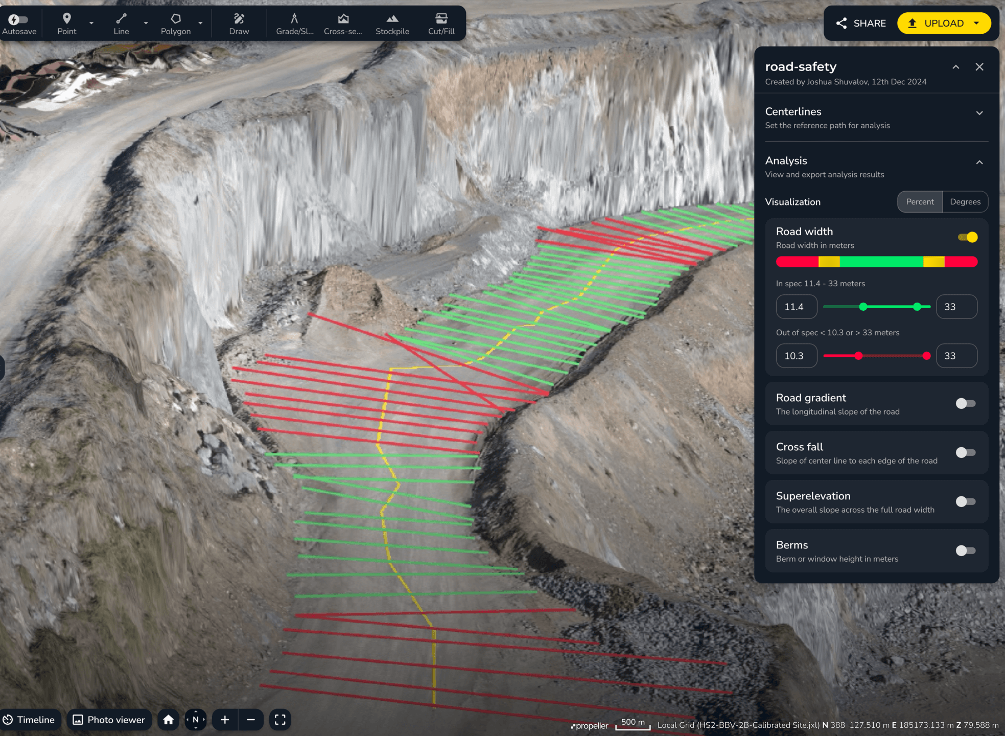
Automated Haul Road Compliance & Safety Audits
Propeller’s Automated Haul Road tool transforms site data into actionable safety metrics, instantly measuring road grades, cross-falls, superelevation and berm heights against your mine plan.
-
Real-Time Compliance: Advise on non-compliant road geometry before it leads to a haulage incident.
-
Operational Efficiency: Optimize rolling resistance to improve both vehicle safety and fuel consumption.
-
Regulatory Readiness: Maintain digital records for compliance without sending a surveyor into the pit.
- Road widths
- Road gradients
- Berm height checks
- Cross fall monitoring
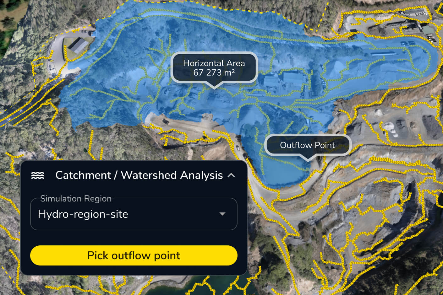
Predictive Safety Planning with Hydrology Analysis
Our Hydrology and Terrain analysis tools allow HSE managers to visualize water flow and catchment areas across the entire digital twin of the mine.
-
Proactive Hazard Detection: Identify where water will collect after rain events to prevent dangerous ponding.
-
Smart Drainage Design: Use high-resolution 3D terrain models to plan effective culverts and drainage ditches.
-
Mitigate Geotechnical Risk: Prevent the erosion and washouts that lead to catastrophic road failure.
- Flood to level
- Surface runoff
- Catchment analysis
- Direct rainfall simulation
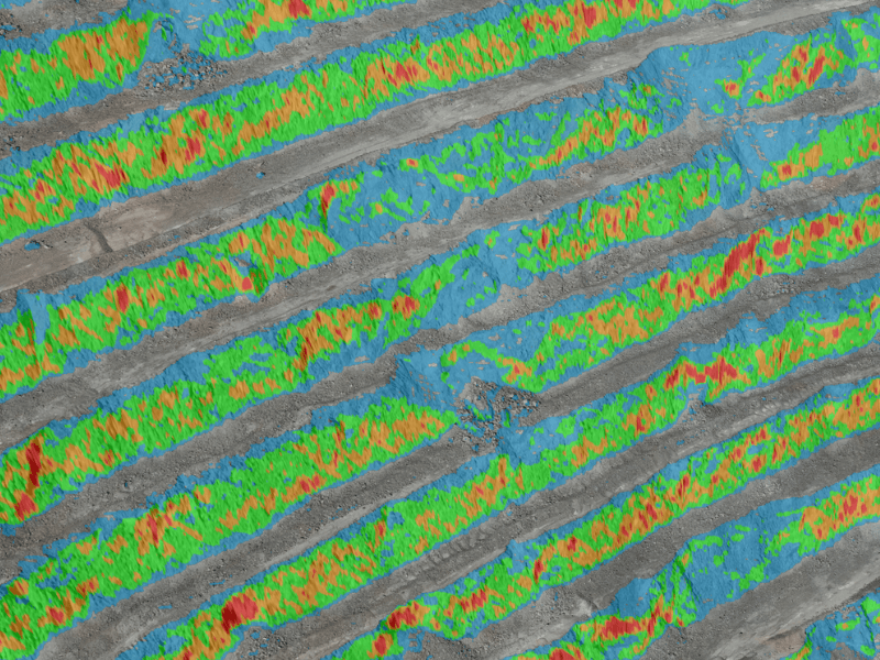
Remote High-Wall Monitoring with Vertical Imagery
With Propeller’s Vertical Face Imagery and 3D measuring tools, you get a high-definition view of benches and faces from the safety of the office.
-
Identify Structural Fractures: Spot signs of instability, crest loss, or scaling needs directly from your browser.
-
Reduce Personnel Exposure: Drastically lower “boots-on-the-ground” time for geologists and inspectors.
- Vertical face imagery
- Media
- Grade and batter checks
- Markup
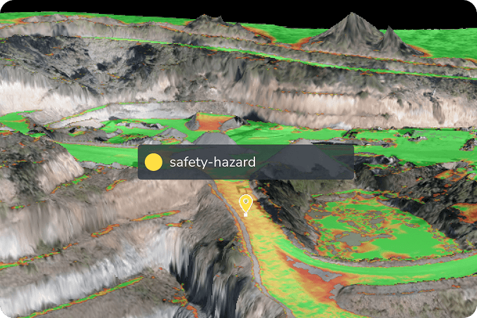
The Mining Digital Twin: A Centralized Collaboration Hub
Safety is a collaborative effort. Our 3D site map and digital twin act as a central command center, bridging the communication gap between the head office and the pit.
-
Markup + Media Integration: Pin photos, videos, or safety alerts directly to the 3D map. Tag a Superintendent the moment a hazard is identified for immediate remediation.
-
Virtual Site Inductions: Conduct safety briefings and pre-start meetings using a 1:1 digital replica of the current site conditions.
-
Historical Safety Tracking: Compare current site data against previous weeks to visualize how safety risks and terrain changes are evolving over time.
- Markup
- Media
- Automated reports
- Timeline
Automate your mine safety management
Join the world’s leading mining operations using Propeller to build a safer, data-driven workplace.