“Contractors and civil engineers don’t like surprises, and by flying a site beforehand, you can get a more accurate cost analysis on the front end.”
– Bryce Morehart, Vice President at Morehart Field Services
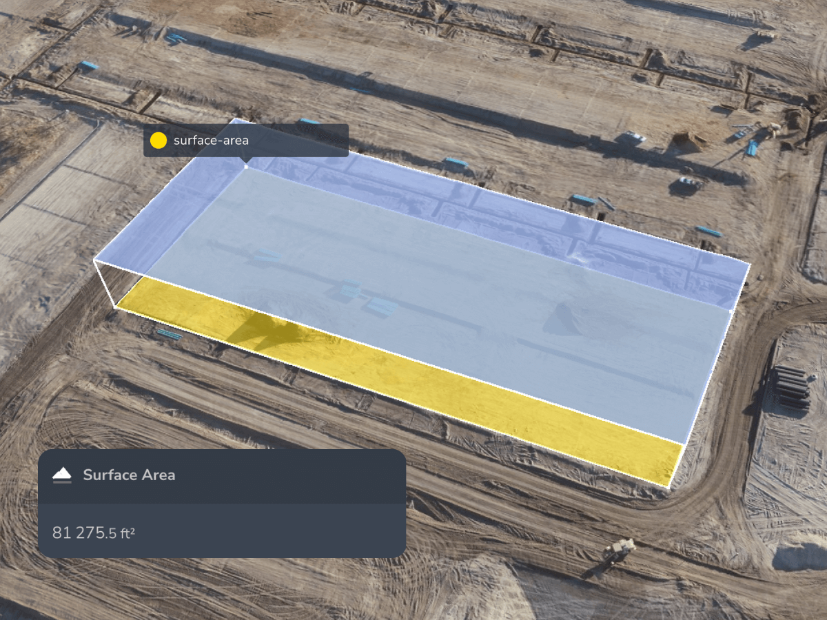
Capture accurate original ground data before your team breaks ground and verify it again after clearing to protect margins.

Unknowns force even the best teams to over-protect bids, shrinking your competitiveness before the job starts.

Stale basemaps and outdated contours lead to import vs. export discrepancies that blow up production plans and skyrocket haul-off costs.

Missing or inaccurate site maps make it hard to defend against quantity disputes and original ground discrepancies, leaving your team scrambling for documentation or absorbing cost differences you can’t prove.
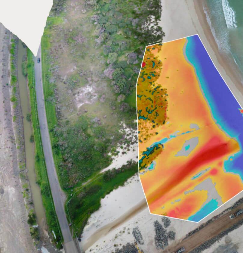
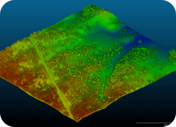
Tree canopy can hide the true shape and cost of a site. Propeller digitally removes vegetation from survey visuals to create a trustworthy “bare earth” model, so teams can validate quantities and surface risks after award, before equipment and crews mobilize. You can also use it pre-bid to strengthen quantity confidence before committing to a price.
The moment the trees are cleared, the clock starts. A quick post-clearing verification survey establishes the true starting baseline. Compare this instantly against the design surface to spot engineering discrepancies before you move dirt.

Work with your capture method of choice, then layer in AeroPoints for survey-grade control

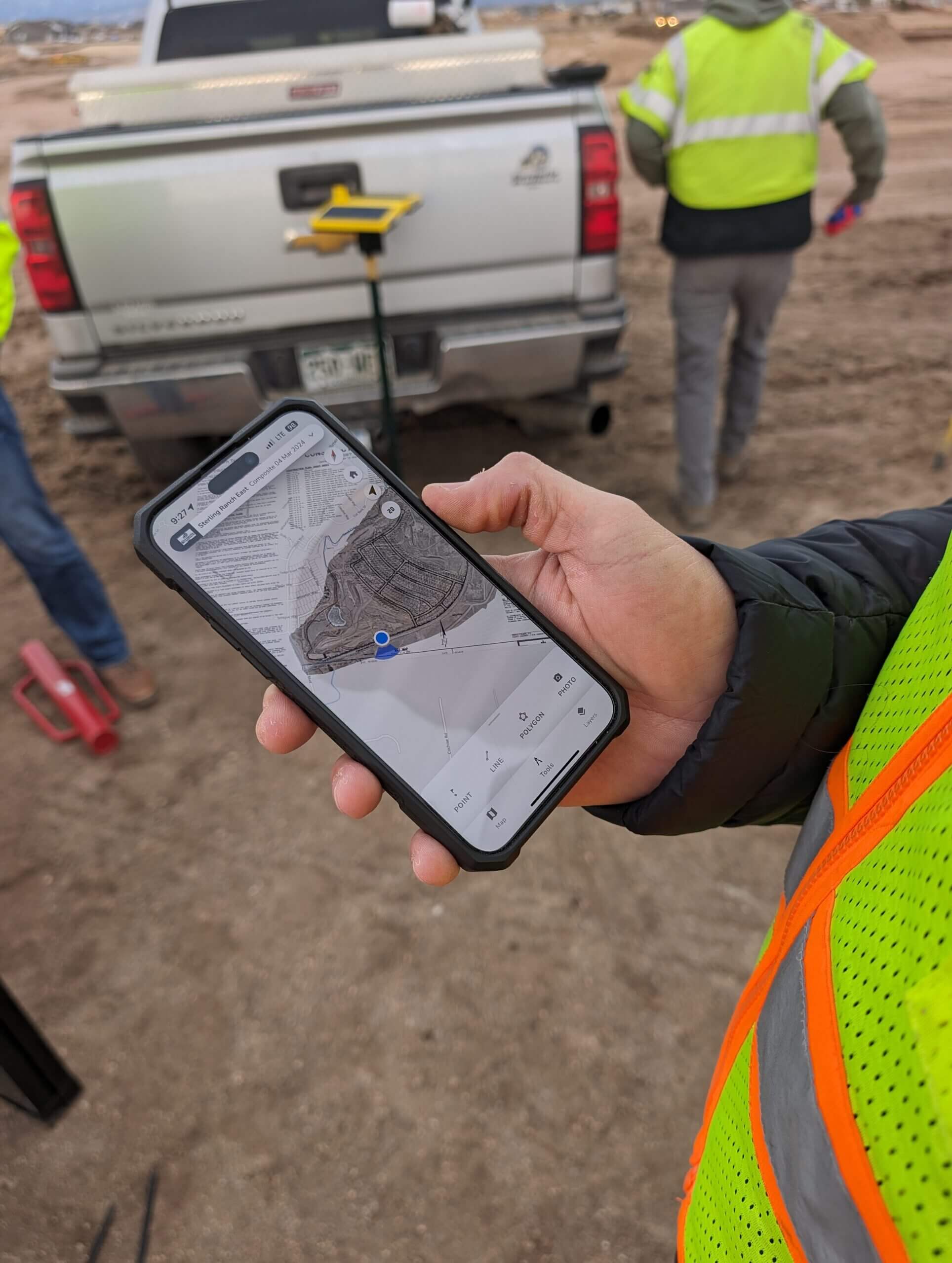
Drag and drop your files into the Propeller Platform and we’ll handle the heavy data processing in a few hours

Get a collaborative 3D map to measure quantities, verify original ground, and more from one place
When you find a discrepancy, you have access to irrefutable, timestamped 3D data to prove change orders to the owner or general contractor.
Prevent profit fade by starting with verified original ground and ending with indisputable billing.
Eliminate blind spots from PDFs, vegetation, and outdated plans so you can price work accurately, win more bids, and protect your margin.
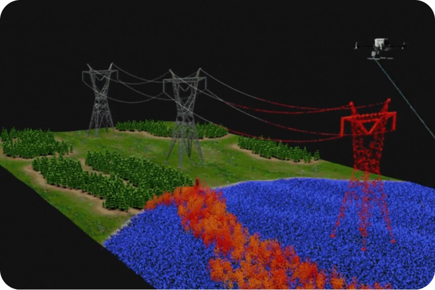
Use drone-based photogrammetry with PPK (Post-Processed Kinematic). Instead of sending a surveyor to walk a grid for two days, you can fly the site in 20 minutes. The drone captures thousands of data points, creating a high-density 3D surface model that is far more detailed than manual shots, with a fraction of the man-hours.
Drones eliminate the “interpolation error.” Most bids are based on sparse survey points; drones provide a continuous surface. By comparing your drone-captured “as-is” surface to the “as-designed” CAD files, you get a true volume calculation. This ensures you aren’t bidding on 50,000 yards of cut when there are actually 60,000.
It is your Source of Truth. It’s a survey performed to document the site’s elevations, existing structures, and stockpiles before a single machine moves. In the Propeller platform, this serves as your “Initial Survey”—the baseline for every yard of dirt you move and every invoice you send.
Engineering files are often based on old data or “interpolated” points. If a surveyor took a shot every 50 feet, the software “guesses” what happens in the 49 feet in between. Additionally, site conditions often change between the time the engineer visits and the time the contract is awarded (due to erosion, debris, or other contractors).
Fly the drone immediately after the clearing and grubbing phase is complete. This captures the New Original Ground. Since clearing can remove several inches of topsoil and vegetation, this survey ensures you are starting your “cut” measurements from the actual dirt level, not the top of the brush.
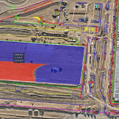
Perform a Surface-to-Surface Comparison. Overlay the provided bid surface onto your drone survey in a 3D environment. Using “heat maps,” you can instantly see where the bid’s elevations differ from reality. Large discrepancies are red flags that indicate the bid quantities are likely wrong.
Beyond just volumes, estimators use the high-resolution maps to check site access, identify hidden obstructions (like old foundations), and plan haul roads. Knowing exactly how steep a climb your scrapers will face allows for more accurate cycle-time estimates and fuel-cost projections.
It’s hard to argue with a 3D model. If you find unsuitable soil or a hidden utility, fly the site to document the “Changed Condition.” You can then generate a report showing the exact volume of extra material moved. Sharing a “Read-Only” link of the 3D site with the owner provides transparent, undeniable visual evidence that justifies the extra cost.