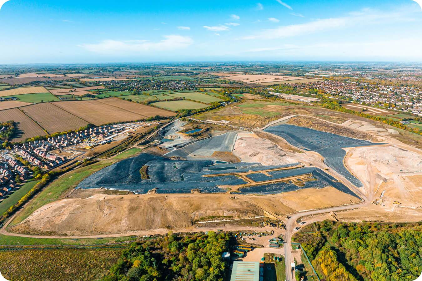
Know exactly what needs to move with a preconstruction topographic survey
Bridge the gap between the engineer’s estimate and the ground truth. Propeller’s existing ground verification workflow provides the survey-grade baseline you need to bid with total confidence, plan with precision, and protect your profit margins from Day 0.
Turn ambiguity into defensible data
For too long, earthworks projects have started with a degree of uncertainty. Relying on outdated topo maps or estimates that don’t reflect current conditions makes it hard to stay on track.
Propeller transforms your pre-construction phase. By performing a pre-bid topographic survey, you ensure your earthwork takeoff accuracy is based on the current reality of the site. Moving from uncertainty to absolute clarity, you can verify the baseline, validate the bid, and ensure every machine is moving exactly what it’s supposed to.
The proof of accurate pre-con
We’ve built the tools to ensure your starting point is 100% verified.
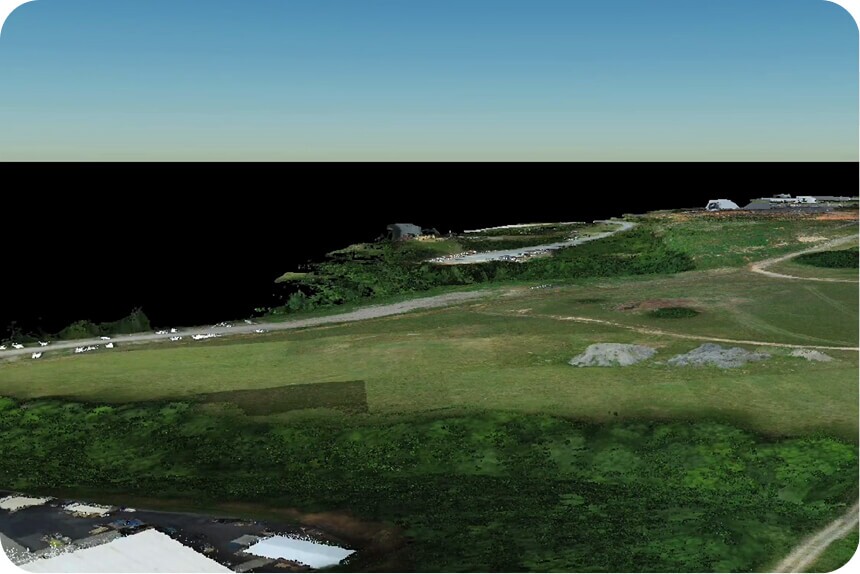
Clean, bare-earth models
Use automated terrain filtering and manual clean-ups to strip away vegetation and equipment “noise.”
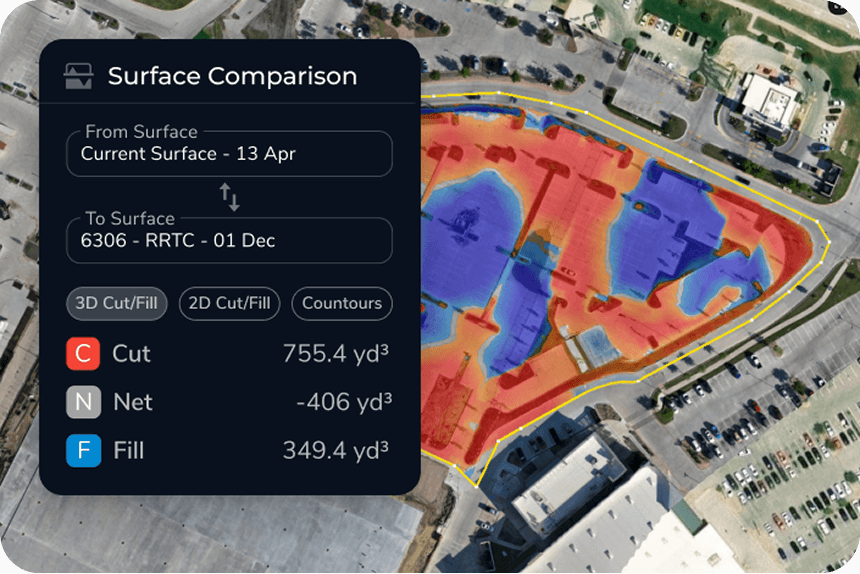
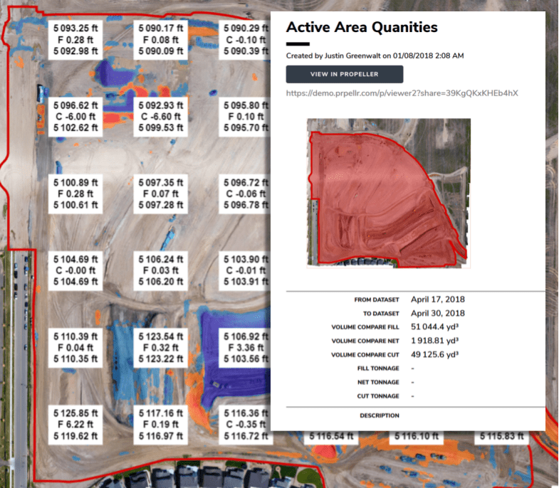
Visual cut/fill heatmaps
Instantly visualize the work ahead by comparing your current survey against the final design.
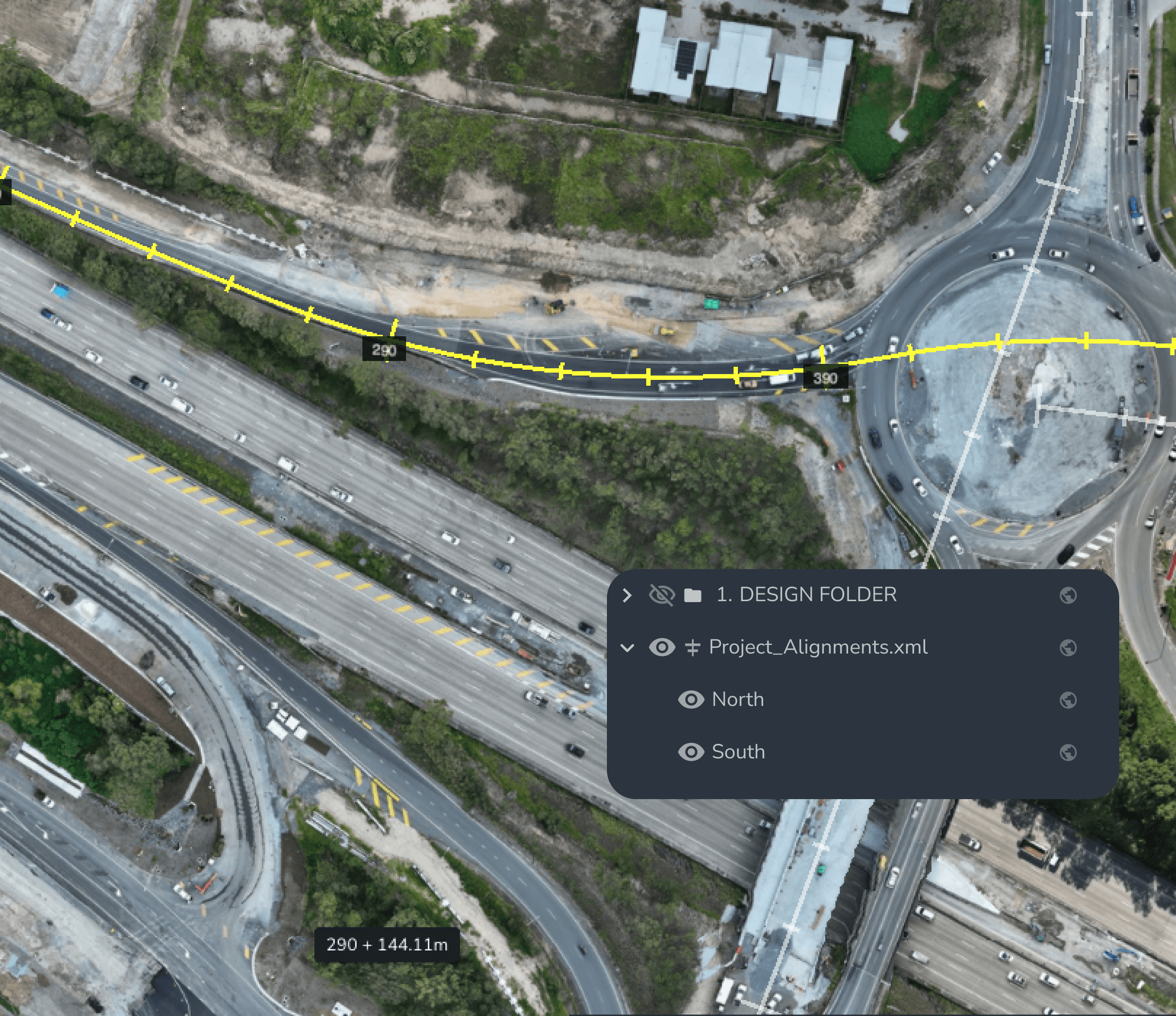
Survey-grade alignment
Whether you use global or local coordinate systems, we ensure your map is exactly where it should be in the real world.
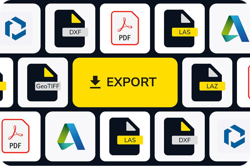
Professional takeoff reporting
Arm your team with PDF reports and maps that document the pre-con state for every stakeholder.
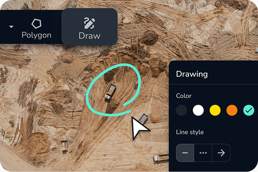
Collaborative site markup
Identify hazards and access points to plan your mobilization before the data is even finished processing.
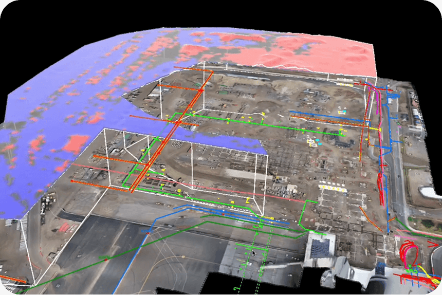
2D-to-3D integration
Overlay 2D blueprints onto 3D ground models to see exactly how the plans sit on the dirt.
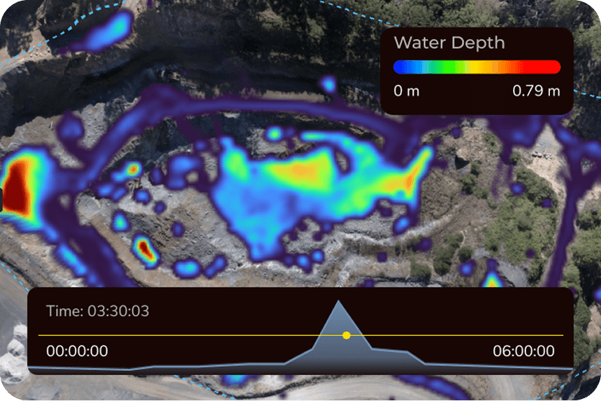
Predictive hydrology
See where the water will go before you clear an acre, allowing for smarter drainage and erosion control.
Open ecosystem
Push your data wherever it needs to go via our WMTS or open API.
One source of truth for every team
Our hardware and software work in harmony to provide a survey-grade foundation for every project.
Estimators
Win the bid without the worry. Verify resource allocations and ensure your estimates match physical reality.
Surveyors
Total verification in a fraction of the time. Deliver 3cm accuracy on day one without the manual slog.
Project managers
Start with Day 0 confidence. Protect your project from future claims with a defensible, data-backed schedule.
VPs and owners
Enterprise-level risk management. Protect your margins from the surprises that eat profit.
The tech behind the truth
Our hardware and software work in harmony to provide a survey-grade foundation for every project.
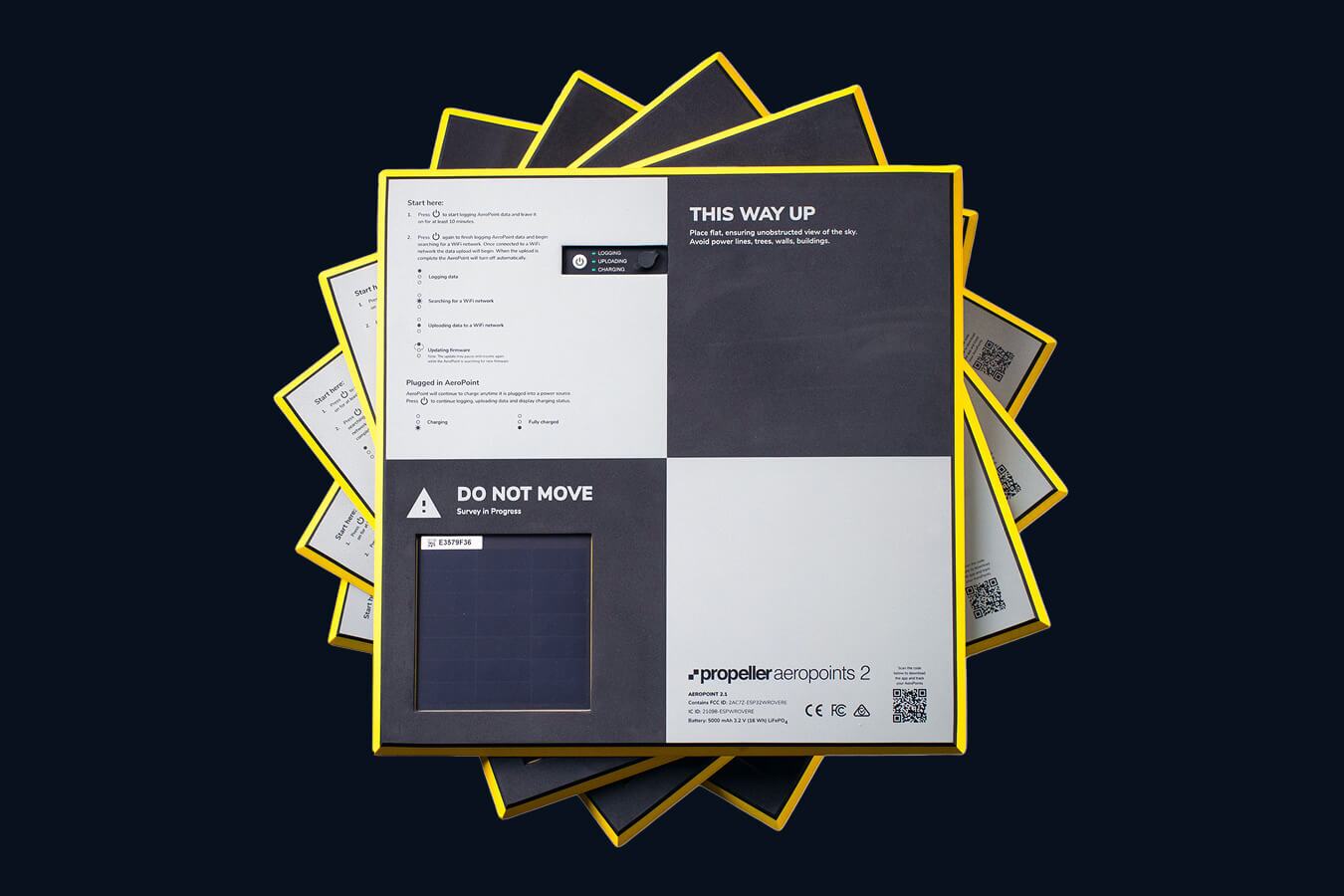
AeroPoints®
The world’s first smart ground control points. Forget the total station for baseline checks—just lay an AeroPoint down, push a button, and get high-precision global accuracy without the manual labor.
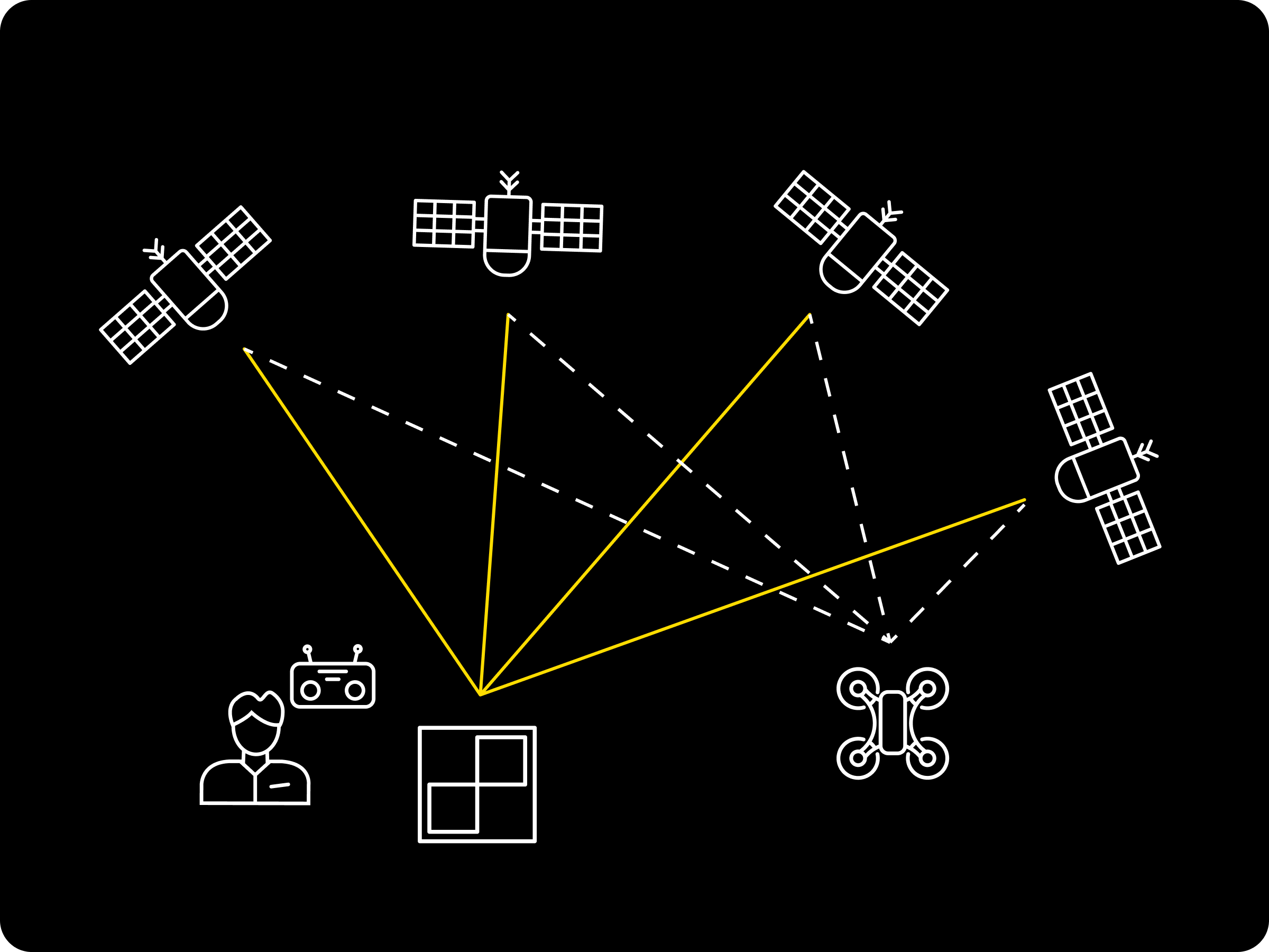
Propeller PPK
Our proprietary Post-Processed Kinematic (PPK) engine is the “brain” behind the map. It turns raw flight data into survey-grade 3D models, removing the guesswork and ensuring your “Day 0” topo is pinpoint accurate.
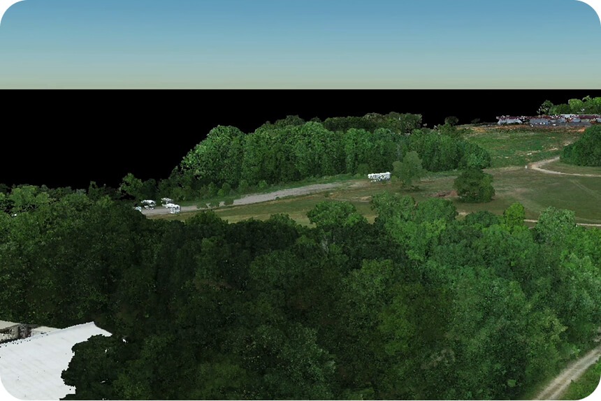
LiDAR processing
Don’t let heavy vegetation hide the truth. Our LiDAR capabilities allow you to penetrate tree cover and brush to capture the true bare-earth terrain, even on the most overgrown greenfield sites.
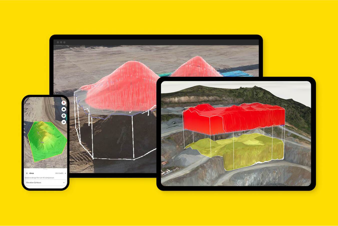
The Propeller platform
A single, browser-based home for all your site data. From here, the whole team can visualize the site, run cut/fill heatmaps, and track progress against design in real-time.
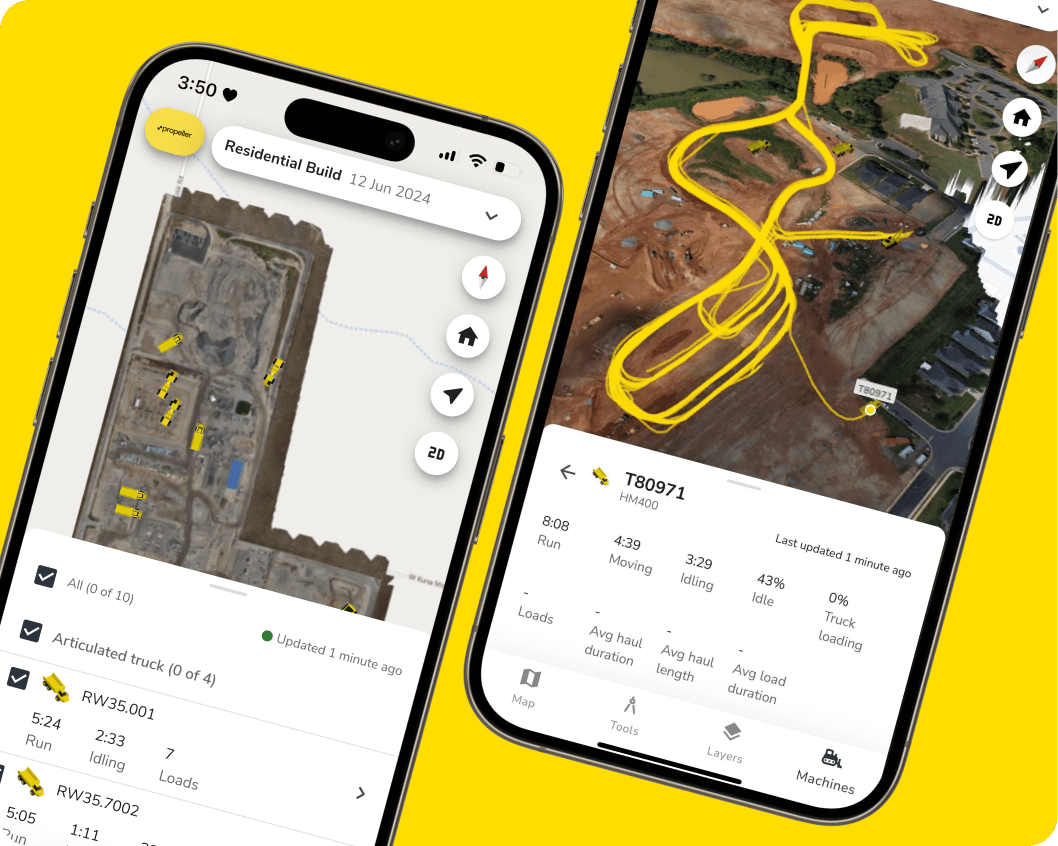
Propeller mobile app
Bring the “Ground Truth” to the field. Use the mobile app to navigate the site using your high-res survey data, making it easy to identify hazards or verify site conditions exactly where you’re standing.

Drone hardware integrations
We don’t lock you into one ecosystem. Propeller integrates seamlessly with the industry’s leading drone hardware, ensuring you have the right sensor for the specific demands of your terrain.
Benefits across industries
Construction
Propeller accepts raw LiDAR files from DJI Zenmuse L1 and L2 sensors, creating an additional dataset that works just like other survey data.
- Verify true existing ground through brush and rough terrain for accurate pre-construction surfaces
- Check earthworks progress by comparing stripped vs. designed grades
- Validate final grade and slopes for pads, roads, and embankments before handover
- Improve cut/fill balance with precise volumes for borrow pits, fill areas, and stockpiles
- Support drainage and stormwater design by seeing the true ground
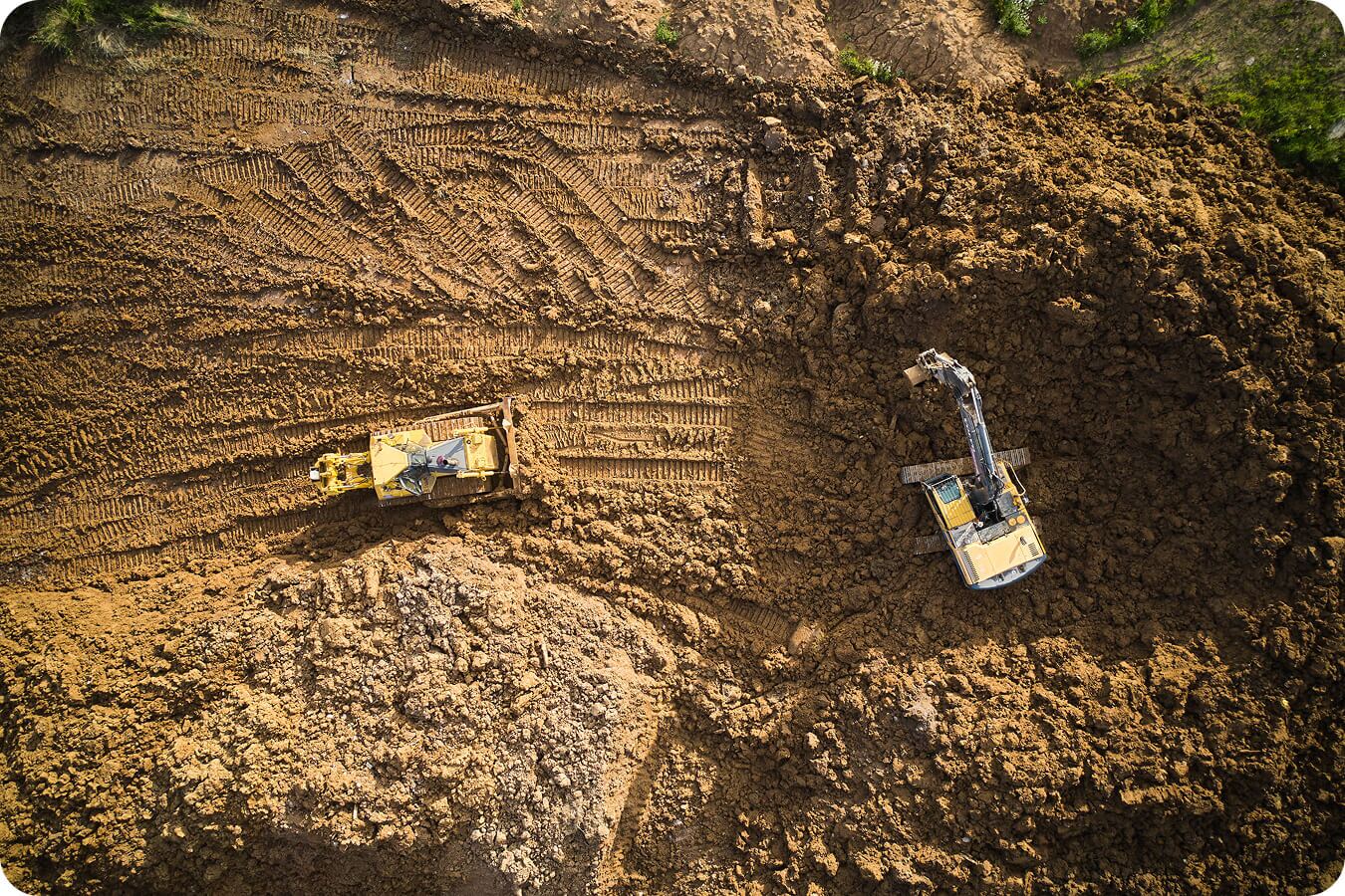
Mining
Accurate baselines through vegetation and rough terrain make pre-stripping, drilling, and pit planning reliable.
- See true ground before stripping or overburden removal
- Plan stripping and overburden volumes precisely
- Monitor pit expansion by verifying bench heights, pit walls, and haul roads
- Improve stockpile accuracy for high, irregular piles
- Boost safety and compliance by spotting hidden voids, erosion, or bench slips
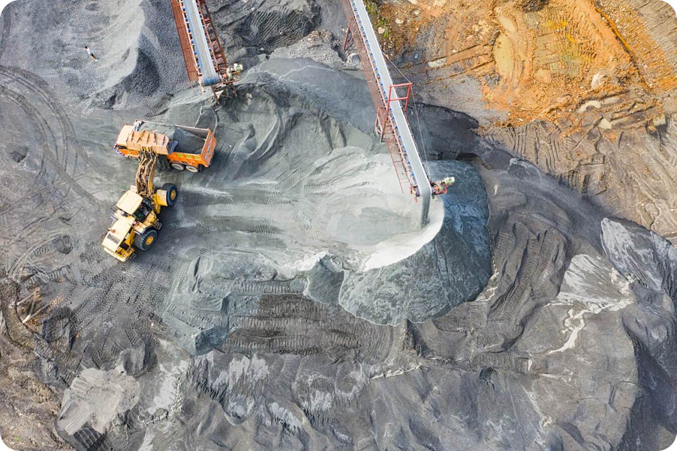
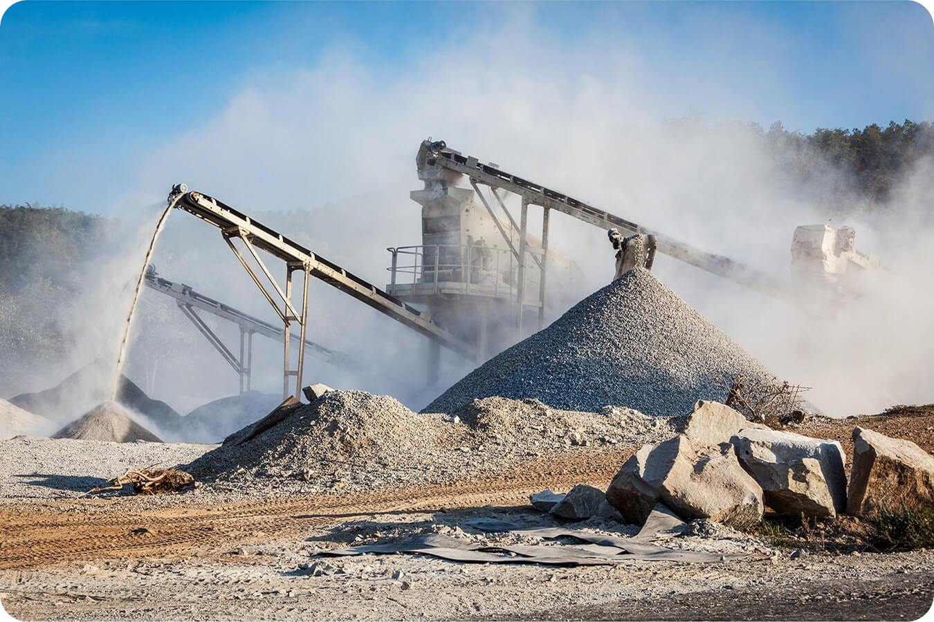
Aggregates and quarries
Track volumes, cut/fill, and site changes with high-fidelity terrain data through vegetation.
- Measure true ground under trees and brush for accurate extraction planning
- Verify material volumes in steep or irregular stockpiles
- Monitor site changes and ensure grading meets design
- Combine LiDAR with photogrammetry for complete terrain visibility
Waste management
LiDAR captures ground under vegetated caps, closed cells, or heavy brush to support safe and compliant operations.
- Detect settlement and ponding hidden by cover
- Verify stormwater flow paths and erosion gullies
- Track slope stability over time to confirm side slopes remain within permitted design
- Protect airspace accuracy and measure remaining capacity or cap thickness more reliably than photos alone
Start with certainty. Finish with control.
Your project doesn’t start when the first machine fires up. It starts with the baseline you trust.
Frequently asked questions
A pre-construction topographic survey (also known as a pre-construction site survey) is a high-precision map of the existing terrain before any earthwork begins. In the Propeller ecosystem, this serves as your “Ground Truth.” By capturing accurate elevations, structures, and vegetation, it provides the definitive baseline against which all future progress, cut/fill volumes, and import/export quantities are measured.
The most efficient way to generate a pre-bid topographic survey is by using a drone paired with AeroPoints (smart ground control points). This allows you to capture a pre-bid topo survey of a 50-acre site in about 20 minutes—a task that would take a traditional survey crew days to grid. By using a pre-construction drone survey, you get survey-grade accuracy for your earthwork takeoff without pulling your field crews away from high-value staking tasks.
A drone survey for bidding provides a massive data advantage over traditional “point-and-grid” methods.
- Surface Density: Instead of interpolating between points 50 feet apart, a drone captures millions of points to create a true 3D surface.
- Risk Mitigation: You can identify “hidden” costs like existing stockpiles, debris, or heavy vegetation that aren’t shown on outdated engineering plans.
- Confident Numbers: A drone survey for bid estimates ensures your earthwork takeoff accuracy is based on what is actually on the ground today, not what was there two years ago.
Engineering topos are frequently based on “stale” data. Between the initial design and the tender phase, the site may have changed due to erosion, previous grading, or illegal dumping. Relying on an outdated pre-bid topographic survey from a third party often leads to significant “elevation busts” that eat into your profit margins once the machines start moving.
To accurately verify existing conditions before earthwork begins, you must perform a post-clearing topographic survey. Once the “fluff” (trees, brush, and tall grass) is removed, the true elevation of the soil is revealed. By flying a drone to create an as-found topo after clearing, you can establish a new “Original Ground” surface in Propeller. This ensures your pay quantities are calculated from the actual dirt level, not the top of the brush.
By overlaying the provided CAD or PDF design files onto a current drone pre-construction site survey, you can visually spot discrepancies.
- Alignment Issues: Do the digital design lines match the physical site boundaries?
- Volume Discrepancies: Does the “existing grade” in the bid docs match your drone’s GPS-verified elevation?
- Unlisted Obstacles: Are there new utilities or stockpiles visible in the drone imagery that aren’t in the documents?
Construction change order documentation requires indisputable proof. When you encounter “differing site conditions”—such as unexpected rock or unsuitable subgrade—a drone flight provides a time-stamped, 3D visual record. You can use Propeller to calculate the exact volume of the disputed area and export a report that justifies the extra costs, making it significantly harder for owners to deny the claim.
Estimators use drone survey for construction bidding to run rapid “what-if” scenarios. By comparing the current site topography against the final design, they can:
- Precisely calculate import/export quantities.
- Determine the most efficient haul roads based on current terrain.
- Identify balance issues early, allowing for a more competitive (and profitable) bid.
- Reduced Liability: Know exactly what you are signing up for before the contract is executed.
- Safety: Capture original ground topo for bidding on steep or dangerous terrain without putting staff at risk.
- Visual Communication: Use 3D models to show the project owner that you have a superior grasp of the site’s challenges compared to competitors.