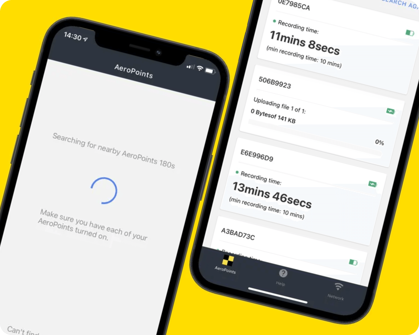
AeroPoints App
The AeroPoints App is the mobile companion to our latest generation of AeroPoints. Run diagnostic checks, upload your data, and configure your network settings on the go.


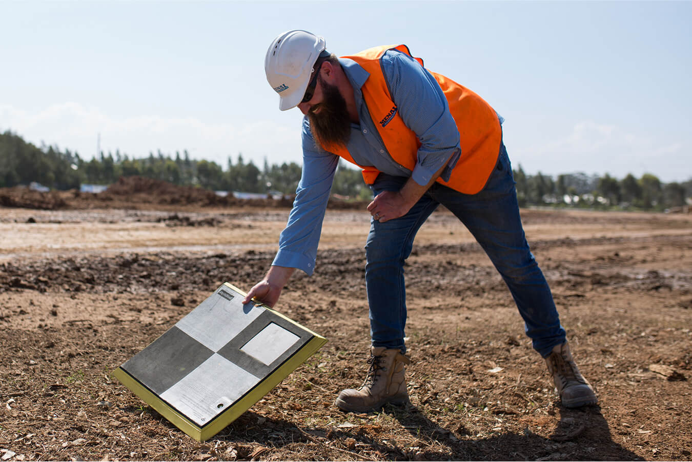
Easy
Lay them out, press a button, and they’ll start recording their position automatically.
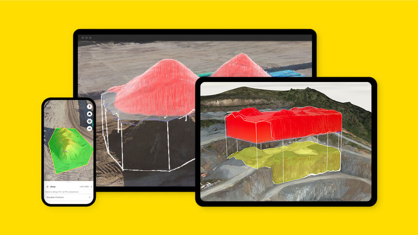
Integrated
Pair with Propeller for an unmatched, all-in-one mapping solution that allows you to transition from capture to volume calculations.
Accurate
Map with centimeter-level accuracy that’s easy to prove using a dual-frequency GNSS receiver that’s protected by a durable outer shell.
What you can do in the app
From your phone, you can:
- Run real-time diagnostics on each AeroPoint 2 before and during capture
- Upload positioning data to the Propeller Corrections Network for automatic correction
- Configure Wi-Fi and network settings without leaving the worksite
- Check battery and logging status at a glance
- Complete setup in seconds per point