For years, construction has been considered one of the least digitized industries in the world. But today, technology is making worksites faster, safer, and smarter—and drones play an essential role in this new era of digital tools.
This post will point you in the right direction and help ensure you have everything you need to start drone surveying on your worksite.
Choosing drone surveying hardware
The most obvious tool in your drone surveying kit is the hardware: the drone itself, as well as complementary tech like AeroPoints to guarantee accurate results.
Over the past few years, advances in technology have made drones more accurate and affordable—the perfect tool for contractors looking to upgrade their operations. They provide centimeter-level accuracy, but without the hassle, expense, and specialized training required to use traditional tools.
What’s the best drone for surveying?
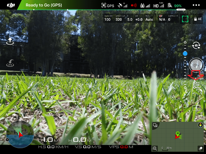
Drones come in many different shapes and sizes, and each has unique benefits depending on your needs. There are three main elements to consider when choosing the right drone for your worksite:
- Survey area size
- Camera requirements
- Budget
Survey area size
If you’re flying large worksites, look at fixed-wing or fixed-wing VTOL (vertical takeoff and landing) drones. They fly much faster than quadcopters, making them a good fit for covering large areas in less time. Depending on your site and flight conditions, flying one fixed-wing drone can be more efficient than flying several multirotor UAVs (unmanned aerial vehicles). Fixed-wing drones also can fly much longer on a single battery charge.
On the other hand, fixed-wing drones can’t hover. They need more space to make turns and a runway for takeoff and landing. VTOL drones are the exception, as they can take off and land vertically—hence the name. Smaller sites or urban environments might be better surveyed with a quadcopter, since they likely won’t require the speed and battery longevity of fixed-wing drones.
As a general rule, sites under 200 hectares (or 500 acres) can be surveyed comfortably with a quadcopter. For larger worksites, consider a fixed-wing or fixed-wing VTOL drone.
You can check out some of our recommended drones here.
Cameras and sensors
A high-quality surveying camera should have a 20MP sensor or better. You’ll also want to look out for the camera specifications that impact ground sample distance (GSD) and image resolution. While 20MP is the minimum requirement, keep in mind that more megapixels will mean more data to process. Your image will be clearer, but it will take longer to shift and upload your data.
Depending on your accuracy needs, you may want a drone with a light detection and ranging (lidar) system. Rather than using a traditional photo camera, lidar sensors send out laser pulses and capture the responses. If you will be surveying highly vegetated sites, or require a different level of accuracy, lidar may be a better fit than photogrammetry.
Cameras are not necessarily tied to a specific type of drone. Some drones allow for camera swapping while others don’t. Make sure the drone you invest in can capture high-quality images. Additionally, if you need lidar, check that your chosen drone has that as an option.
For a deeper dive into drone cameras, check out this post.
Budget
Of course, money matters—especially when you’re making a new investment. Fixed-wing and VTOL drones typically cost anywhere from 3-4 times more than quadcopters, so your budget is a factor.
That said, choose your drone with the total cost of ownership in mind. Quadcopters are better for surveying smaller sites, but they can handle larger ones with more frequent battery changes. Fixed-wing and VTOL drones are more expensive, but they are ideal for large sites and fewer battery changes.
Still wondering about the best drone for you? Click here for our recommended survey drones. You can also reach out to our team for a drone recommendation based on your company’s specific needs.
Using ground control for better accuracy
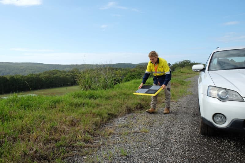
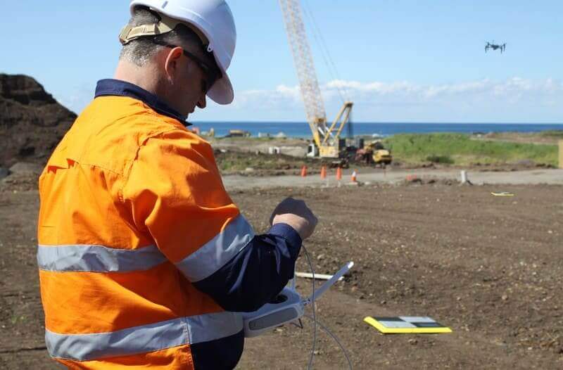
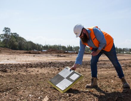
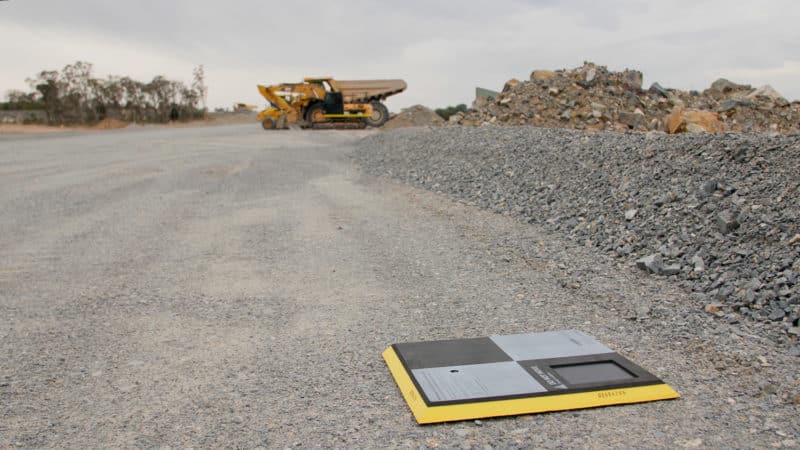
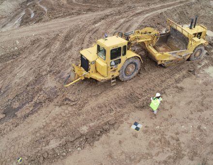
While drone surveying can be done without ground control points (GCPs), you’ll get much higher accuracy if you use ground control. Fortunately, high-tech hardware exists that makes ground control easier, too.
Propeller’s AeroPoints are GPS-enabled smart ground control points. They deliver the same level of precision as traditional control without the hassle. Simply place one on the ground near your launch site, turn it on, and fly your mission. If you choose a PPK (post-processing kinematic) workflow, the AeroPoint functions as a base station and GCP rolled into one, helping to ‘pin’ drone images to the ground. This makes it the fastest method for achieving survey-grade results.
Navigating regulations and restrictions
Okay, so you’ve got all the equipment and software you need to start drone surveying. Now all that’s left is the knowledge required to use it.
Drone hardware is pretty straightforward to operate these days, but there are basic licensing steps before you can fly your UAV. Primarily, this step is meant to ensure that drone pilots understand their local and regional airspace. Check out this post for country-specific information on what’s required before you fly.
Your first flight
Once you’re ready to fly your site, the process is fairly straightforward:
- Power on your AeroPoint(s) for ground control
- Fly your drone for at least ten minutes (the longer you fly the drone, the more data will be captured)
- Process your imagery
That’s it—you’ve completed your drone survey.
How to process drone survey data
Once the drone has collected images and GPS data, you’ll need software to make sense of your results and convert that data into 3D maps. If you use a PPK workflow, your drone’s positional data is refined after the flight using data from a base station or other known point on the ground.
Factors to consider when determining the software setup that’s right for you include:
- Turnaround time: Consider how fast you need your data. If your worksite changes rapidly, you’ll want access to the most current data in order to make informed decisions.
- Accuracy: Determine the level of accuracy you need. Even small miscalculations can add to your project costs.
- Bandwidth: Data processing is time consuming. You’ll need to decide if your project teams have the bandwidth to handle this task in-house or not.
Is drone surveying a replacement for traditional land surveying?
Nope! A surveyor’s job is more important than ever before. With simpler tools that make data capture more accessible, there’s a need for a more thorough verification process. A professional will be able to help you meet these requirements. Think of drone surveying as a tool in the data capture toolbelt—not a replacement for professional expertise. The right technology has safeguards built in, but sometimes you’ll need a greater level of validation that can only be done by a trained surveyor.
Processing with Propeller
Propeller’s platform is a practical way to process and visualize drone data. It’s also compatible with any local coordinate reference system you’re using. Generally, you’ll get your data back within 24 hours of flying your site, and you’ll gain a number of benefits from letting us do processing, including:
- Quickly and easily scaling your drone program because no additional employees or computers are required to do the processing
- Ensuring your results are reviewed and validated by a team of geospatial scientists
- Giving you the ability to use your processed data to make the right decisions and share with project stakeholders
- Not having to rely on expensive and powerful computers to process data
The accurate data you can get from drone surveying and processing with Propeller can help take your business to the next level—and improve those important conversations with your project teams and customers.