Established in 2012, Lange Land Surveys (LLS) is a full service land surveying company in Arvada, Colorado. The owner, Jonathan Lange, and the company’s twenty-plus employees all have unique work experience, along with strong backgrounds in AutoCAD, office and field coordination, construction, or performing surveys.

LLS works with engineers, developers, builders, architects, and realtors to successfully complete a wide range of projects. Their team possesses conventional, GPS, and now drone-mapping and analytics capabilities, all of which deliver versatility to their clients. LLS performs land development, staking, as-builts, ALTA surveys, plat preparation, legal exhibits, infrastructure staking, plot plan creation, building stakeouts, improvement surveys, and grading certifications.
Propeller’s drone-mapping and analytics solutions give worksites the power to measure and manage themselves, with visual tools that everyone can use from any device, anywhere, anytime. Heavy civil and resources operations trust Propeller to help teams work together better to understand how fast they’re working, how much they’ve done, and if they’re on budget. Track, inspect, and report on job progress and productivity safely and accurately, with the platform that shows you where you are and where you’re headed.
Opportunity
Lange Land Surveys provided their client, Remington Homes, with better information and data about the quantities and status of dirt on one of their sites—a residential development comprised of 75 home lots. They both wanted a solution that would allow them to measure their site’s status with greater accuracy and ensure they never missed a survey shot. Accurate information about the status of the site means the client could predict dirt movement costs and build it into the budget rather than eating the cost later.
Solution
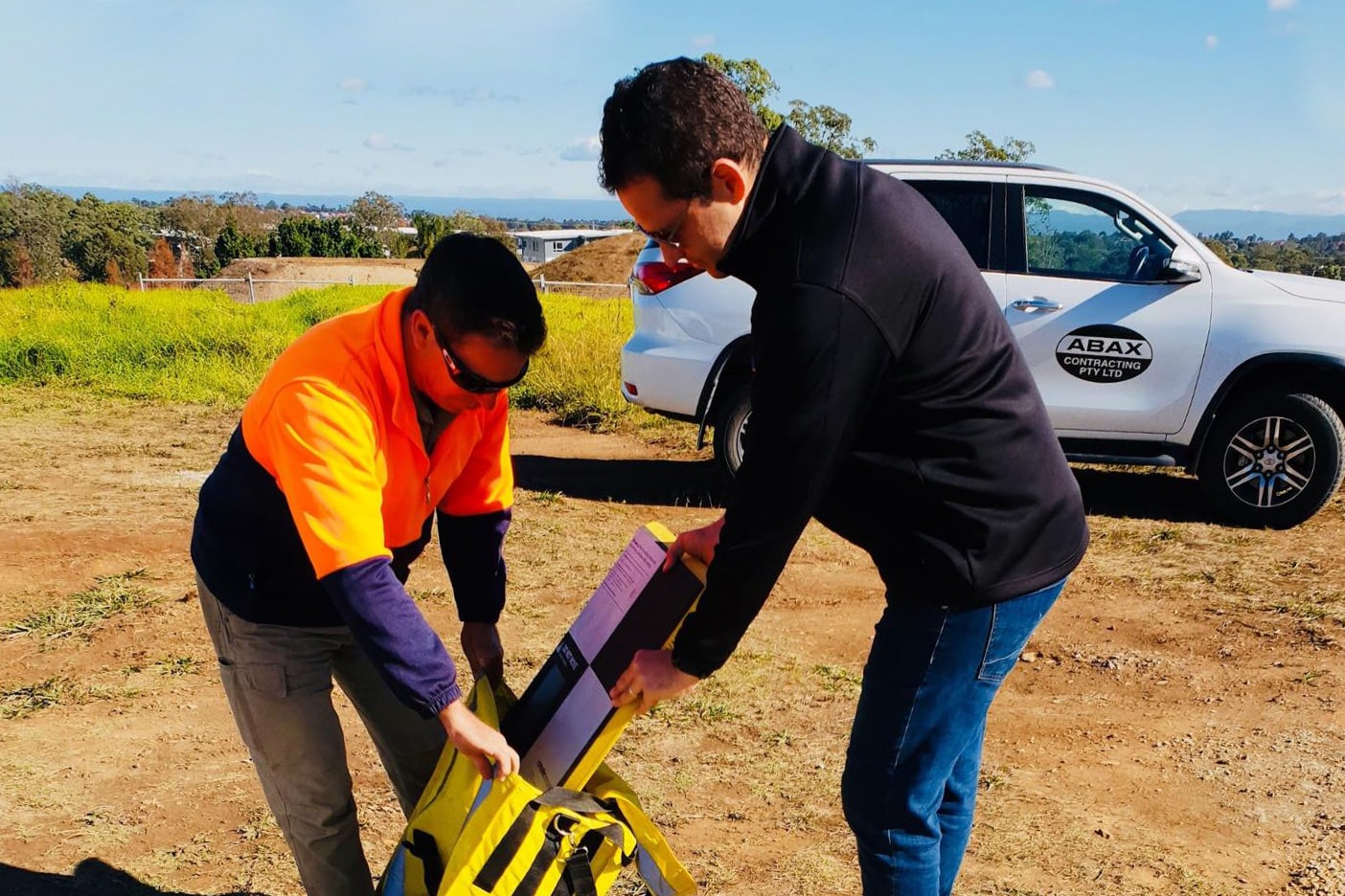
LLS tested a few other drone-mapping and analytics platforms before Propeller. The reason none of the others stuck? With their busy schedules, LLS didn’t want to set aside time to learn how to process the data. “We tried to use some of the other solutions and they’re pretty complicated. It’s not that they don’t work, we just don’t have the time to learn how to process the points and make it work for us,” said Jon Lange. “With Propeller, we give them our survey points and we’re all on the same page. We’re very confident in Propeller’s data processing team. We compared the first couple of flights we did with a drone against data gathered with conventional methods. Everything checked out really tight, within a half inch.”
Results
The first site Lange Land flew with Propeller was for Remington Homes on the Candelas development. Normally a 25-acre lot would mean three days spent in the field shooting GPS points. “With Propeller’s AeroPoints ground control hardware, and drone-mapping and analytics software platform, we’re able to fly the entire site in just half a day, so it’s saving us two and a half days of boots on the ground,” Jon said. Additionally, they captured everything in between conventional surveying points, which can—and did—fill huge surveying data holes.
“With a drone we can check 100 times more points, we can get all of the dirt piles and all of the holes. Everything that’s between the points on the ground is captured with the drone. It’s great for us, and it’s an awesome bonus for our clients. They get a true picture of what’s happening on site. From start to finish, it’s good to know what we’re going to be doing and what we’re dealing with,” he said.
With the existing 3D surface in Propeller, the LLS team uploaded and compared their data against the design and preliminary development surfaces.
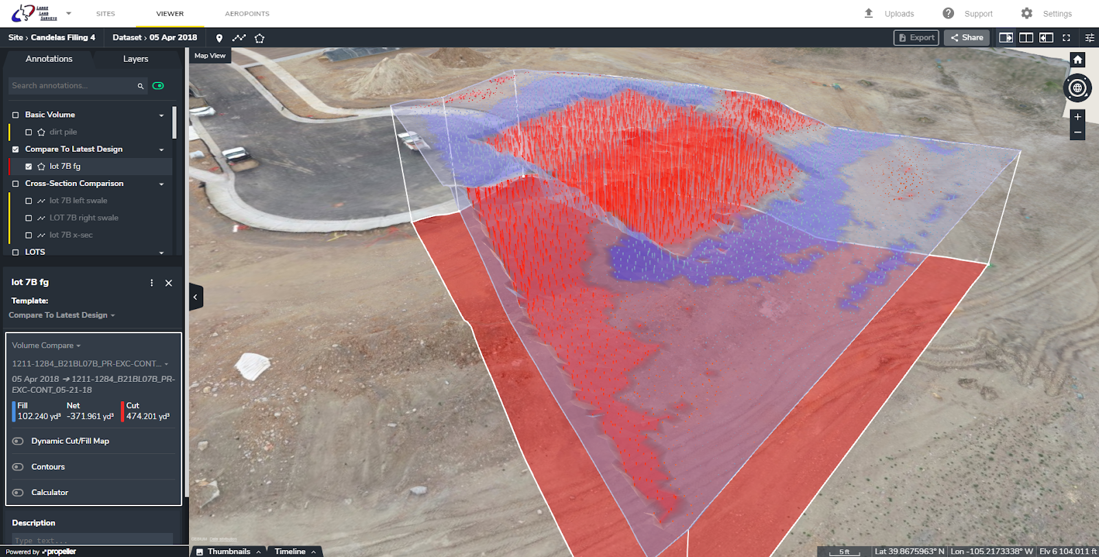
The drone flight captured more dirt on each lot than was originally budgeted by Remington Homes. With this data, the builder was able to build the additional dirt movement cost into the price of a home, amounting to a $2,000–$3,000 savings per lot. All in all, that’s roughly $187,000 of savings LLS helped their client recoup. “Propeller is helping us with land surveying—we’re able to manage our time more wisely. Our clients are super interested in it—it’s a cool product that’s given us the ability to supply them with better information and better data,” Jon said. “We’re saving our clients tons of money and making our investment in Propeller back quickly.