On most sites, checking haul road compliance is a manual job. Someone walks or drives the road, eyeballs the berms, and flags the spots that look too narrow or too steep. It works, but it is slow, it is subjective, and it only captures a moment in time. Meanwhile, road width, gradient, crossfall, and berm height all drift between checks, and that is where risk creeps in.
There is a faster way to get the full picture.
In our latest Power Hour, our mining team walked through Propeller’s road analysis tool: how to generate centerlines, measure compliance against your own parameters, share the results, and use hydrology to catch the problems water creates. It’s a session worth bookmarking if haul road safety is anywhere near your list of site headaches.
Missed it live? Watch the full recording on YouTube.
From terrain to compliance, automatically
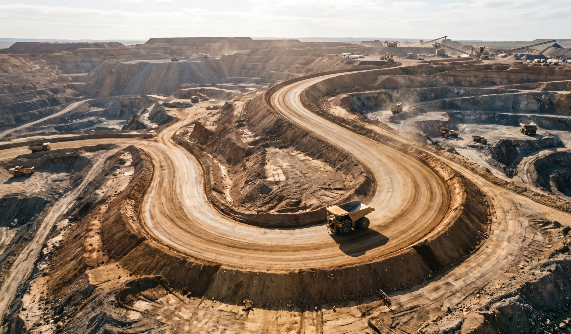
Propeller’s road analysis tool reads the terrain on your map and detects haul road centerlines on its own. No drawing required. From there, it measures the road against the parameters that matter for safety and compliance: road width, gradient, crossfall, super elevation, and berm height.
In the Power Hour, our mining team ran a complete analysis across an entire quarry in Northern New South Wales in about four minutes, without drawing a single centerline. The tool detected the roads from the digital terrain model, then color-coded every section so the team could see at a glance where the site was compliant and where it was not.
It works the same way on a single intersection or across a full mine site, and on quarries and aggregates operations too.
Tune it to your site
Every site is different, so the parameters are yours to set. You can define minimum and maximum road width so the tool knows what to look for, and adjust the symbology ranges for gradient, crossfall, and berm height to match how you assess safety on your roads.
A few of the controls worth knowing:
- Minimum and maximum road width: tell the tool the realistic range for your roads so it captures the running surface and both berms, and ignores the rest
- Preservation and sensitivity: refine how the centerlines are detected, from smooth lines through to tighter fits around bends
- Surface profile: choose a profile built for your conditions, whether that is steep pit roads, flatter haulage, or sites that use rock as berms
- Berm sampling points: control how the tool finds the berm next to the road, which is especially useful in colder climates where a muck berm forms in front of the high berm
You can also edit detected centerlines by hand before running the analysis, so a quick QC pass gets everything squared up before you commit.
Once you find the settings that work for your site, they keep working. The first run takes a little experimentation, then you are set.
Spot the problems water creates
Compliance is only part of the story. Propeller’s hydrology tools sit alongside the road analysis, so you can map preferential flow paths and see where water moves across your roads.
A healthy road shows a clear crown and ditch, with water flowing off to the sides. When flow paths converge toward a central point instead, that is a sign of pooling, the kind that drives erosion, and in colder regions, frost heave and potholing. It is a simple way to catch road issues before they cost you.
See it on your own roads
The haul road compliance tool is the first in our mining add-on suite, with more analytics on the way. If you want to put it to work on your site, your customer success manager can get you set up.
Want to see it run on your roads first? Request a demo and we will walk you through it.


