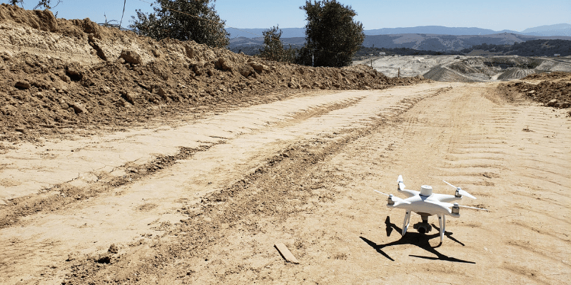
When DJI released its Phantom 4 RTK drone a few months ago, it opened up a new avenue of drone surveying for worksites. But as we’ve discussed in previous posts about RTK vs. PPK technology, sometimes RTK isn’t the best option for surveying your site.
Propeller offers a comprehensive PPK solution, Propeller PPK, which includes a drone. However, if you’ve already bought a Phantom 4 RTK yourself and still want to use it for PPK with Propeller’s cloud-based processing platform, we can help. Propeller is offering a PPK upgrade option for a flat yearly fee.
While you might have heard about the Propeller and DJI partnership to launch the Propeller PPK solution, you might not know that we also offer an upgrade package for those who already have a Phantom 4 RTK drone.
How to upgrade your Phantom 4 RTK to PPK
Since PPK is not a separate hardware component, but rather the method you use to process your drone data, you can use the Phantom 4 RTK drone as it stands.
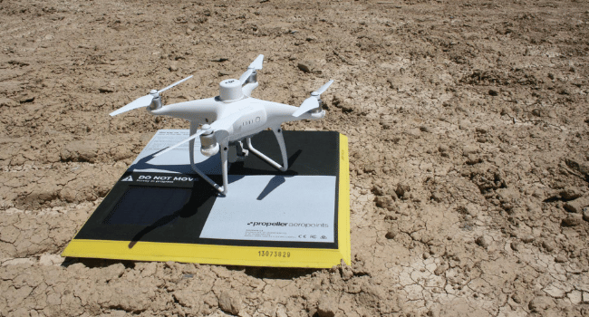
Turning your RTK drone into a PPK drone means processing your data post-flight, having a base on the ground to ensure accurate data-capture (that AeroPoint), and uploading both sets of data—geotagged images from the drone plus positional data from your base—into a processing platform.
For Propeller, this whole process is made quick and simple with one of our AeroPoints. For one yearly fee, our PPK upgrade package provides you with:
- One dedicated AeroPoint
- Cloud-based data processing and corrections
In our workflow, you only need a single GCP—an AeroPoint—serving as a passive base on the ground to get 1/10ft accuracy.

While “real-time” technologies are appropriate in some situations, post-processing of flight data using a PPK workflow brings an additional layer of reliability to your surveys. This is because PPK doesn’t rely on a continuous connection between the base and the drone like RTK does. This connection can be lost, and when it is, your data doesn’t record, leading to holes in your survey.
How PPK works
Surveying with PPK works like this: the drone geotags X,Y,Z coordinates to each image based on its on-board GPS unit. While this is happening, your AeroPoint base is also recording the positional information, but with much more accurate triangulation
After the flight is over, those two sets of GPS data are matched up using the photo timestamp and the initial, less-than-accurate onboard GPS data is corrected, giving precise geotags for the imagery. (For more information on PPK vs. RTK technology, check out our ebook.)