If you’ve ever found yourself waiting (im)patiently for volume reports, or trying to piece together drone and ground surveys to get an accurate picture of your site, you’re in luck—this post is for you.
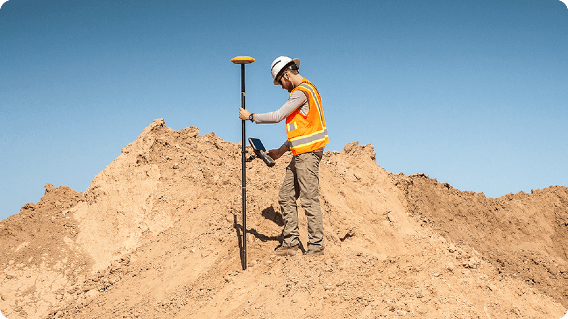
Drones have revolutionized site surveying, but they can’t do it all. You still need ground surveys for pre-construction topos, as-builts, no-fly situations, and tasks that require the highest possible precision.
The problem is, those datasets usually live in separate platforms, making it hard to get a unified picture of your site.
One map to rule them all
That’s where Propeller’s integrated survey platform comes in.
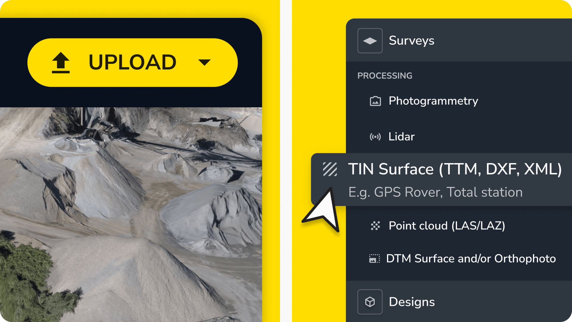
You can now upload TIN surfaces from rovers and total stations directly into Propeller, bringing your drone and survey data together into a single 3D site map.
Not running a drone survey program yet? No problem. Keep using the ground survey hardware you’re comfortable with—and save on expensive software licenses while making your survey data easier to use and share.
With all your survey data in one place, your team can spend less time pulling data together and more time using it.
Why it matters
You need multiple inputs to get a complete picture of your site: drones to cover the sky, ground survey equipment, and machine mapping to cover the ground.
But when all that data lives in separate software, you run into serious roadblocks:
- Disconnected workflows: Field crews, PMs, and survey teams aren’t always looking at the same data, creating misalignment and inefficiencies.
- Limited visibility: Without an integrated view, you don’t always have the latest data when and where you need it.
- Software overload: Specialized ground survey software is often expensive and clunky, forcing you to manage multiple licenses for tools that don’t talk to each other.
Propeller’s integrated survey platform eliminates these problems so you can spend less time searching and more time doing.
What do we mean by “integrated surveys”?
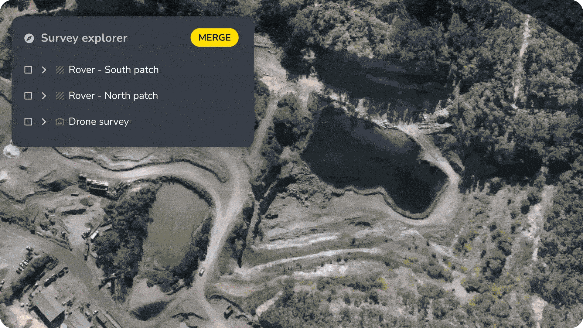
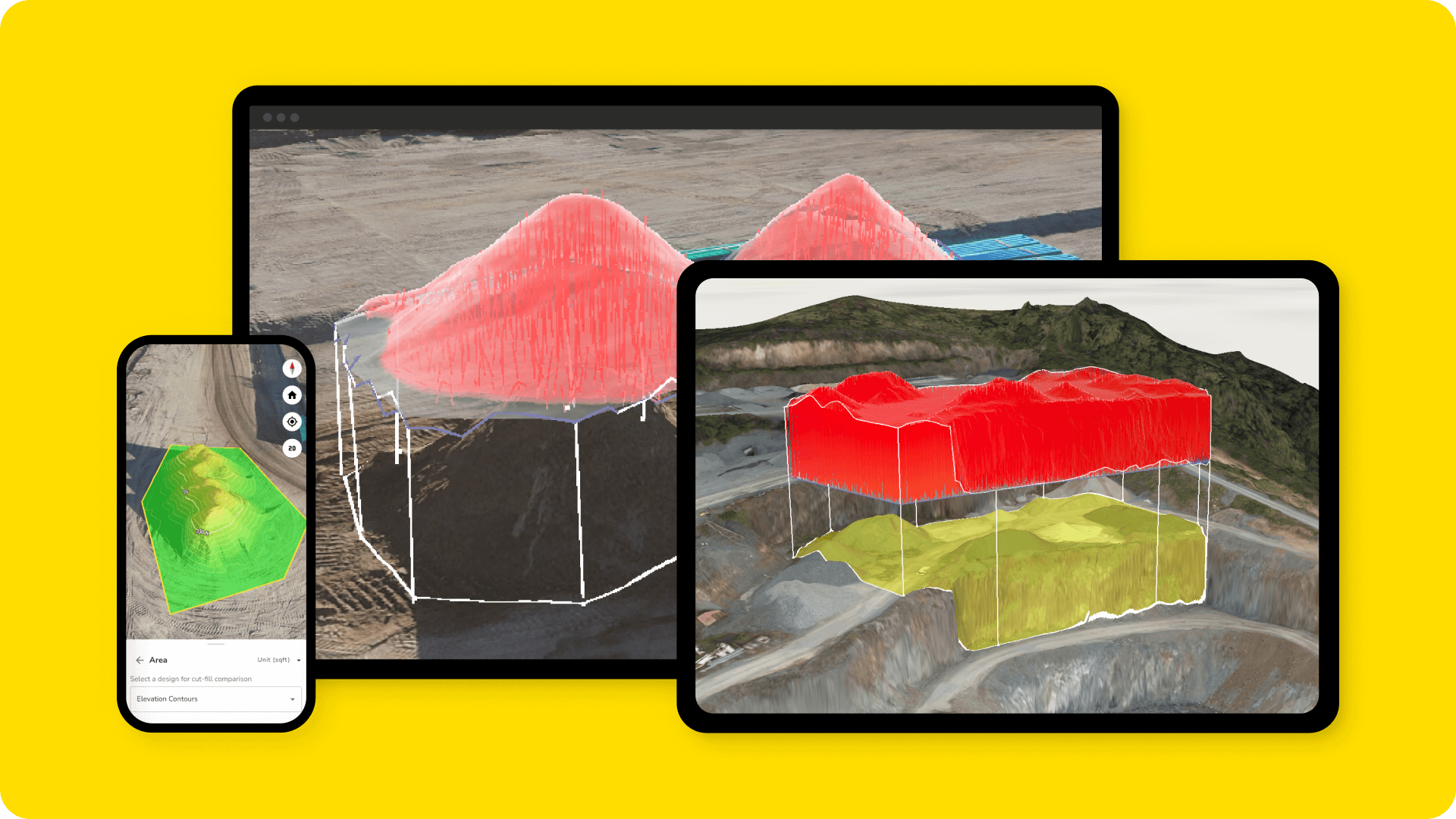
Integrated or composite surveys let you merge drone and ground data into a single, unified surface, giving you a complete and up-to-date look at your site. You can update sub-sections of your site as you survey without having to re-survey the entire site each time.
Best of all, our integrated surveys aren’t limited to just one data collection source (like drones).
That means you can:
- Fill in gaps where drones can’t fly, like controlled airspace or over uncleared terrain.
- Update small sections of a site quickly, even when a full survey isn’t possible.
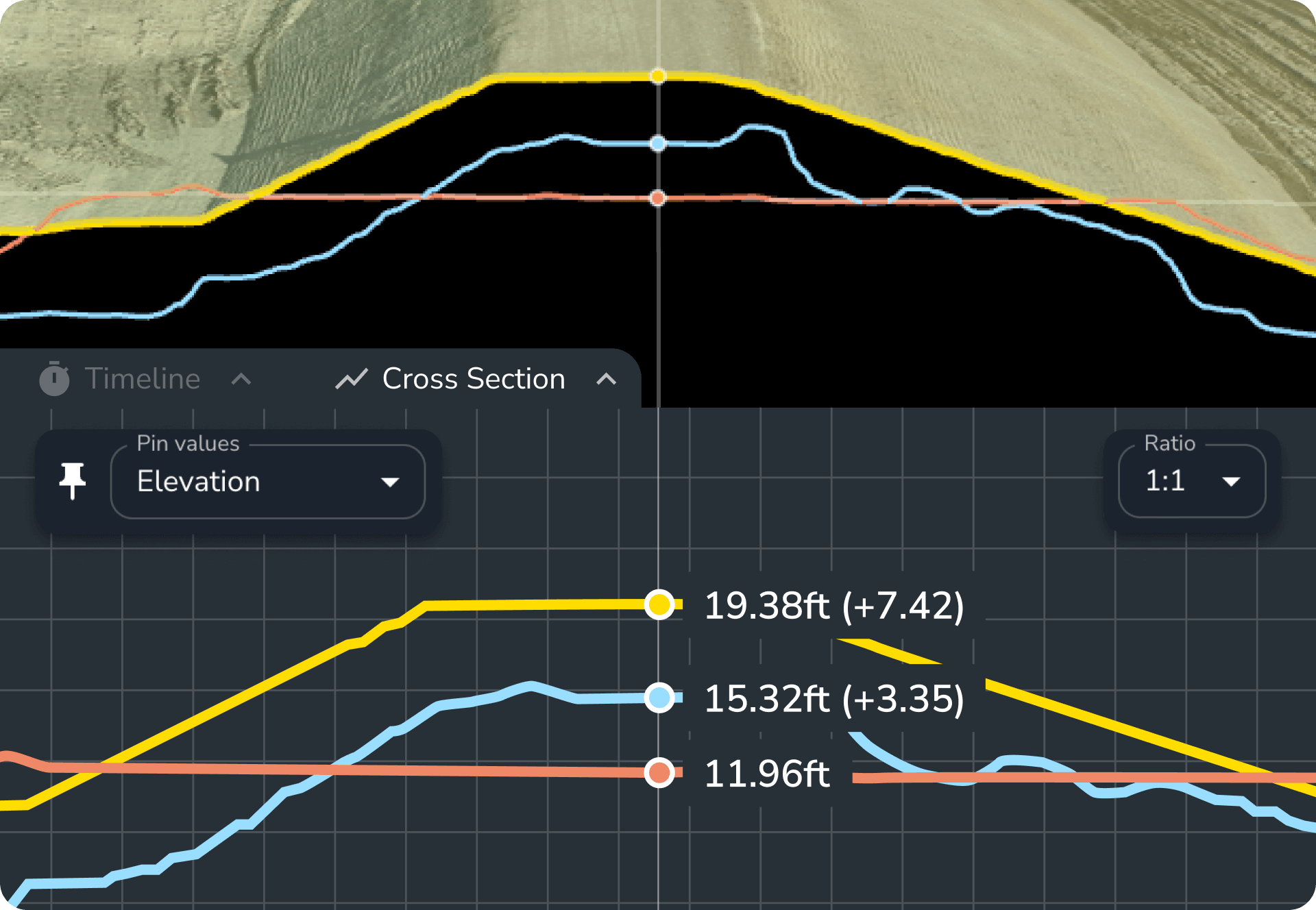
- Boost accuracy for high-precision tasks like as-builts while reaping the benefits of aerial photogrammetry.
The result: a 3D map that’s as close to reality as a digital model can get.
How Propeller makes it easy
We accept data from the hardware you already use via TIN surface imports and transform it into an integrated, easy-to-share surface model. Whether you’re using a base and rover, total station, or a drone, you can store and visualize all of these data types in Propeller.
Your upgraded survey workflow:
- Collect: Capture survey data with your preferred hardware: aerial survey, ground survey, or machine mapping.
- Stage: Upload data from every source into Propeller.
- Analyze: View, measure, and share a fully integrated 3D site model.
TL;DR: No matter what hardware you use, your team can capture the ease of use and seamless sharing Propeller is known for.
How teams are using integrated surveys:
- Stay connected through every phase from first scrape to final pour.
- Overlay fresh ground survey data onto older drone-captured surfaces—or vice versa—to track progress as it happens.
- Share high-precision data across teams, from the office to the field, using one cloud-based platform built for all stages of the job.
- Combine drone surveys with ground-based data to uncover true ground levels—especially under vegetation or water—for a clearer, more accurate site view.
What can integrated surveys do for you?
From rough grade to ribbon-cutting, Propeller keeps everyone aligned.
- Align across phases: Survey teams and field crews work from the same data set—from bulk earthworks to final as-builts
- Reduce costs: Keep processing in the right hands, while others access what they need in Propeller
- Make confident calls faster: Share the latest map and measurements in real time
- Use your tools: Drone, rover, or total station—work with the hardware you already have