Haul road maintenance isn’t always at the top of the priority list for mine and quarry managers. Once a haul road is designed and cut, it tends to get forgotten until someone reports a problem.
By the time a complaint reaches you, a washed-out switchback could have already put your crew at risk, and a steep grade could have quietly burned thousands in extra fuel.
With drone data and the Propeller platform, survey managers who fly their entire site regularly can keep haul roads safe and efficient, without sending out a dedicated road survey team.
Performing regular safety checks
Windrow heights
Windrows are a vital barrier to keep beside any haul road near a slope. Once you’ve flown and processed a site, the cross-section tool makes it easy to check windrow heights straight from the 3D map.
Switchbacks
Switchbacks can wash out after heavy rain or overuse. The 2D view helps you spot which ones need attention before they turn into a safety issue, so they slot neatly into your regular site checks.
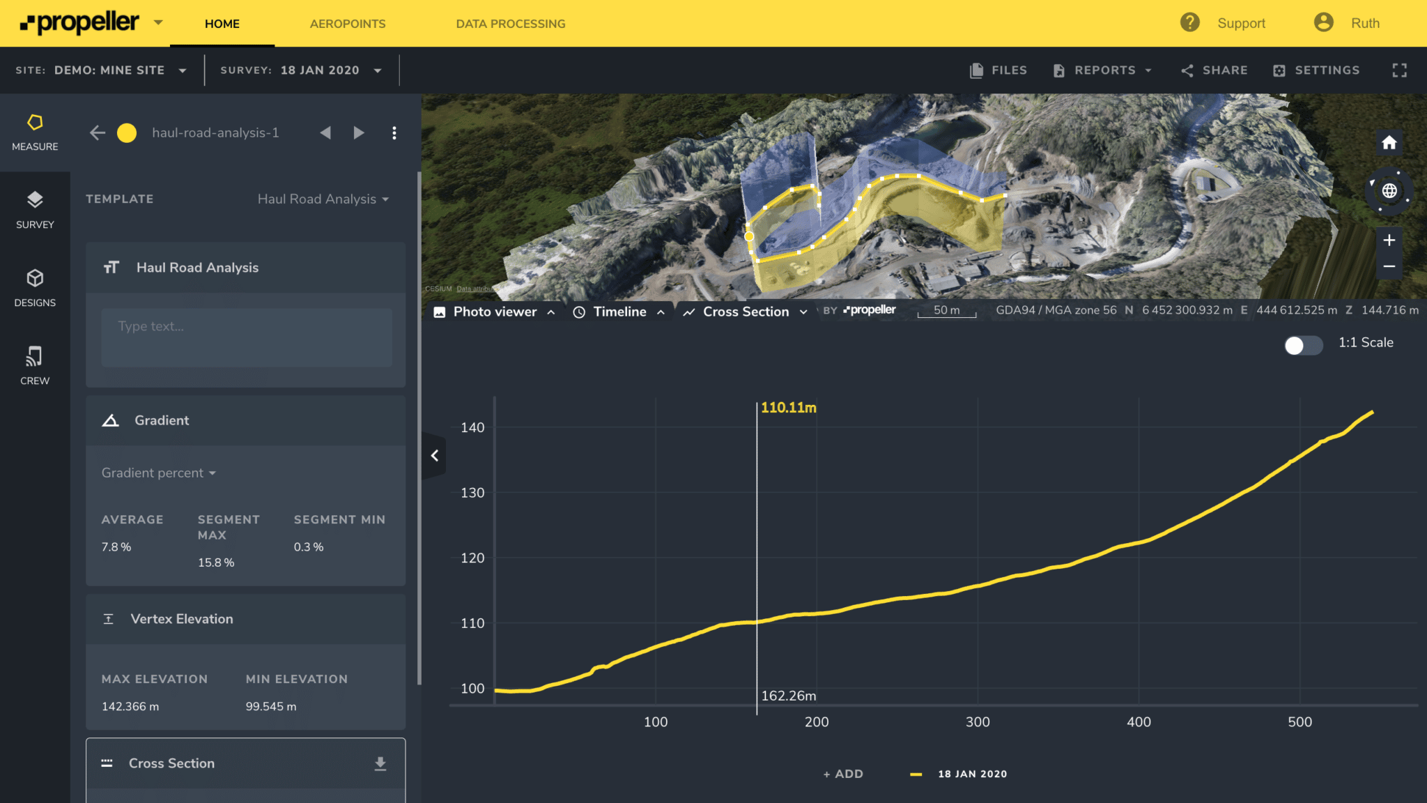
Grade, elevation, and surface length
For safety, haul road gradients should stay below 10%. To check whether your roads meet that mark, or to compare your surveyed surface to the road design, use Propeller’s cross-section tool to read the grade, elevation, and surface length along the road. Add segments for curves to keep your measurements accurate.

Shallow roads burn less diesel than steep ones. Keeping grades gentle wherever possible can cut your fuel bill month over month, and pairing that with a clear view of how your haul fleet is running makes the savings easier to prove.
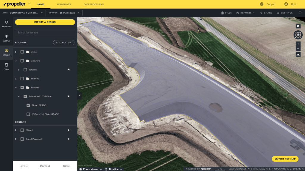
Planning and building with confidence
When expanding your site into new areas, good haul road design and management are essential.
Propeller helps teams like yours find the most efficient way to design new haul routes and connect them to existing ones. Overlaying up-to-date drone surveys with your design files gives you a full view of the project and makes it easy to plan the most efficient routes and check cut and fill as you go.
Whether your focus is safety, cost, or expansion, haul road maintenance is simpler with Propeller. See how other mining and quarry teams keep their sites moving.


