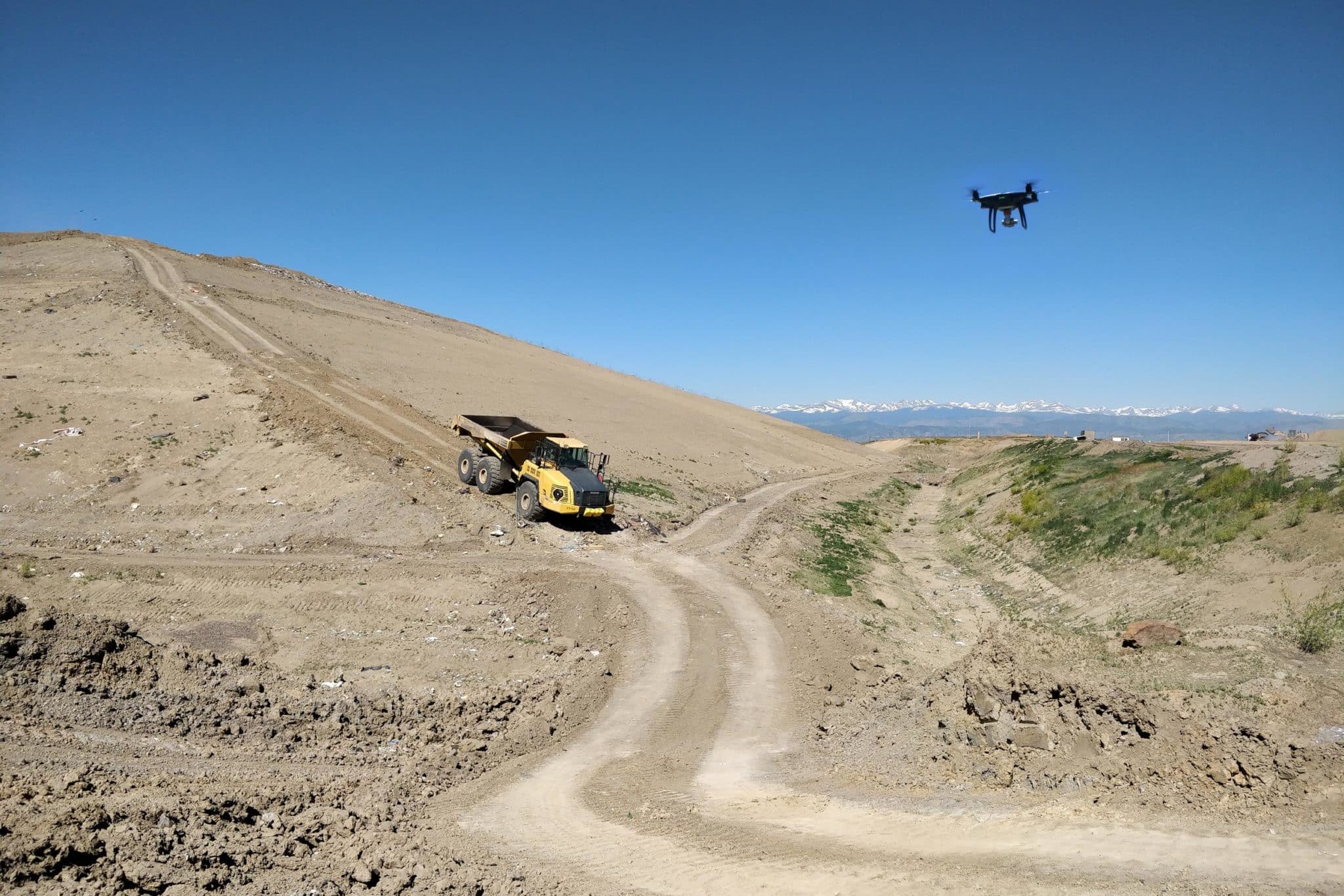
Drones cut down surveying times to hours instead of days, and they’re cheaper than traditional survey equipment. However, there’s a whole lot more that drones can do for waste management. Let’s look at some workflows to see how you can use your data to best effect.
Calculate remaining airspace
Better landfill performance means getting the most waste under the top-of-waste (TOW) design as possible. Because of compaction rates, you overfill cells selectively and depend on waste settling back down under the cap.
But overfilling too much can spell catastrophe, that is significant repercussions from your environmental protection agency or local council. Sometime this means sinking time and money into digging the waste back down to spec.
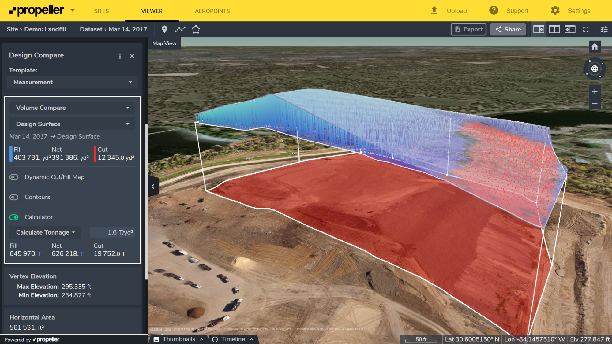
With drone-captured surveys, you can measure overfill and remaining airspace easily. Sometimes in just a few clicks.
This is big change from traditional methods. In the past, you’d need to walk multiple lines across the landfill, use those points to interpolate an approximate elevation model, and then compare that model against the TOW design.
But with 3D surveys, rendered by processing platforms like Propeller, allow you to measure volumes right on the visual model. Because the drones capture data in all three dimensions, you can see cross sections of your cell or site over time and, most importantly, against design.
Once you upload your design file, it too becomes a 3D overlay in your survey. This allows you to easily see how far you have to go, or how far you have to pull back. You can spot mistakes before the become expensive and check if your estimating correctly.
Add to that sophisticated calculators that crunch the numbers to give you remaining airspace, you can get a handle on the performance and status of your whole site right from your browser in a little as ten minutes.
Improve landfill cell management

Since landfills are paid per ton of waste and you’ve only got a set amount of airspace you can fill, you want to be able to put in as much waste as possible to get the best performance from your site. You want the best possible compaction rate. As you might guess, drones can help with that too.
Basically, it works like this: weighbridge + drone + processing platform = measuring compaction everytime you fly. Now that probably sounds too easy, but that’s the gist. Once you survey your site, you can compare volumes on individual cells from survey to survey. Couple that with your weighbridge data and a density calculator like Propeller’s, you can get your rate in a snap.
This data can also be exported into CSV and PDF files for the necessary reporting, or you can share those measurements with colleagues and bosses directly from your platform.
Contractual talks and operator reviews have usually been done on a quarterly or maybe monthly basis due to cost and time constraints. But as this frequency, by the time the information gets to you about a mistake, it’s generally too late to react to changes. Think of it like driving a car that only tells you your speed from a few hours ago.
But because drones are more cost effective and efficient, you can fly as frequently as you want to gather data. You can have an up-to-date speedometer. With frequent data capture, you can arm yourself with correct and timely data to actively manage your landfill and track progress.
Manage environmental areas on your landfill
Monitoring environmental areas is vital for any waste management operation. With drone surveys, you have the visual data on hand to easily indicate both of those things. Since everyone is working from the same data, you have one source of truth that everyone can rely on. And with cloud-based processing platforms, you can share the data with your team.
If you have an area that requires regular reporting, just mark it out once and share it with everyone who needs to know. From there, every time you survey your landfill, you can include visual updates on that area in your reports.
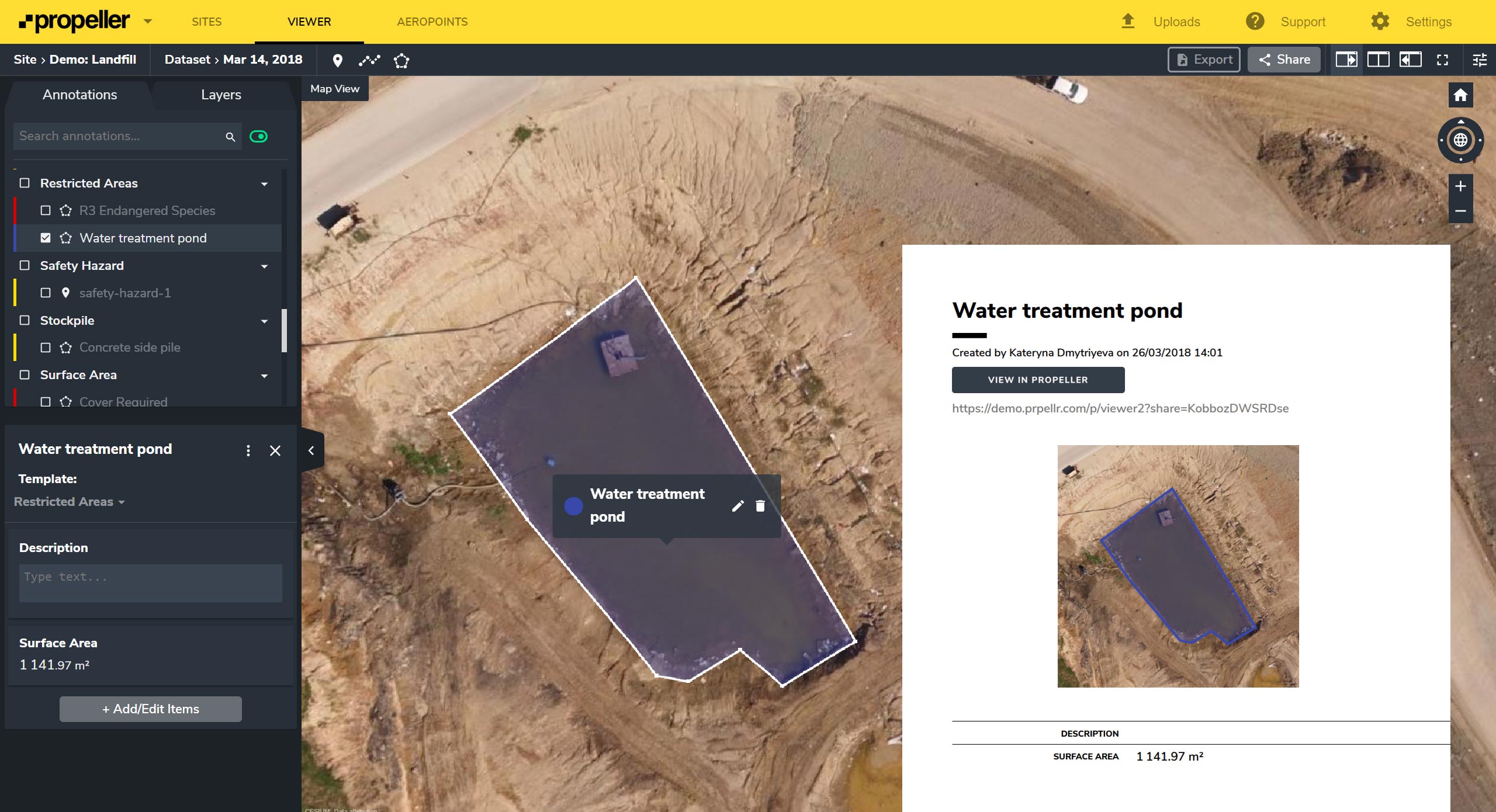
As we touched on above, since drones make surveying less expensive, you’re able to do it with more frequency. This means that compiling all that survey data together provides an accurate, visual timeline of the life of your site.
In many jurisdictions it’s fairly common for environmental protection agencies to check in on landfills to ensure that protected areas have not been tampered with. A visual timeline allows you to easily and quickly check a particular location on site over time and provide a no-arguments source of truth. Without capabilities like these such questions are not easy to answer and answers are not easy to prove—often extending into time-consuming disputes that affect everyone.


