Following on all the testing we and our customers have done, the Propeller Team has recently decided to run another experiment to prove just how accurate the relative positioning of AeroPoints is when comparing to an independent survey using a total station.
Hardware we compared
- Propeller AeroPoints
- Sokkia SET530R
Method
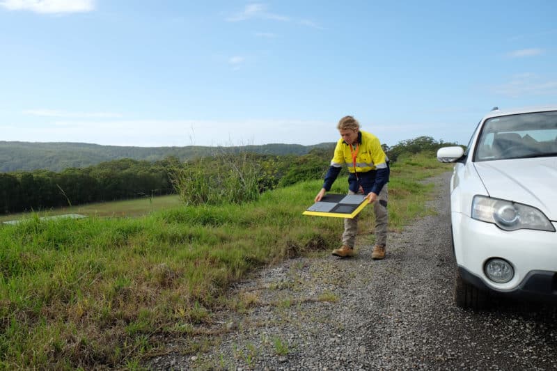
Our team have placed three AeroPoints on the ground in locations that could be seen by the total station. With a single button press, they started recording their location.
Then we set up the total station in an arbitrary location using 2000E, 1000N, and 100m elevation and roughly pointing north for a bearing as the test was for relative distances and not absolute coordinates, although the correct ground to grid scale factor for the location was used.
Using a range pole and a Leica prism with a 34mm offset, we surveyed the location of each AeroPoint and recorded them in the Total Station. AeroPoints were left t0 record positioning data for the minimum period recommended and then turned off with a second button press. On the way back to the office, the AeroPoints uploaded their data back to Propeller for processing via a WiFi hotspot one of our phones.
Results
Back at the office, we downloaded the data from the Sokkia into Trimble Business Center and compared the relative distances and heights for the three points. We did the same for the AeroPoints, with the only difference that the AeroPoints user interface allows you to export the results in a KML file which can be dragged and dropped directly into Trimble Business Centre.
Distances and heights differences are shown below:
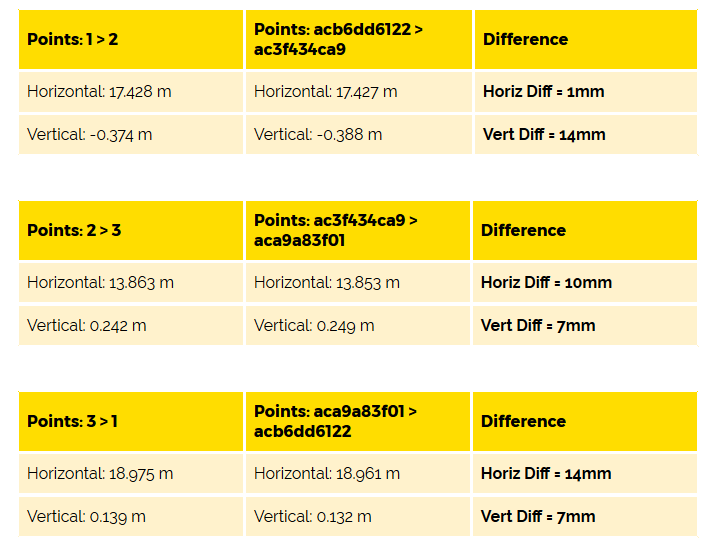
This table clearly shows that AeroPoints have managed to deliver excellent results even in an urban environment with higher chances of multipath errors.
Getting high relative (or internal) accuracy is very important, as it defines the scale of your model, and affects the accuracy of all your distance and volume measurements.
So, if your data is properly accurate internally, then your volume measurements will be also very accurate.