Modern navigation technology has become part of everyday life, and it’s widely used in a variety of industries to improve efficiency and accuracy. For example, as digitization in the construction industry increases, earthworks companies continue to embrace technology like drones and ground control (which uses modern navigation) to help guide worksites toward greater productivity and efficiency.
Originally, satellite navigation was created for military applications. But today, the use cases for it are vast and include both the public and private sectors across numerous market segments, including science, construction and earthworks, and more.
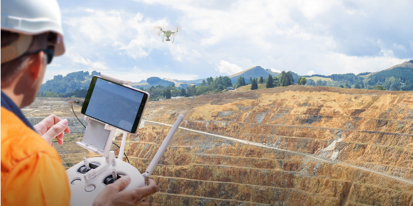
Drone surveying programs were among the first to use GNSS and GPS technologies because they were much faster, more accurate, and were less labor intensive than conventional surveying methods. Since knowing your exact position on your worksite is essential to building an accurate 3D map, we thought we’d take time to explain what these navigation systems are and how they actually work.
GNSS vs GPS: Differences Between GNSS and GPS Satellite Navigation
The term GNSS stands for Global Navigation Satellite System; it’s a collective term that covers all satellite navigation systems with global coverage. Currently, the United States’ Global Positioning System (GPS), Russia’s Global Navigation Satellite System (GLONASS), China’s BeiDou Navigation Satellite System (BDS) and the European Union’s Galileo are the four fully operational GNSSs. Global coverage for each system is generally achieved by a group of 20 to 30 medium Earth orbit satellites across several orbital planes in space.
Satellite navigation has a wide variety of applications, used on both a national and international scale. GNSS systems are useful in any field where precise timing and positioning information is required like transportation, vehicle navigation, marine navigation, mobile communications, and even athletics.
GPS is the most widely used GNSS system in the world. This United States government-owned system was originally developed for military use but is now widely available for civilian use and is accessible to anyone with a GPS receiver.
GPS provides geolocation and time information to a receiver anywhere on or near the earth where there is an unobstructed line of sight to four or more GPS satellites. However, obstacles like mountains and buildings can block relatively weak GPS signals.
GPS does not require the user to transmit any data, and it operates independently of any wireless or internet connection, though these technologies can enhance the value of GPS positioning information.
How GNSS and GPS Work
GNSS technology is used in conjunction with existing GPS systems to determine precise location positioning anywhere on the Earth. Though both global navigation systems work together, GNSS equipment works on a larger scale. GNSS-compatible equipment can utilize signals from navigational satellites in networks outside the GPS system.
Both GNSS and GPS consist of three primary elements:
- Satellites
- Ground control stations
- Receivers
Satellites send continuous radio signals toward Earth, picked up by GPS and GNSS receivers. The ground control stations that monitor the GNSS track the satellites, updating their positions so information can be transmitted from Earth back to the satellites.
The Broader Reach of GNSS
GPS technology makes it possible to accurately find a location using satellite signals. However, GPS only uses satellites operated by the United States. These satellite signals are limited–they can easily be blocked by bad weather or geographical obstacles like mountains. If too many of the signals are blocked, a GPS receiver won’t properly transmit until the signal can be reestablished.
However, GNSS technology operates on a much wider scale, using signals from any navigation satellite, not just GPS. With more signals available, the accuracy and reliability of the data received is substantially increased. Simply put, all GNSS receivers are GPS-compatible, but not all GPS receivers are GNSS-compatible.