
Propeller is used for high-accuracy drone mapping by survey teams all over the world. It’s made us experts in a very particular area: coordinate reference systems.
If you’re planning work or tracking progress on a worksite, you’ll have designs, plans, and survey data, all of which will be in your site’s CRS. It might be a national grid or state plane system, or it might be in locally calibrated coordinates.
Making drone data useful is all about collecting the right information and communicating it effectively. You need to be producing data that meshes seamlessly with the information you already have.

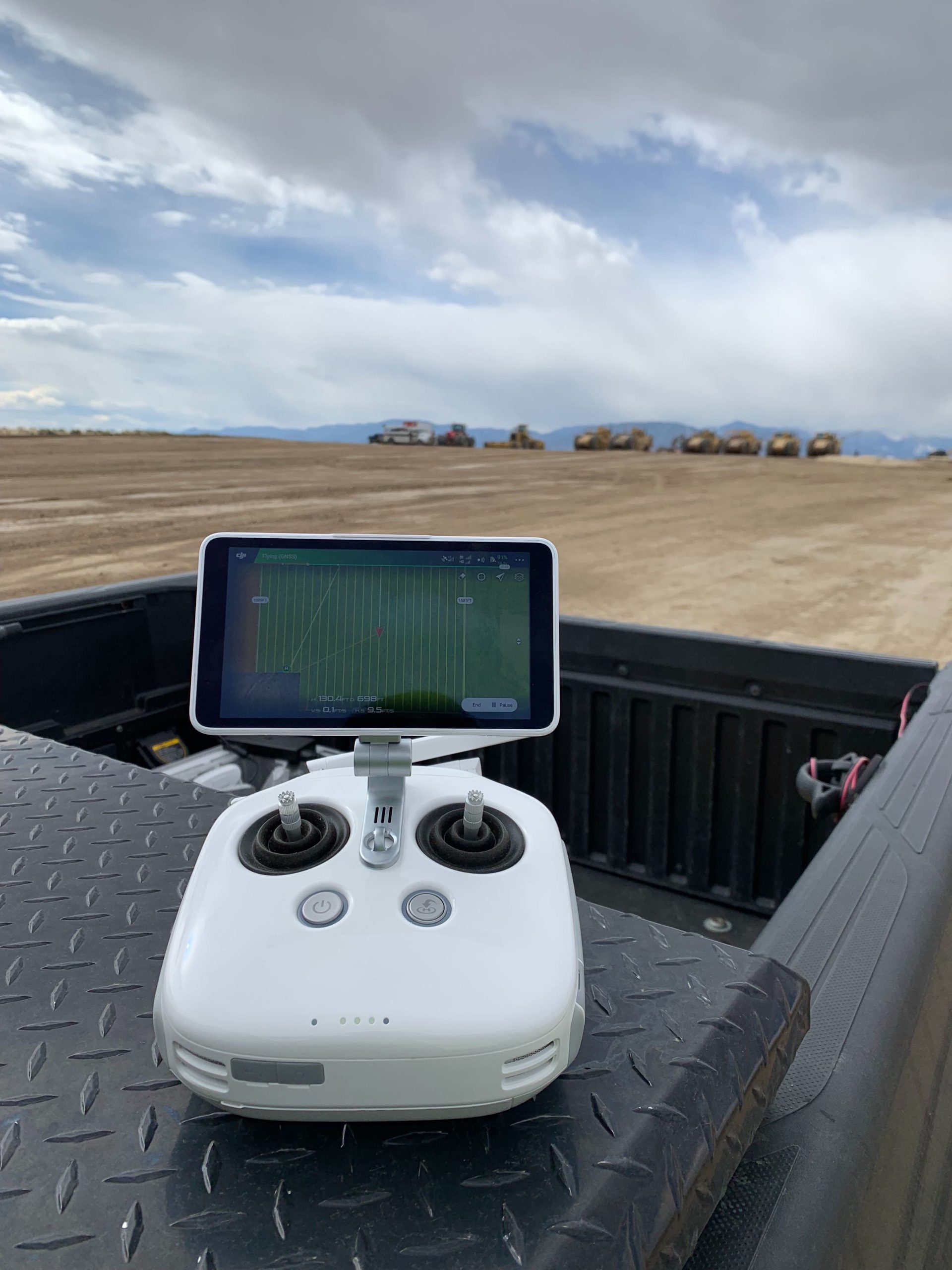
Drone data is collected using GPS, meaning it uses the global WGS84 CRS. However, it’s unlikely that you’re using WGS84 on site (unless you prefer working with degrees of longitude and latitude over feet or meters, in which case you belong in a very small minority).
So, how do you get newly collected data to align with the CRS you use on your site?
What coordinate reference systems does Propeller support?
Every piece of georeferenced survey data, whether a topographical terrain model or an orthomosaic, will have some kind of CRS associated with it. CRSs determine how a given point is described in reference to the real world.
If two datasets—say an orthomosaic and a .DXF file—reference different CRSs, then measurements will not line up when you try to use them together.
Propeller supports many of the most popular published CRSs. If you provide your customer success engineer with the name of the public CRS you use, we’ll sort out the rest for you.
Alternatively, you can use our Coordinates Converter to easily transform coordinates from one CRS to another.
The value of local and customized CRSs
To ensure the highest accuracy, many sites operate on a “locally calibrated” CRS. Local calibration involves surveying known points and monuments on site and setting up a coordinates grid that is specific to that site. Unlike some of our competitors, Propeller does support local CRSs.
For example, if you have a site calibrated by a Trimble rover, you can use Trimble Business Center to export your calibration in a JXL, upload it directly to Propeller, and we’ll handle the rest for you.
We also support the ability to customize existing systems to suit your needs or to define your own. We have had customers use local systems from council archives and modified existing nationally recognised systems to produce models that mesh seamlessly with historical data.
If you have a published CRS that doesn’t have an EPSG code, or want an existing system in a different linear unit, you can contact our data success engineers directly through the Propeller Platform. We’ll get everything set up so you can process your data without delay.
How to set up a coordinate system in Propeller
Once you know the coordinate system you want to work in, it’s easy to use it throughout the Propeller Platform.
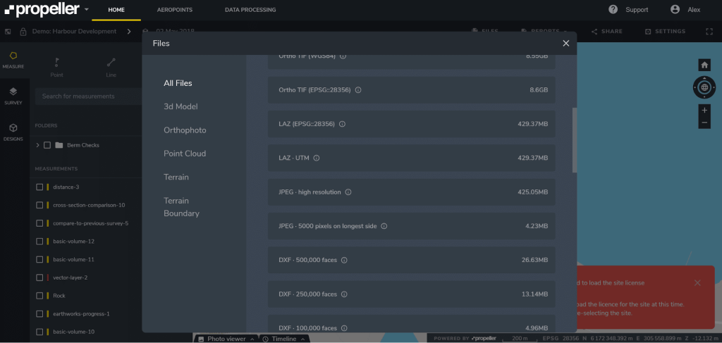
In your site’s files: Our default survey files include DXF files and point clouds in your site’s default CRS. You can configure your default CRS for a site when you set it up. You can see below the files for a site in EPSG 28356, which is the GDA 94 CRS used in Australia.
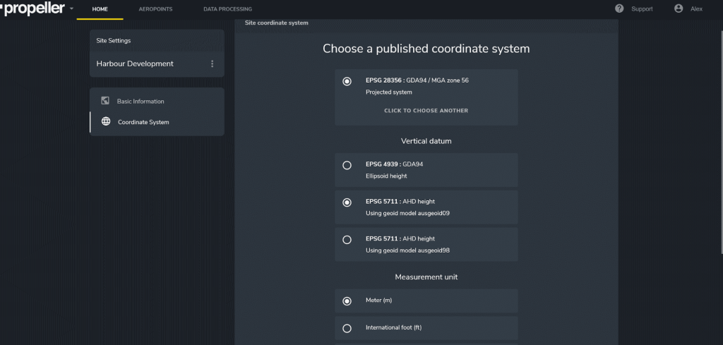
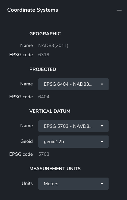
In Propeller’s online viewer: You can also change the CRS (or projection), reference ellipsoid or geoid, and output units (metric or US imperial) in the Coordinate System tab in your Site Settings. This can be useful if you want to observe a particular location on your site where you know the latitude and longitude, or if you’ve got data you want to cross-reference in another CRS.
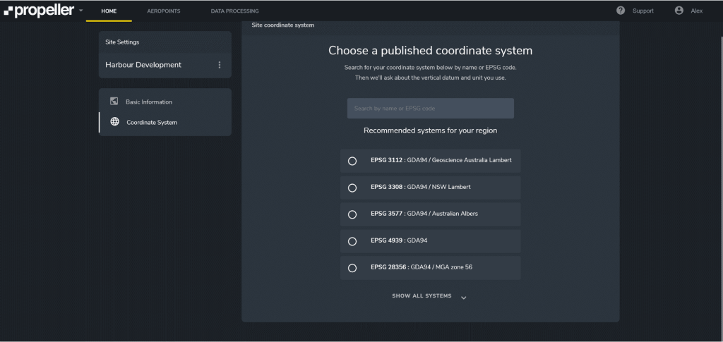
When you click to choose another CRS, you can enter the EPSG code of the new CRS in the provided field. Propeller will also populate a list of CRS recommended for your region.
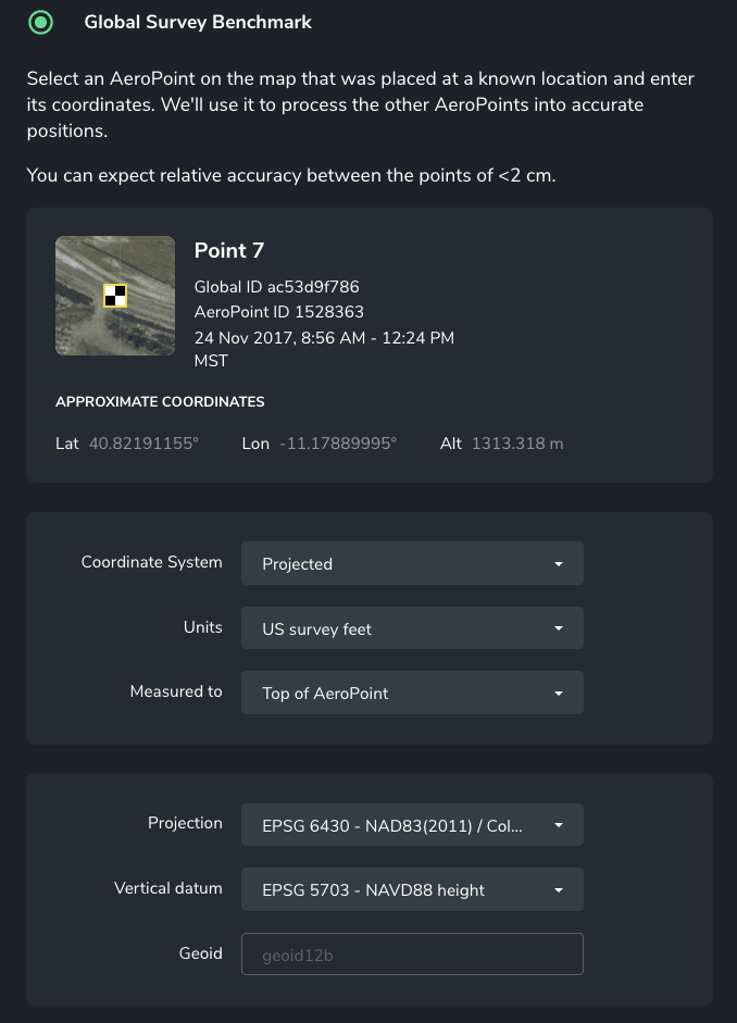
AeroPoints: Using AeroPoints for easy, automated ground control? You can also use any of these coordinate systems—or a local calibration that you’ve configured—to process your ground control points in your own CRS.
Please note that Local Coordinate Systems and Local Site Survey Benchmark processing options are only supported when processing data sets using AeroPoints with the Propeller or Stratus platforms. If you would like more information, please contact us.
And you can still configure another CRS to download your results.
Regardless of the CRS you want to work in, Propeller will ensure you and your team are speaking the same language at every stage of the project.
Meanwhile, you can try our free coordinate systems converter: