There’s a version of this story that plays out on sites every day.
A foreman drives past a cut section, slows down, and gets that feeling. The kind that comes from years of reading a site. Something’s off. The grade looks wrong. Maybe it’s fine. Maybe it’s not. But there’s no way to know for sure, not without calling in a surveyor, waiting for a crew, and hoping the answer comes back before anyone lays another inch of base.
So they make a call. Keep moving, or stop the work and wait.
Neither option is great.
The data was never the problem. The access was.
Propeller has always been built around one idea: everyone on site should be working from the same map. When your drone goes up, the data comes back, and the whole team (field, office, stakeholders) can see exactly what’s happening.
But there’s a gap in that story. Between flights, the site keeps moving. Decisions keep getting made. And the people closest to the work, the foremen, the supervisors, and the operators, have been going on their best judgment and not much else.
That’s an access problem, and it’s one worth fixing.
“Trimble Stratus empowers our engineers, safety personnel, and project managers with autonomy, eliminating the need for constant surveyor reliance.”
DirtMate RTK: the same map, now in their hands
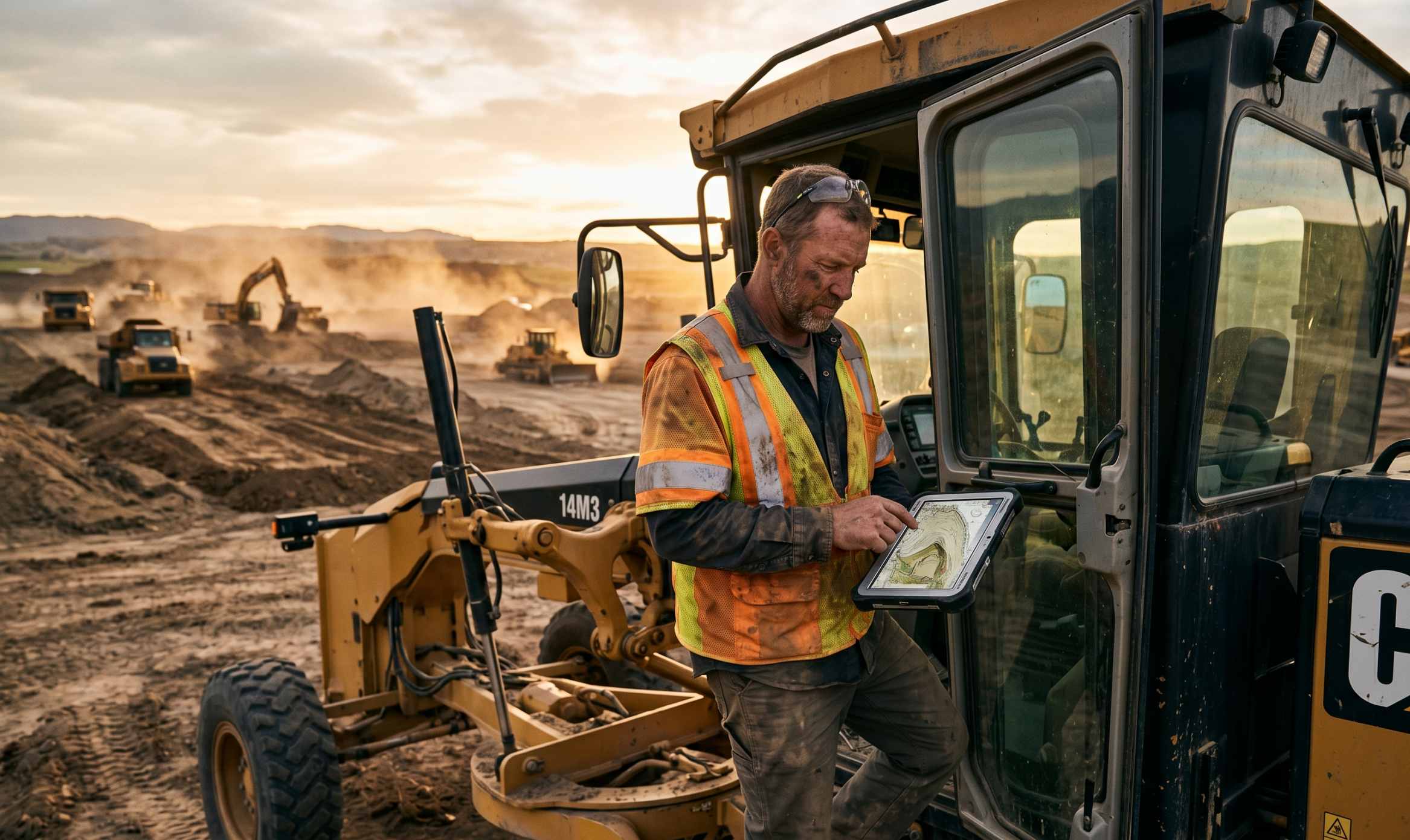
DirtMate RTK is Propeller’s newest hardware capability, and it’s built specifically for the everyday checks that keep a site moving. It puts instant survey capability into the hands of the people running the work: high-precision capture, live elevation, and surface-to-design comparison, all synced straight back into Propeller.
Walk to the spot. Tag the point. Know the answer.
From the cab, an operator can see their live position against the design surface and track rough grade as they move across site. Off a rod, a foreman can capture a point, run a quick stake out, or verify an elevation in minutes. One device, multiple workflows, and everything recorded on site shows up on the same map the office is already looking at.
That changes who can answer the question “is this built to design?” Now it’s anyone who needs to know, right now, before the next pour or the next shift.
“As soon as the data is available, our team can jump on and get volumes themselves. They’re not fully reliant on me to get the data to them, and they can see everything a lot easier with a 3D map of the site they can zoom around.”
Built to complement your survey crew, not replace it
Worth saying clearly: DirtMate RTK works alongside your survey crew. High-precision stake out, complex control networks, and final as-built sign-offs still belong to the people trained to do them.
What DirtMate RTK handles is everything in between. The everyday checks. The quick verifications. The “I just need to know if we’re close” moments that used to mean stopping work and waiting.
When your surveyor’s time isn’t eaten up by routine spot checks, they can focus on the work that actually needs them. And when your foreman can confirm what they already suspect without losing half a day, the whole site moves faster.
The goal is simple: get the right answer to the right person at the right time, backed by data that’s already synced into the platform everyone’s using.
One map. Everyone on it.
The Propeller platform has always been about bringing the field and the office together. DirtMate RTK is the next step in that story, closing the gap between drone flights, putting high-precision tools in the hands of the people who need them most, and making sure the foreman who spots something wrong can do more than have a feeling about it.
They can prove it. Fix it. Move on.
That’s what a real-time command center for earthwork looks like.
DirtMate RTK is now live as part of Propeller’s Release Blitz. Want to see how it fits into your site workflow? Book a demo →


