From HAL in 2001: A Space Odyssey to The Terminator, robots have been the subject of conflicted feelings in popular culture for a long time. Human fears about the implications of robots date back at least as far as the 1920s. (And let’s be honest—haven’t we all wondered if a robot might take our job someday?)
AI and robotics have advanced far enough that workers across industries share concern over being replaced. Surveyors in particular often ask us if drones will make their jobs unnecessary—but nothing could be further from the truth.
In fact, we’re passionate believers that drones are actively improving the professional landscape for surveyors, engineers, contractors, and other earthworks professionals.
Drones can’t possibly replace a surveyor on a job site, but they are a valuable tool in a surveyor’s toolbox. Like any other tool, they’re useful only in conjunction with people, not instead of them. Even the biggest and best construction equipment is useless without a human to operate, guide, and respond to it, and the same is true of drones.
If you’re wondering how drones can support your surveying efforts on a job site—or even if you’re wondering whether a drone is next in line for your job—read on. We’ll explore both the benefits and the limitations of drones, and show why humans remain an essential part of any successful drone surveying workflow.
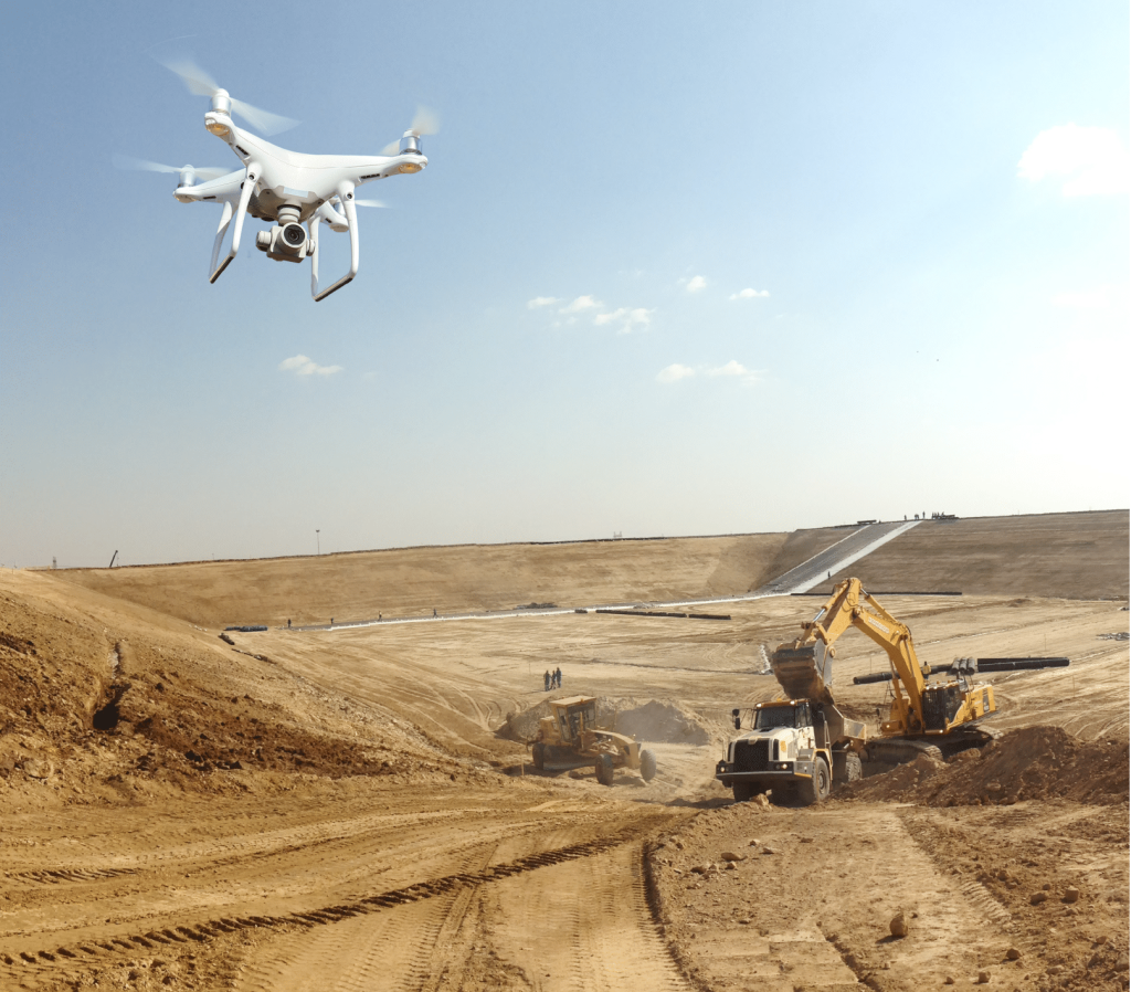
Drones help capture survey data—humans analyze it
Land surveying isn’t for the faint of heart. It’s a demanding profession requiring many years of experience and a special license, which means that it’s far simpler to train surveyors to use drones than it is to try to train drone operators to produce topographic data.
Survey drones are essentially GPS-enabled flying cameras. They can capture aerial photos of a worksite, geotagging them so they can be stitched back together into a meaningful 3D map by software like the Propeller Platform—but that’s where their capacity ends.
Surveyors, of course, do a whole lot more than walk a site and take measurements. They interpret those measurements and contribute to critical project decisions.
Drones enable surveyors to do more in less time, enabling them to focus on the bigger picture instead of spending hours walking a busy worksite. The value of surveyors isn’t in the physical work of capturing measurements by hand. It’s in the analysis and other cognitive work that drones simply can’t do.
Field workflows can be made more efficient without sacrificing the essential value that surveyors provide. And since surveyors are well-versed in technology already, operating a drone is well within their skill set. Everyone wins.
Why drones are a valuable survey tool
Drones provide a more robust and versatile mapping solution than traditional methods, including the ability to render a digital 3D model of a site’s topography. Thanks to their bird’s-eye view of a worksite, drone images can incorporate angles, elevations, and imagery that simply aren’t available from the ground.

Drones help surveyors accomplish more in less time and with fewer resources—a benefit that matters even more during today’s skilled labor shortage.
While drones can’t eliminate the need for surveyors to visit project sites, they can dramatically reduce the amount of time they spend there. Instead of walking a grid over an entire site, surveyors can complete a drone flight within just a few minutes. Yes, there’s still office work involved in creating a final survey—but Propeller handles the data processing, leaving surveyors and project teams with ready-to-use topos within 24 hours. Some estimates put total labor savings at up to 60% per project.
As government initiatives and global economic recovery prompt more construction project kickoffs, efficiency and accuracy have a distinct market value. As one customer put it, drone surveying workflows are “too expensive not to own.”
How drones make construction sites safer and more enjoyable
Drones can do even more than help surveyors achieve high-accuracy surveys in less time. They have numerous other benefits, too:
- Worksite safety: Drones can fly over hazardous terrain, eliminating the need for surveyors to put themselves at risk.
- Dispute resolution: A single, shared source of truth keeps everyone on the same page, making disputes a rare occurrence.
- Less rework: Bad or confusing data creates rework, which has a massive downstream impact on your bottom line. Prevent rework with fast, frequent surveys and updates you can share with all stakeholders.
- Avoid downtime: Know ahead of time if a site isn’t ready for your crew—and get the pictures to prove it. Our clients save thousands of dollars per day in avoided downtime.
- Worker satisfaction: Safer, more efficient worksites create happier employees, reduce turnover, and boost workplace morale.
Far from replacing surveyors, drones reduce their time onsite and make their days more enjoyable, freeing them to focus on the bigger picture. Like a base and rover, drones are simply another tool in a surveyor’s tool belt.
Technology is a significant asset across industries, but it’s ultimately humans who make its output meaningful—and that will never change.
The construction and earthworks industry is changing. Advanced technology is leading the way to help companies improve efficiency, gain greater visibility, improve worksite safety, and more. Get the scoop by downloading, “Shaping the Contractor of the Future: 5 Essential Pillars for Success.”