Shannon Valley is revolutionizing soil stabilization with streamlined data access
About the project
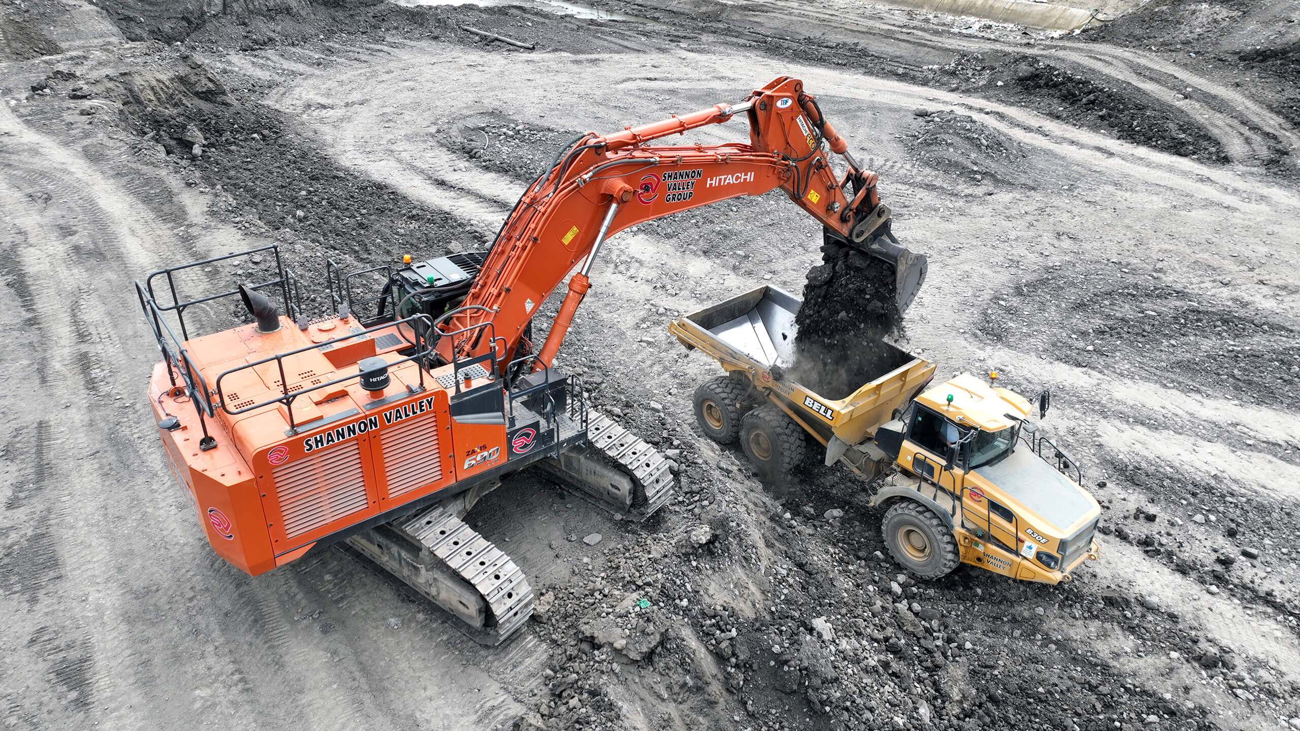
Originally established in 1991, Shannon Valley is a family-operated and owned business that has grown over the years into one of the leading civil engineering and construction contractors in Ireland. While they primarily complete groundwork both in Ireland and abroad, Shannon Valley is also involved in recycling works, quarry works, demolition, and plant hire.
Site engineer Maciej Masiuk, the present-day head of the drone surveying department, was initially unenthusiastic when his manager signed on with Propeller. “I preferred self-processing the data, so I wasn’t really into it at first,” Maciej told us. “But then I realized how much time and work it saves.”
Read on to learn how 3D site maps and streamlined data processing have transformed Shannon Valley’s workflows, supporting their innovative (and sustainable) soil stabilization projects across Europe.
Time-consuming data capture with limited access
Before Propeller, Maciej found himself wondering how long his knees would survive his surveying work. Each week, he’d set up a GPS total station and walk a worksite, traversing dozens of kilometers to collect survey data by hand.
Examples of some of the downsides of this process include:
- Long processing timelines: After surveying on foot, it took another day or two to process the data licensed computer. All told, the average groundwork survey took about a week from start to finish.
- Wide margin of error: This labor-intensive workflow also cost the team accuracy. Because work couldn’t stop for surveys, lots of material would move before surveyors got from one end of the site to the other, yielding a few thousand cubic meters of error each time.
- Cumbersome data storage: Sharing survey data and orthophotos took longer than it should have—partly due to large file sizes, and partly because locating the right survey data took about 10-15 minutes each time. Those inefficiencies stacked up over the course of a day, leaving Maciej to spend hours each week searching for data.
Streamlined processing and data sharing in the cloud
Originally, Shannon Valley sought out Propeller to help democratize access to survey data. They wanted a way to share their survey results with everyone on the team, regardless of technical background.
After the rollout, even the initially-skeptical Maciej was won over by Propeller’s ease of use and consistent accuracy.
Shannon Valley’s favorite features and workflows
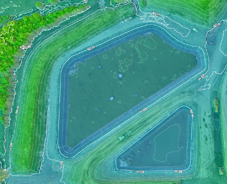
Survey-grade accuracy
The magic is in keeping your data consistent over time so you can accurately track your work. He’s found this magic in Propeller. “If I use good ground control, the data is very consistent. I rely a lot on it,” Maciej said.
Quick survey timelines
Where traditional surveys might take two or three engineers at least a full day of work—plus another day for data processing—Maciej can now survey a worksite and upload data within 30 minutes. The data is processed while he sleeps and ready to use the next morning. The team uses this streamlined process to regularly survey ecological projects in Ireland that change too quickly for traditional surveys to keep up.
Direct data access
Everyone on the team now has access to survey data they can easily read and understand. With a browser-based way to share surveys and orthophotos, Maciej saves hours each week on finding and sharing data alone.
Volume management
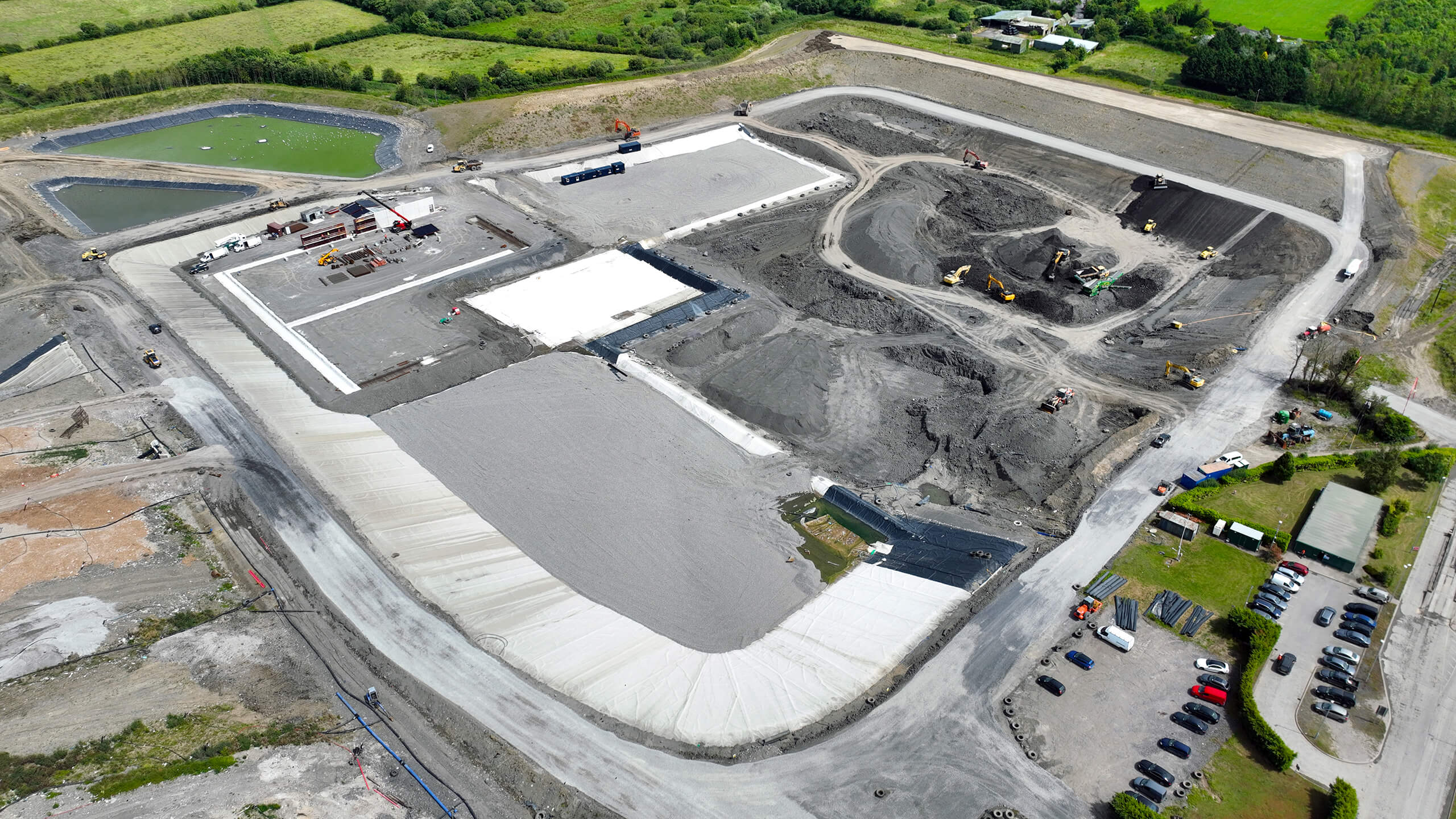
Shannon Valley does innovative work in soil stabilization, recycling soil on-site rather than moving it to a landfill. By screening and processing subsoil waste, they stabilize the soil while reducing fuel burn thanks to an 80% reduction in aggregate movement. This process relies heavily on volume management; the team needs to know exactly how much material is on-site and how much is required to complete a project. With Propeller, Maciej can fly a site before work ever begins to determine stockpile size and required material volumes.
Design verification
Maciej also likes the ability to verify design accuracy against 3D site models before the team ever sets foot in the field. “Rather than assuming the design is right, we can drop it in Propeller and do a quick check to see how it matches with existing ground conditions,” he told us.
Timeline
Before Propeller, Maciej had to manually sift through surveys to answer questions about when and where different stages of work happened on-site. This process involved disparate data sets and large files that were slow to open. “If you survey every week, the exact date of what you’re looking for gets blurry,” Maciej said. Now, he uses the Timeline tool to quickly scan backward and forward in time with a simple slider.
Easy for non-engineers, better communication and quick site checks
- Easy for non-engineers: Maciej has been pleasantly surprised by the amount of work the team can complete within Propeller. “You don’t need a NASA computer to work with your data,” he said.
- Better communication: Propeller simplifies and clarifies on-site communication. While field workers spend every day on-site and are familiar with its rapid changes, keeping up isn’t always as easy for those in the office. With everyone looking at the same map, clarifying requests is easy, reducing rework.
- Quick site checks: Without the need to set up surveying equipment and walk a site to answer questions about measurements, Maciej can pull up a 3D model from anywhere and conduct quick site checks in less than a minute.
Overall, Maciej considers easy access to data the biggest win from using Propeller—especially for those new to drone surveying. “If you don’t have much experience, Propeller will definitely help you achieve high-quality data,” he said.
Want to know how Propeller can help you?
Learn more about Propeller’s products, pricing, and how to get started on your site.
You might also like

Cross Section Survey in a Matter of Minutes Using Drone Data

How to Use Drone Data to Improve Landfill Performance
