Some customers like using their survey data outside of Propeller to plan work on site, so we’re excited to bring you a new way to do that. Now, you can export and download orthophotos for a specific area of your worksite in a matter of minutes. From there, the option’s yours—import into another system, share the data with a colleague, or fit it into another workflow. Here’s a breakdown of how it works.
But first, what is an orthophoto?
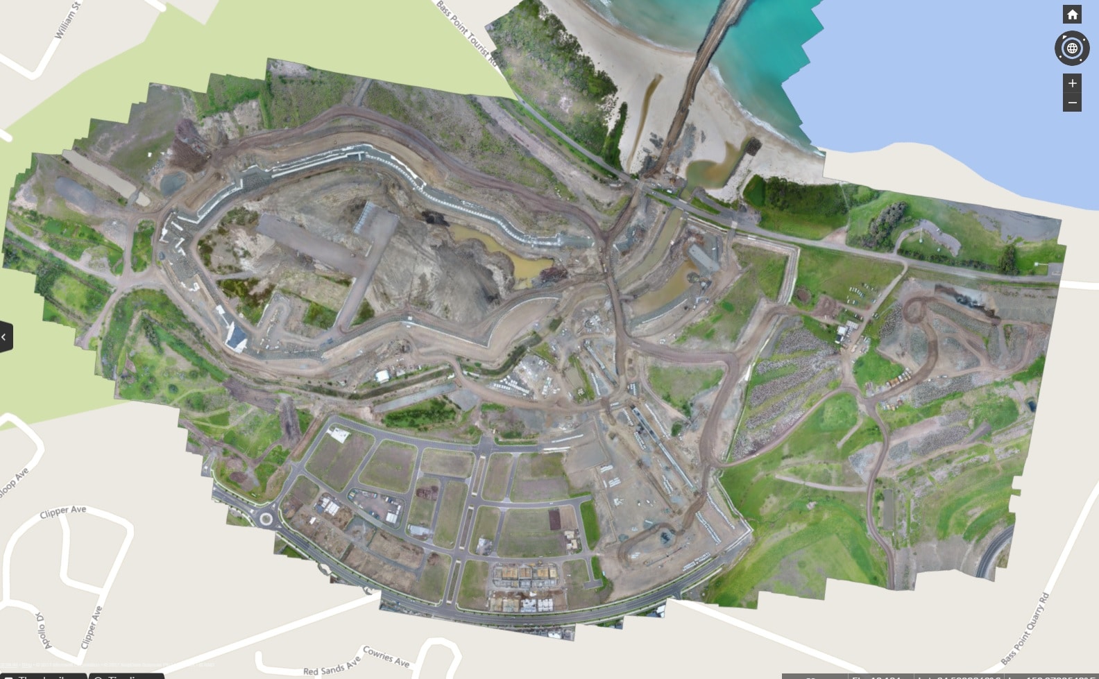
An orthophoto is a geometrically-corrected (orthogonal) image with uniform scale relative to a given map projection. It can be used to measure true distance because after being adjusted for topographic relief, lens distortion, and camera tilt, it becomes an accurate representation of the Earth’s surface. The key difference between a normal aerial photo and an orthophoto is the perspective and accuracy.
By combining many small overlapping aerial images, you’re able to create a large, high-resolution orthophoto, which you can use to measure a wide range of site activity.
Exporting orthophotos from Propeller
With this latest update, earthmoving contractors can easily export an orthophoto from any polygon region of their worksite. After the export, users can carry out further work, outside Propeller, using the data they captured from drone surveying.
You can export an orthophoto from Propeller by:
- Selecting an area of interest
- Choosing the resolution GSD (ground sample distance)
- Choosing the format— JPEG or GeoTIFF (We also support BigTIFF for large files.)

The coolest part? With this new functionality, we’re giving you expanded options. You can export a specific section of your site in your desired resolution, rather than exporting your entire site.
Composite surveys
The new export orthophoto feature also works perfectly on composite surveys. Within Propeller, a composite survey allows you to fly and upload small, active sections of your site and then merge them to produce a view of your entire worksite. You don’t have to spend time surveying areas of your site that haven’t changed, and you can work with smaller datasets that are quicker and easier to upload without compromising the big picture of your worksite.
These new options to export orthophotos of your site from the Propeller Platform provide you with the ability to obtain your survey data in more manageable file sizes that you can use to continue your site analysis and complete any other tasks that are part of your workflow.
Would you like to learn how to export orthophotos from the Propeller Platform? Find out how. Check out this demo of Propeller’s orthophoto export function.


