Know your inventory. Plan your pit. Run a tighter quarry.
Accurate stockpile volumes, on-demand site surveys, and a shared 3D map that connects your entire team, from the weighbridge to the boardroom.
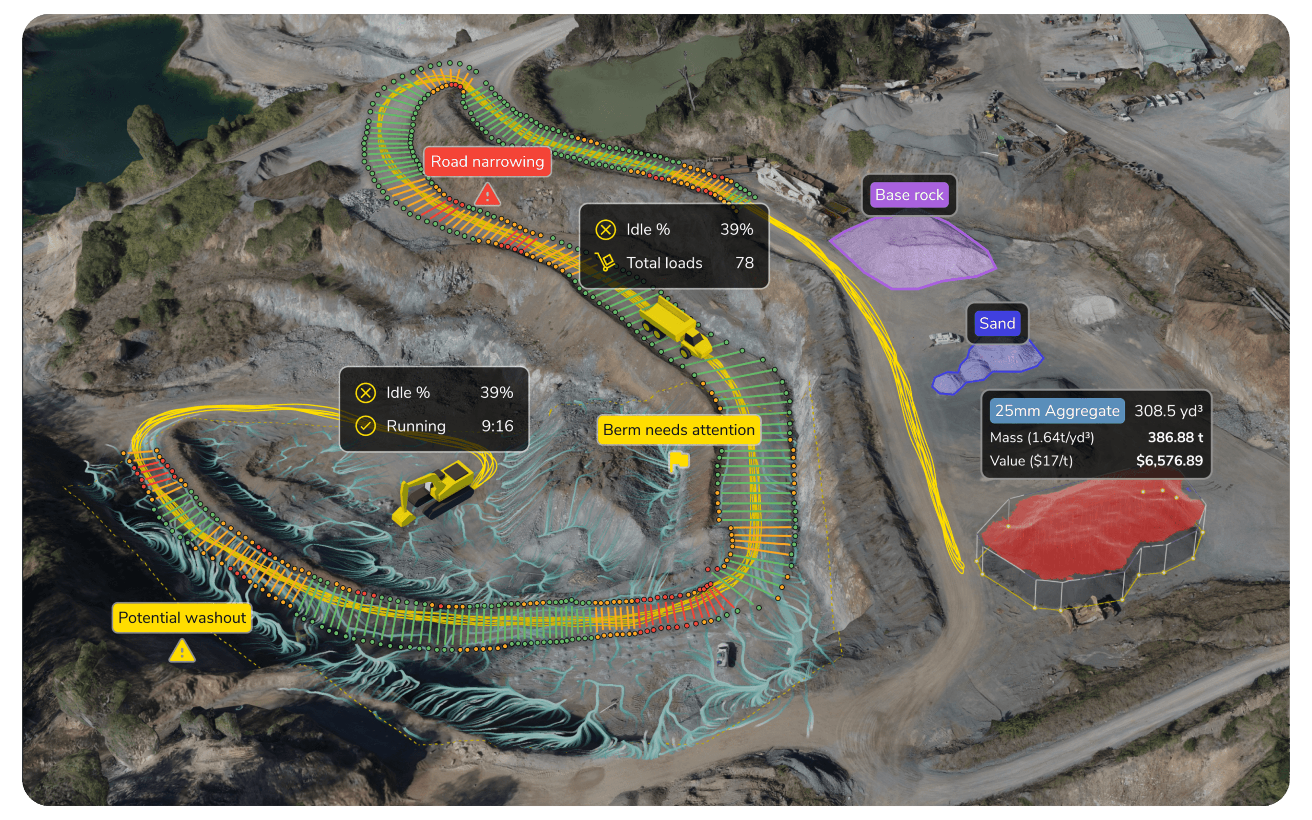
Core workflows: How we solve aggregates problems
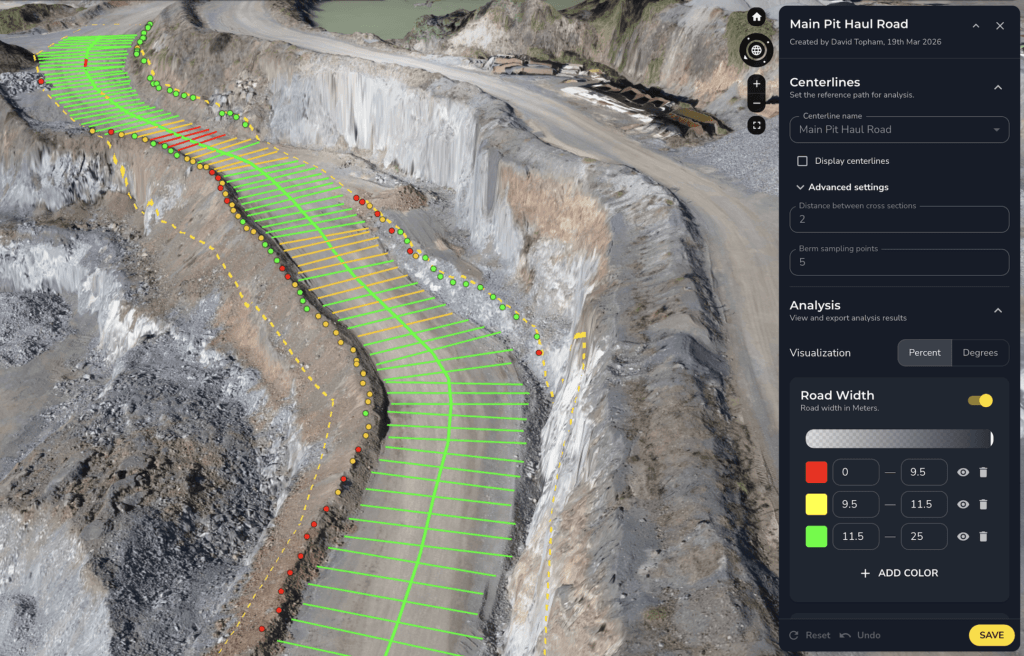
Site Safety and Operational Compliance
- Protect your people and maintain your site standards with data, not guesswork.
- Highwall and face monitoring Track wall movement, cracks, and slope changes with regular drone surveys. Spot instability before it becomes an event.
- Vertical face imagery High-resolution imagery of steep faces and bench walls without sending crews into hazardous zones. Support geotechnical reviews from the office.
- Haul road compliance checks Automatically check road widths, berms, and gradients against site standards. Flag maintenance needs before conditions deteriorate.
Daily production tracking with DirtMate
Track every load, every cycle, and every machine in real time.
- Live load and cycle tracking Real-time load counts, haul cycles, and material movement across loaders, trucks, and dozers.
- Fleet productivity Run time, idle time, and utilisation at a glance. Spot bottlenecks and adjust during the shift.
- Gap-fill between drone surveys DirtMate streams machine data onto your Propeller map, giving you daily surface updates and volume estimates between flights.
- Machine and manufacturer agnostic Fits any machine. No need to replace equipment or lock into a single manufacturer.
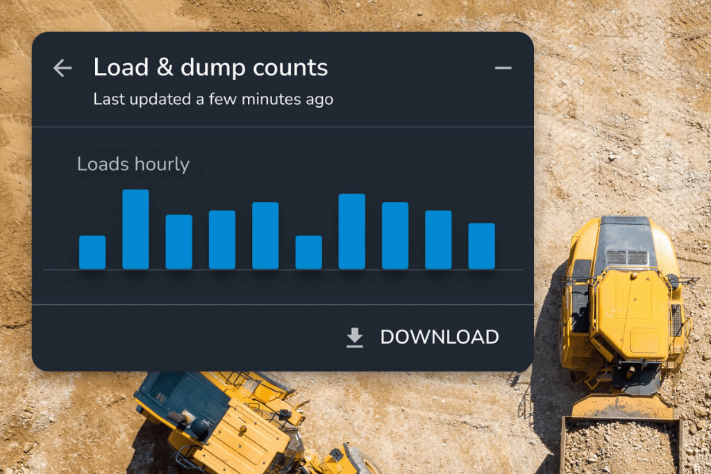
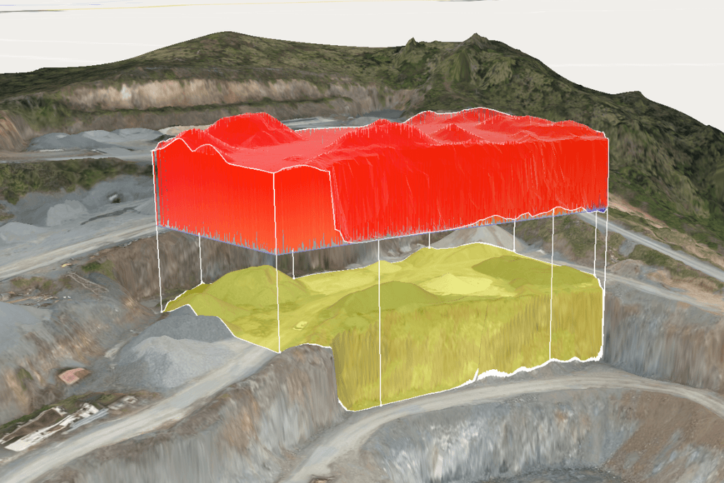
Pit Planning, Blasting and Extraction
Layer designs over reality. Make confident decisions about what to dig next.
- Design overlay and conformance Import pit designs and overlay them against your latest survey. Check bench heights, face angles, and extraction progress against specification.
- Remaining reserves Cut/fill comparisons against your final design to calculate how much material remains. Plan production around real numbers.
- Pre-blast planning Estimate blast volumes using accurate terrain data from your latest flight.
- Post-blast verification Measure muckpile volumes and material movement after every blast. Compare results to plan to refine future designs.
Water Management and Environmental Compliance
Water management is one of the highest-stakes compliance obligations on any quarry. Plan proactively, not after a rainfall event.
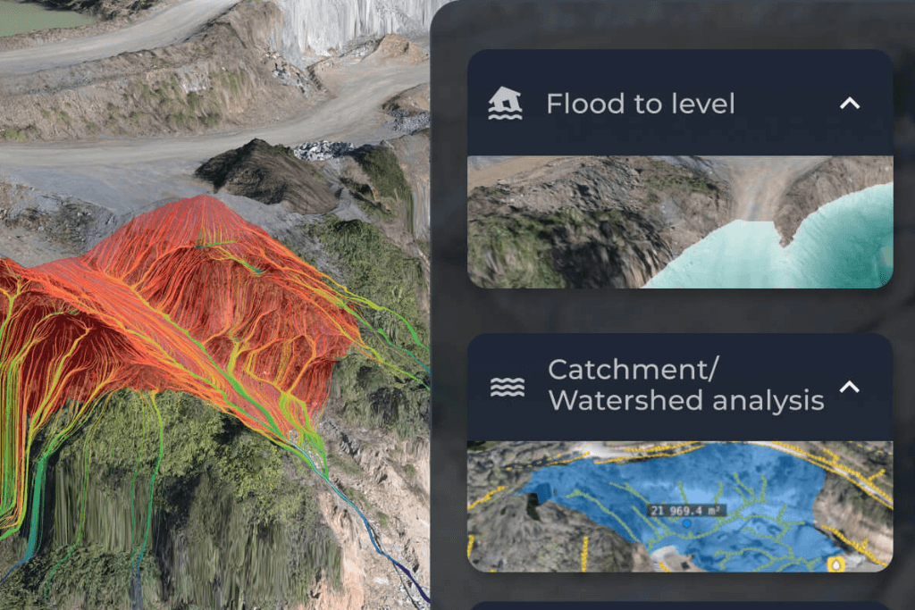
- Drainage and runoff modelling Visualise water flow paths across your site. Identify where runoff concentrates and where drainage infrastructure needs attention.
- Rainfall simulation Simulate storm events to understand how your site responds before the rain arrives. Plan sediment controls and size detention basins with confidence.
- Flood level visualisation Set specific water levels and instantly see which areas would be affected. Use this for dewatering decisions and communicating risk.
- Disturbance boundary tracking Overlay permit boundaries on your latest survey to verify extraction stays within approved limits. Auditable visual records over time.
- Rehabilitation progress Before-and-after comparisons to demonstrate progress to regulators, landowners, and community stakeholders.
Stockpile Inventory and Volume Reconciliation
Stop relying on biannual surveys and end-of-year write-offs. Know what you have, when you have it.
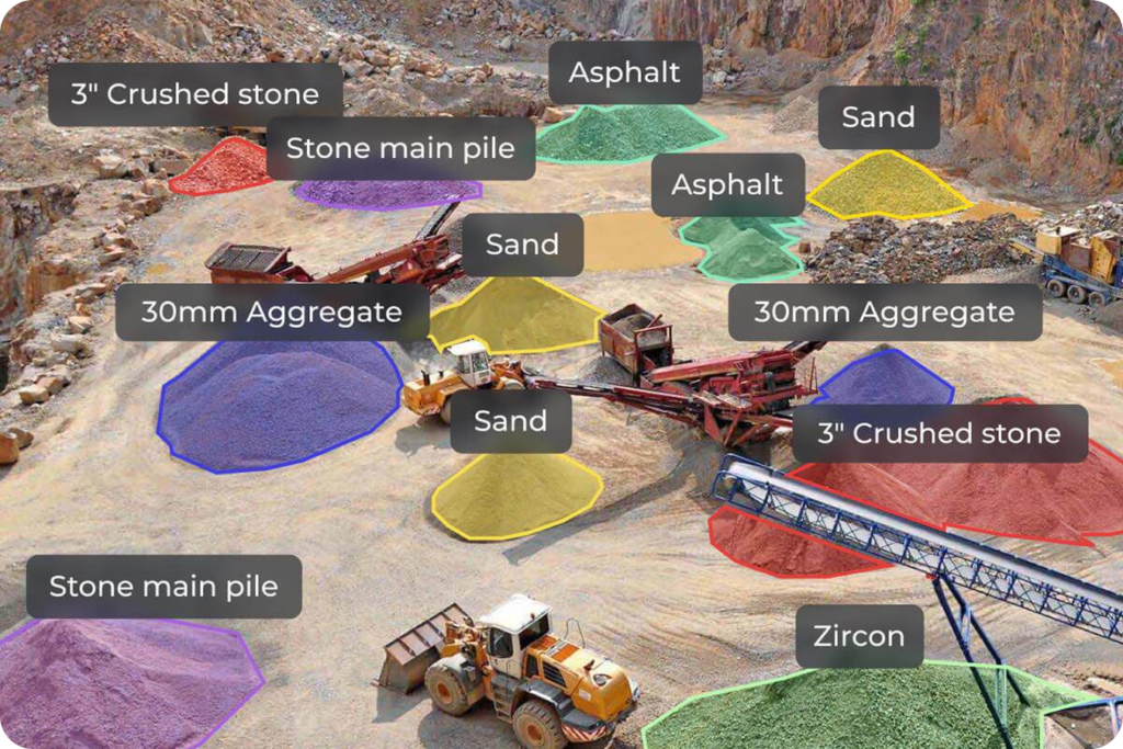
- AI-assisted stockpile detection Automatically identify stockpiles and generate volume calculations in clicks, not hours
- Accurate volume tracking Stockpile volumes with shrinkage and swelling factors for material-specific precision
- Monthly reconciliation Compare volumes between surveys to track what has moved in and out
- Inventory reporting for everyone Generate reports that finance, operations, and sales can all understand. Export to CSV or PDF.
The easy button for site surveys
You run a quarry, not a survey company. Propeller makes it simple to collect accurate data on your own terms.
AeroPoints: drop, fly, done
Self-calibrating ground control that replaces base-and-rover setups. No tripods, no coordinate entry. Accurate ground truth in minutes.

Propeller PPK: no ground control needed
High-precision accuracy using satellite corrections after the flight. Fastest path from drone in the air to data you can trust.
Fly your schedule
Anyone on your team can capture a full site survey in under an hour. Fly weekly, monthly, or the day before a stocktake.
From flight to 3D map in hours
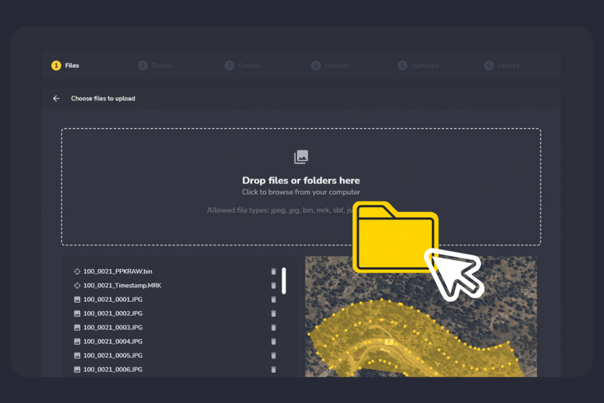
Upload your images, we handle the rest. Done-for-you processing in the cloud. No desktop software, no local servers, no GIS expertise.
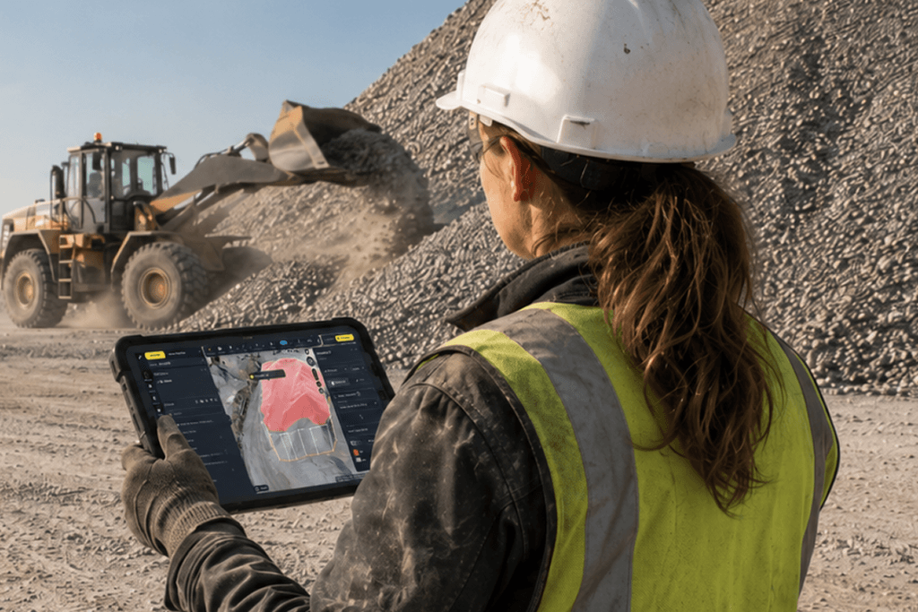
Built for the entire mine

For independent and single-site quarries
Quarry managers, owner-operators, site engineers, plant operators
- Self-sufficiency
Fly when you need to, not when the contractor is available. Get data back in hours, not weeks. No survey department required. - Payback from day one
Replace biannual contractor surveys with on-demand flights. Most quarries see the cost difference within the first quarter. - One platform for everything
Stockpile volumes, pit progress, road checks, and site safety records all live in one 3D map. No more switching between spreadsheets, PDFs, and email chains. - Simple enough for the whole team
Propeller is designed so that the site manager, plant operator, and weighbridge operator can all access the information they need, without GIS training.

For multi-site and enterprise operators
Regional operations directors, finance, HSE, multi-site managers
- Portfolio visibility
Compare production, inventory, and compliance status across every quarry in your network from one platform. Standardise practices across sites with different levels of technical maturity. - Financial confidence
Frequent, accurate stockpile data means tighter month-end forecasting and fewer write-off surprises. Give your finance team numbers they can trust. - Compliance at scale
Centralise environmental, safety, and disturbance records. Clear, visual evidence across every site, ready for internal audit or regulatory inspection. - Rollout without bottlenecks
Propeller is intuitive enough that individual sites can adopt and get value quickly, without waiting for a central IT deployment. Your team at a 3-person quarry can be up and running as fast as your team at a 50-person operation.


“I can easily check what it looks like in the quarry and see how much left there is to mine. During an inventory, I can easily check the stockpiles that are in the area.”
– Jonas Thim, Site Manager, Peab
Your geospatial analysis toolbox
Meet the tools and features behind the map.
Distance
Measure point-to-point distances.
Elevation
Track height changes across various captures or at a specific point.
Elevation difference
Calculate height differences between points.
Cross section
Generate cross section charts of designs and surveys.
Surface area
Measure surface areas within any polygon.
Stockpile
Quickly measure stockpile volumes and create reports.
Shrink/swell calculator
Account for the shrink and swell of soil for more accurate load calculation.
Survey explorer
Combine survey data to plan and review.
Composite builder
Merge multiple survey captures into a single measureable map.
Timeline
Visualize how your site has changed over time, between survey captures.
3D + 2D viewing
Explore a digital twin of your site in 3D or 2D.
Crop and cleanups
Easily crop maps and remove obstructions.
Map layers
Toggle between your terrain model, orthophoto, camera positions, and point cloud.
Base map
Designate any surface as your base map to begin measuring and tracking site activity.
User permissions
Securely share projects and surveys with adjustable access levels.
Workspaces
Easily organize your design and measurement files for quick access.
Custom homepage
Group sites or star favorites for faster access.
Folders
Organize measurements into folders via drag-and-drop.
Read-only public API
Query site and survey data to pull terrain files into CAD and GIS platforms.
Web Map Tile Service (WMTS)
Stream orthophotos from your site directly to your GIS software.
Imports/exports
Import and export surveys, surfaces, and reports.
Flood level
Visualize flood impacts at specific levels.
Surface ruined
Map water flow directions across your site.
Watershed analysis
Identify water catchment areas quickly.
Direct rainfall simulator
Simulate runoff from rainfall events.
Scheduled reports
Automate daily email reports with load/cycle data, a volume heatmap, and a 7-day volume chart.
Media
Pin images and 360 photos to an exact location on the map from the field.
Crew
Share your map via a unique URL on any device.
PDF map
Export plotter-ready map printouts.
Measurement report
Create customizable PDF reports of your site data.
Timelapse
Export progress videos showing site changes over time.
Flythrough
Create dynamic flythrough videos of your site.
Takeoff map
Generate reports comparing surveys with design surfaces.
Markup
Add, style, and share labeled points and freehand scribbles on the map in real-time.
Platform analytics
Monitor Propeller usage across your organization.
Propeller mobile
Visualize your live location against designs, perform critical site checks, and share real-time updates—all from your mobile device.
Utilization view
View utilization data for all DirtMate machines in a table, including run/idle time, load count, and dump count.
Machine location and trails
Identify slow-moving or inactive machines with color-coded trails and real-time location tracking.
Speed analysis
Track average, minimum, and maximum speeds to ensure fleet efficiency.
Smart cycles
Review cycle length, duration, and total cycles for each DirtMate machine.
Point of interest
Drop points on the map and add contextual details.
Hazard
Mark safety hazards and assign severity levels.
Grade check
Assess grades as degrees, percentages, or ratios.
Cut-fill
Compare any two surfaces to track progress or changes in volume over time.
Area progress
Compare site progress against previous surveys or designs.
Material properties
Track materials with tonnage and cost reports.
Surface comparison
Compares surfaces, design-to-design, survey-to-survey, or survey-to-design, to track progress or plan ahead.
DirtMate surfaces
Stream real-time surface data and production volumes on the map.
Platform FAQs
That’s common, and Propeller doesn’t have to replace them overnight. Many of our quarry customers start by supplementing contractor surveys with their own drone flights between formal stocktakes. Over time, most find they can bring the entire workflow in-house, reducing survey costs and increasing frequency. Your existing contractor data can also be uploaded to Propeller for comparison and historical records.
Most quarry teams are flying and processing data within the first week. Propeller’s implementation team handles onboarding, and the platform is designed to be intuitive from day one. You don’t need GIS expertise or specialist training.
We build plans around your site count and usage needs. Contact us for a conversation about what makes sense for your operation.
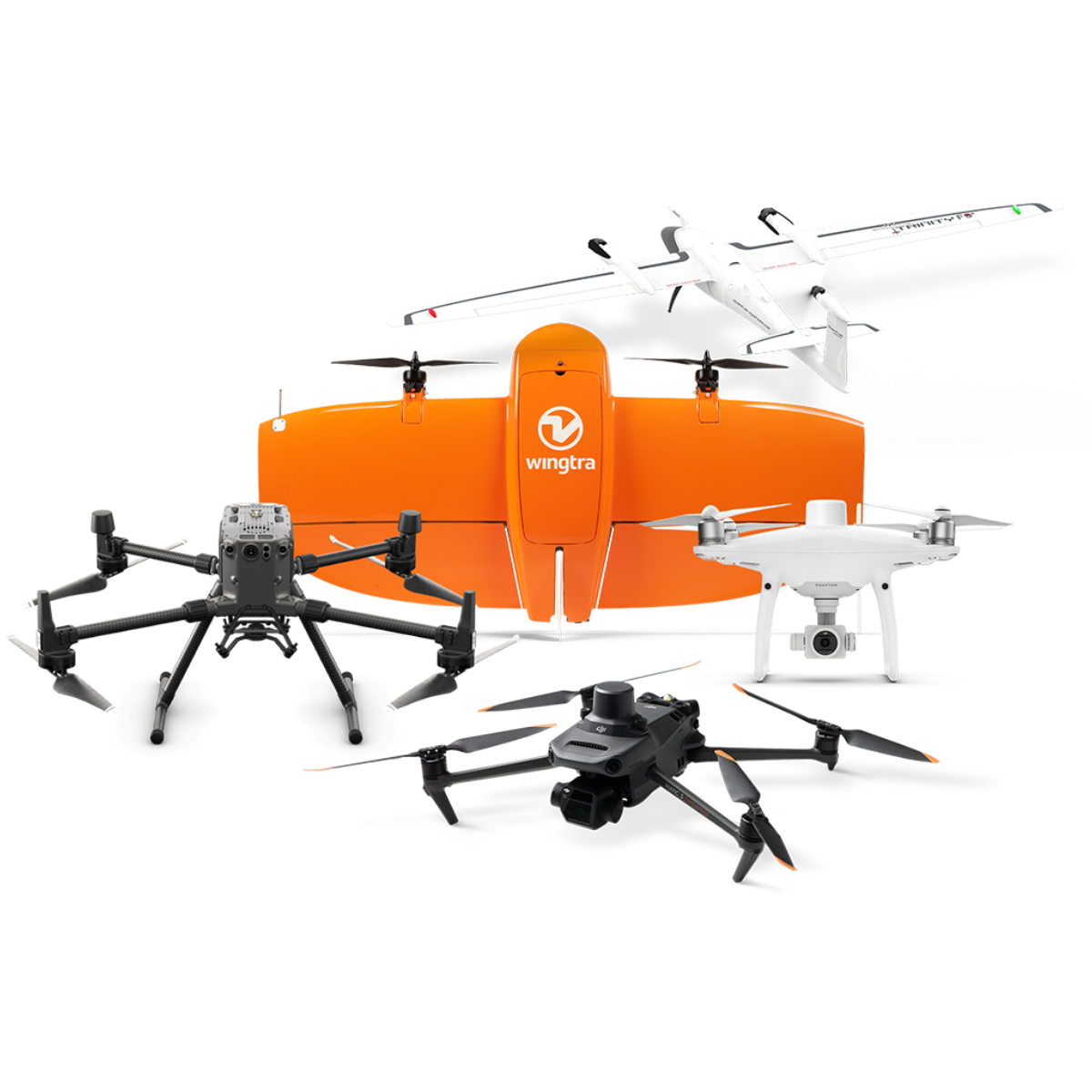
No. Propeller is hardware agnostic. We work with all major drone manufacturers, sensors, and GPS systems. If you already own a drone, it almost certainly works with Propeller. We can also recommend hardware if you’re starting from scratch.
We are hardware agnostic. Upload processed data, point clouds, or TIN surfaces directly. If you have historical surveys from a contractor, those can be imported too.
Yes. Composite Builder merges multiple smaller surveys into a single site map. This is particularly useful for large quarries where you fly different areas on different days.
Yes. Propeller mobile gives field teams high-precision data on the quarry floor.
Yes. Upload point clouds or we can process raw LiDAR scans for you.
Yes. Download in .DXF, .XML, .TTM, and other formats for third-party software.
Yes. Group quarries, customise your homepage, and give regional teams visibility across your portfolio.
Yes. Limit access for contractors while giving your team full permissions. Manage visibility by role, site, or region.
Visit out trust centre to learn more: https://trust.propelleraero.com/
We build a plan that fits your needs. No artificial user limits. Everyone who needs access can have it.