As the decade comes to a close, naturally, we’re feeling introspective. Last January, we set out with audacious company-wide goals to scale outward and evolve the survey workflow beyond the industry standard.
This year we brought in-platform terrain editing to the table, refined the design file experience to help you run a tighter ship, and shortened the path to data visualization for lidar users.
Let’s take a look at some of the features Propeller built for you this year and what they mean for you and your worksite.
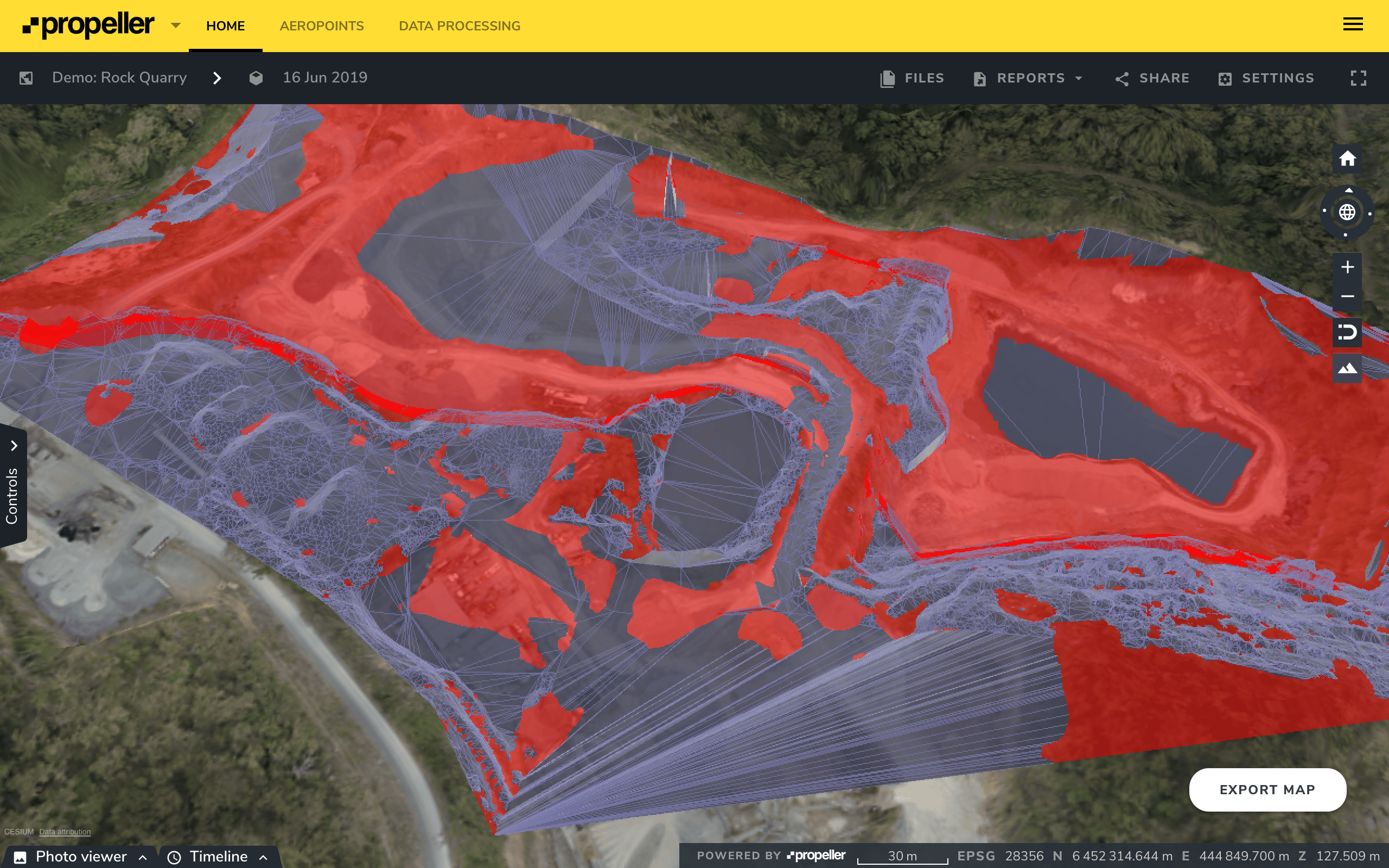
Terrain Editing Capabilities
New tool
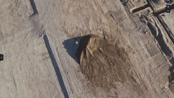
There’s a large number of obstacles on the average worksite. You have your dynamic site features—your vehicles, heavy equipment, and stockpiles. But, sometimes, the physical terrain’s compromising survey data quality and inhibiting site analysis.
The real frustration? There’s no way to control natural barriers, but you need survey data to fuel the earthwork progress tracking that keeps your project running smoothly.
This year we made it possible for you to edit terrain models right from the Propeller Platform, enabling you to strip site visualizations of inaccuracies so there’s nothing standing between you and your aerial data.
Using the Terrain Editing feature, you can remove, patch over, or correct problem areas, whether it be dense vegetation or a bridge over part of your site.
Don’t want your entire team manipulating terrain? No problem. You have total control over who has access to the Terrain Editing feature. You’ll know exactly who made a change, where on the site model, and when.
Want to try out the Terrain Editing feature for yourself? Here are some resources for you:
Point cloud uploads
New tool
We get it. Point clouds are an integral part of many site management workflows. Georeferenced data is your survey superpower, and often, a georeferenced dataset takes the form of a point cloud.
With the Point Cloud Upload feature, you can drag and drop your LAS or zipped LAS (LAZ) files from any source—yes, that includes Pix4D and Revit—right into Propeller.
After that, explore the uploaded point cloud in your browser, using all the features to map, track, and measure what’s happening on site.
For more information about the technical specifics of the Point Cloud Upload feature, try this help article.
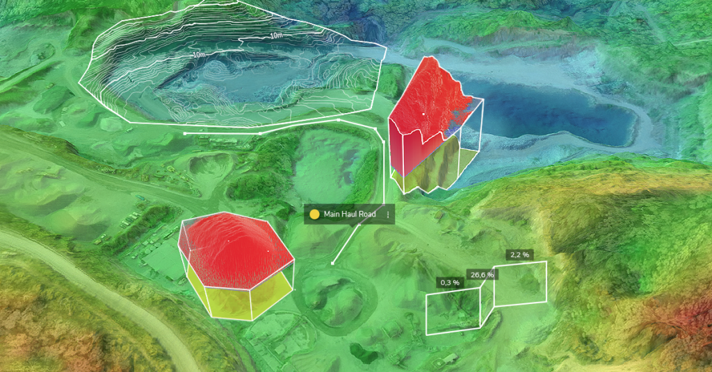
Update to Material Properties
Feature update
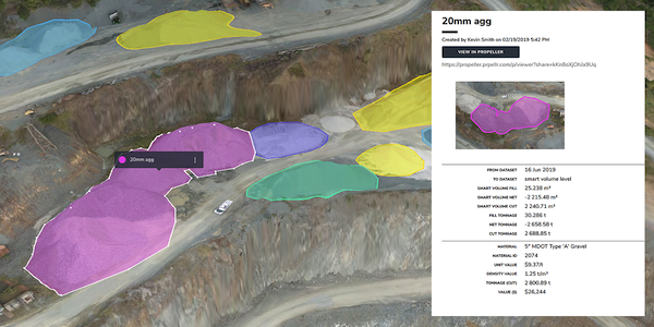
For a quarry or mine, everything is a game of quantities. Your profitability depends on your inventory and how efficient your blasts are. Keeping track of material movement is a top priority.
The Material Properties feature helps you keep a materials stock sheet and create aggregated material reports. Material properties can be added to any volume measurement created with the Polygon Tool.
This tool has existed for a year or so now, but we made a critical update in 2019. Now, we support a complete list of global currencies. Generate quick stock sheets and material reports in your native currency.
If you think stockpile reports may be useful for you, give this step-by-step guide a try,
Design file organization
New feature
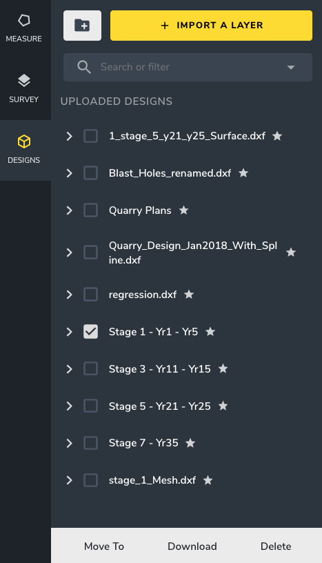
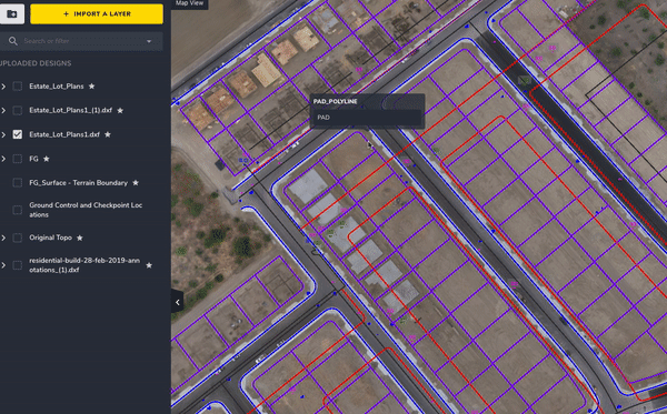
Design files get messy fast. You’re working on multiple projects and each project’s pulling from a handful of designs.
Most of our users upload their design documents into the Propeller Platform to compare them against recent flyover data. It’s the most painless means of progress tracking possible, and a great way to unify what’s happening in the office and what’s happening in the field.
We’ve worked on a way to help you find the files you need faster by keeping your site data organized:Design folders.
Categorize your designs in folders and assign search filters to your files for quick access. Toggle between your folders and reference filters to ensure you’re working from the right file, the first time around.
On top of that, we’ve made some improvements to the speed and performance of the DXF workflow. You can expect a more reliable, more responsive design file experience on all fronts.
Bulk convert to measurement
New feature
If you’re working with intricate linework for, let’s say, a road job, converting individual design or linework elements into measurements one-by-one becomes becomes painfully tedious.
To combat this annoyance and save some in-platform time, we added a little something extra to the design file workflow.
If you need to create cross-sections or make changes to your road alignment, select all the elements you need to quantify and convert those selections to measurements at the same time.
And then when you need to make the same measurement again, simply pull up the converted measurements and apply to the same area on your new dataset.
PDF Map Exports
New tool
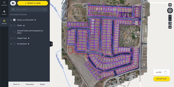
We saved the best (or the one we’re most excited about) for last. Say hello to the new and extremely useful PDF Map Export tool.
Although we consider use-friendliness one of the Propeller Platform’s strengths, it still requires initial training and it easiest with a moderate level of technical know-how.
The thing is, even though not everyone on your site is trained to use Propeller, every last person can benefit from the objective, bird’s-eye perspective that a site map presents. So, how do we make that holistic view accessible to everyone who needs it?
The answer: PDF map exports, also known as the connective tissue between two disjointed teams—your team in the office and your team in the field.
These PDF maps are easy to create and easy to use, requiring no training or self-learning. Just a few clicks and you have up-to-date data in your hands.
What’s next for Propeller?
There’s some really exciting things to the horizon for Propeller that’ll make your life (and your team’s life) considerably easier on the worksite.
We’ve dreamt up a worksite ecosystem where everyone has the data they need on hand, surveyors can collect site data quickly, without sacrificing accuracy, and all surveys are processed reliably every single time.
We want you to stop worrying about the data collection and the processing and refocus your energy toward the more important things—running a connected, accident-free worksite and getting projects done on-budget, on-time.
Stay tuned for product news and all other Propeller announcements, as we dive head-first into 2020!


