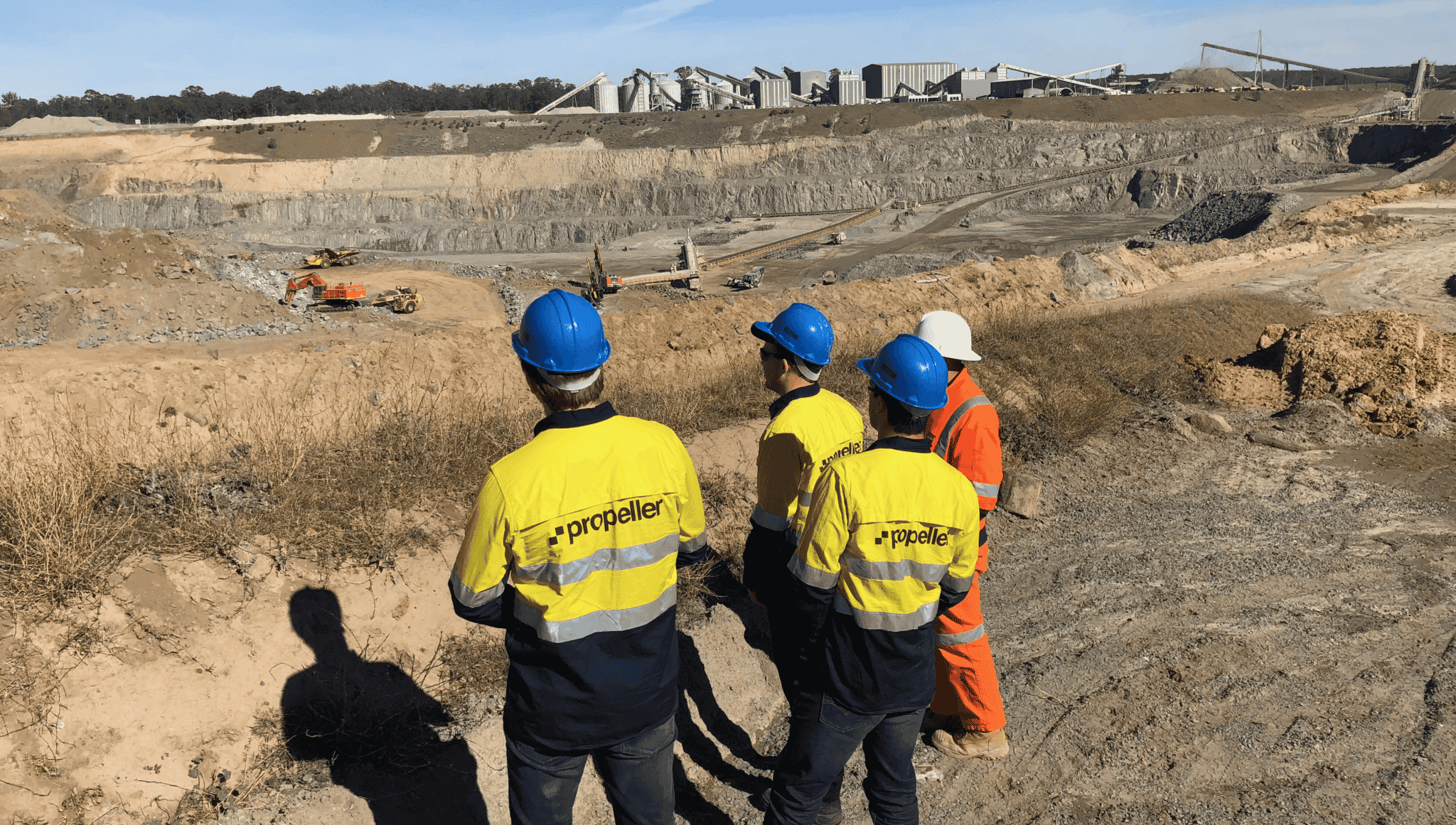
Since our inception, Propeller has taken a customer-first approach to product development. No one knows how to improve Propeller’s drone technology and worksite management solutions better than the people with first-hand experience using them out in the field.
Over the years, we’ve continually introduced new features to the Propeller Platform, improvements to our PPK workflow, and upgrades to our hardware that were inspired—and often, explicitly requested—during conversations with our customers.
Below, you can check out everything we’ve been up to over the past several months, from new Propeller Platform add-ons and features to improvements to our measurements and reporting.
Crew: Use mobile maps to improve communication between the office and worksite.
In just a few clicks, you can generate a 2D map of your site with only details you want to include (think linework, cut/fill remainders, design specs). The Propeller Platform supplies you with a one-off link, which redirects users to the browser-based map, that you can share however you see fit.
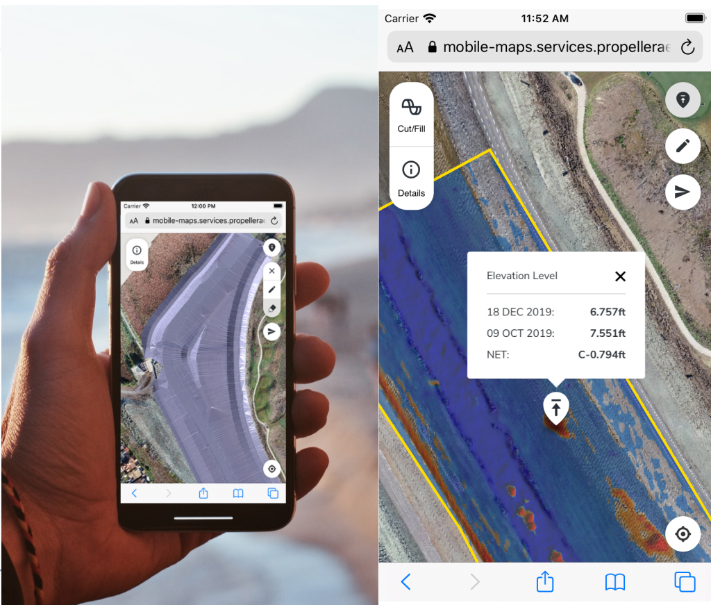
Crew was designed to help you provide the best visual information possible to your own crews so they can execute projects with greater confidence and with less chance of miswork. With Crew-generated maps, mobile users can:
- Spot check cut/fill elevations from anywhere on the job
- Monitor earthworks progress and check design conformance
- Identify subsurface utilities in the field to reduce strike rates
- Communicate with others in real-time with map drawings and annotations
See how Crew’s mobile maps work in the video below, then check out our Crew case study to see how it’s being used in the field right now!

Improvements to measurement calculation speed and accuracy
We know that time is money on jobsites. Every second your teams are left waiting for mission-critical information costs you in hard dollars.
That’s why getting our customers the measurements and insights they need faster—without sacrificing survey accuracy—is a mission that never stops for us. After all, accurate, cost-saving drone surveys that improve project efficiency are the heart of our business.
Recently, we made several changes that improved the performance of the Propeller Platform. Here’s a quick rundown:
Faster performance on every device
Measurements are calculated in the cloud now, not in your computer’s browser. That means faster measurement calculations on any device, including older and less powerful computers.
Less dependence on your local internet speed
Because measurements are calculated in the cloud, performance is likely to improve when working with a slow or intermittent internet connection.
Greater accuracy, particularly for large measurements
Our new sampling algorithm increases the sampling density. The impact of this is most noticeable when making volume measurements across large areas or with high levels of small terrain detail.
More consistency between measurements created in Propeller and exported as DEM surfaces
We synchronize the surfaces that are used to create measurements within the Propeller Platform with the TIN surfaces that can be exported out of Propeller. The result is increased consistency between measurements created in the Platform and those created from exported DXF or TTM surfaces using other packages.
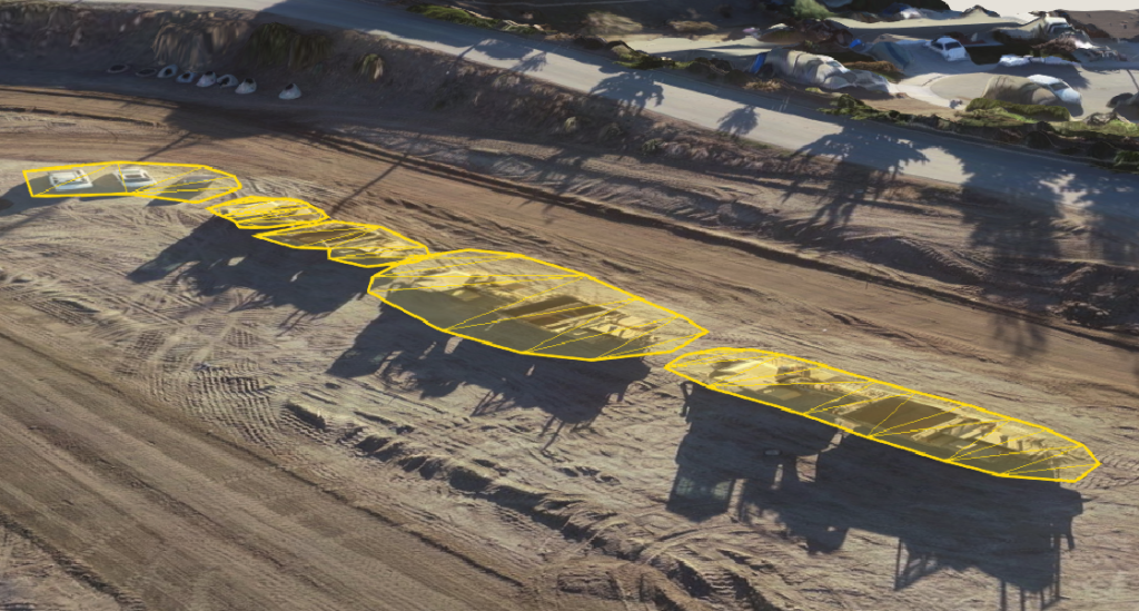
Stockpile Reports for easier inventory management
Keeping track of stockpile volumes is critical for mining and aggregate operations, as well as any earthwork projects that require stocked material. Photogrammetric drone surveying is a particularly effective method of calculating stockpile volumes, since aerial images can capture angles that you can’t get from the ground.
To help our customers take greater advantage of our superior stockpile measurement capabilities, we’ve improved the Propeller Platform’s Stockpile Reports feature.
In just a few clicks, you can generate a report with information on all your stockpiles, including material type, volume, density, and value. Depending on who you’re generating the report for, you choose what data to include. That means more focused, streamlined reports that your teams can use more efficiently. With Stockpile Reports, you can:
- Export reports CSVs for easy integration with other reporting software
- Improve financial forecasting, resource planning, and supply chain management
- Empower anyone in your organization to seamlessly create their own reports
- Reconcile actual and reported quantities of material with greater accuracy
Check out a quick demo of our Stockpile Reports:
Vertical Design Offset for planning against subgrade surfaces
Since earthwork projects are typically completed in phases, a final grade surface is rarely the only surface construction managers need to measure progress against. Our customers have long requested the ability to compare their drone surveys to multiple surfaces at once—so we listened.
With the Propeller Platform’s Vertical Design Offset feature, users can create a subgrade right in the platform. This removes the need to edit surface models in an external CAD package, export them, and import them into Propeller, accelerating progress tracking workflows.
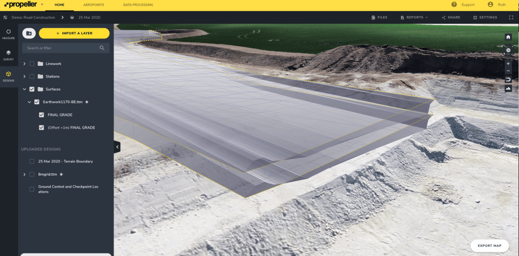
It also means no more costly updates for organizations that outsource their model building. Even adding a small offset can cost on average $500. Add to that the time lost communicating your desired offset and waiting for it to be applied. Now, anyone with basic training in the Propeller Platform can adjust the design themselves.
Improved Terrain Cleanup workflows for more convenient measurement workflows
Features like vehicles and machinery, when captured in your drone survey, can create distortions in your measurements and make it difficult to cleanly measure earthwork progress.
With the Propeller Platform’s Terrain Cleanups feature, removing an unwanted object and patching over holes in your survey is as simple as drawing a boundary around it with your mouse.
We recently updated Terrain Cleanups to allow users to temporarily remove objects, rather than delete them from site models completely. This is particularly helpful if you want to measure a stockpile and then remove it from your survey so you can capture the bare-earth elevation underneath.
Find out all about the Propeller Platform’s Terrain Cleanups and Smart Filtering capabilities.
Grant anyone Platform access with View-only permission levels
Our customers want to take advantage of the Propeller Platform’s worksite measurement and progress tracking powers in every corner of their organization. That means granting portal access to more people. But anyone who’s dealt with enterprise-class software before will tell you how quickly that can get out of hand, creating privacy and data integrity concerns.
With our new View-only permission level, you can get anyone, including clients and other project stakeholders, access to the Propeller Platform. In View-only, users can view and interact with your 3D worksite models, but they can’t:
- Create, share, or export measurement
- Generate and export and kind of report
- View sensitive information, like volume measurements or designs
Not only does this let you safely share worksite maps with people outside your organization—it also gives you the ability to share streamlined Platform views with personnel who don’t need to be bogged down in extraneous tools and features.
Check out our full announcement on the Propeller Platform’s View-only access
Point cloud uploads are now accepted by the Propeller Platform
Propeller now accepts the upload of point clouds in a LAS or zipped LAZ format. This unlocks the Propeller Platform for worksites using lidar technology to capture site data as a point cloud.
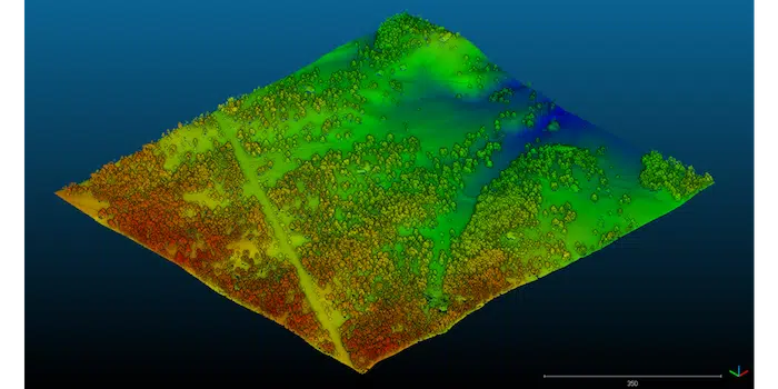
You can now easily convert a point cloud into a 3D terrain, which can be measured, analyzed, and shared with your on-site teams in the same way you use terrain generated by photogrammetric surveys. We’ve made it easy to:
- Drag and drop preprocessed LAS and LAZ files from any source (e.g. Pix4D or Revit)
- View the uploaded point cloud or newly created DEM surface in your browser
- Easily reduce the size of large, unmanageable point cloud files with our Crop to TTM or DXF feature.
Small (but mighty) Propeller Platform updates
View cross sections in 1:1 aspect ratio
Cross-sections you create in the Propeller Platform can now be viewed as a true representation of the measured surface, provided by a vertical and horizontal scale.
Using our cross-section comparison tool, you can visualize cross-sections in 1:1 scale of the cross-section axis. This is particularly useful when creating roadway cross-sections or conducting bench analysis as part of in-pit operations.
Search by material type when comparing volumes
When using the Propeller Platform’s Volume Compare tool to calculate the difference between survey data and a design surface, you can now search a list of your uploaded design surfaces available for comparison to quickly locate the right file.
The search functionality is also available when using Cross-Section and Elevation History measurement types.
Offset points when using custom base volume
When using the Custom Base Volume and Terrain Editing tools, you can now offset a selection of points at the same time, rather than having to individually adjust the elevation of each point.
This is a huge time-saver when making complex stockpile measurements which require changes to the base of the volume.


