Handheld scanning
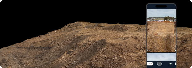
Capture fast, without flying
Fast capture. One workflow. A more current site record.
Beta spots filled faster than expected — the program is now closed. Register your interest below and be the first to know when Handheld Scanning launches
The problem
Some site decisions can’t wait for the next flight.
Trenches before backfill, indoor or covered stockpiles, under-canopy areas, tight corners, vertical faces. The work keeps moving, but the record can lag behind.
The solution
Capture those moments on demand.
Handheld scanning gives teams a practical way to capture site moments without waiting for the next drone flight. Anyone already on site can use the Propeller mobile app to capture a 3D scan, upload it from the field, and have it processed by Propeller and viewable in the platform alongside the rest of your site data.
Handheld scanning: capture fast, connected to Propeller
Keep site context moving with the work.
Capture feature-level scans from the field and keep them connected to the same map your team already uses.
01
Capture fast between flights.
- Capture trenches and excavations before backfill
- Capture indoor, covered, and under-canopy stockpiles when flying isn’t practical
- Capture tight-access zones near structures, canopy, or active equipment
- Add ground-level context whenever decisions can’t wait for the next flight
02
No extra hardware or separate tools.
- Scan with a phone or tablet your team already has
- Capture, upload, process, view: end-to-end in Propeller
- No desktop upload, no third-party file juggling, no “where does this live?” confusion
03
Keep the site record current, on demand.
- Add proof as the work happens, not days later
- Reduce the wait-and-wonder gap between updates
- Keep field and office aligned around the same map and the same truth
04
A workflow your teams already understand.
- Uploads run through Propeller’s existing processing pipeline
- Results land on the same site in Viz alongside drone surveys
- The office can review without another trip to site
05
Built for practical, everyday capture.
- Complements drone capture: it doesn’t replace it for site-wide topo
- Best for feature-level scans: trenches, stockpiles, structure detail, small faces
- Not for utilities mapping as a utility locating workflow
Beta
Capture now. Connect it to Propeller.
Give your team a faster way to document feature-level site conditions and keep the record moving with the work.
Reasons to use handheld scanning
More proof, less waiting.
Capture the small-but-critical moments that move decisions forward.
01
Faster decisions, backed by proof.
Answer everyday site questions in hours, not days, with visual evidence your whole team can reference.
02
Less rework and fewer surprises.
Capture critical before-it’s-covered moments, like pre-backfill as-builts, so issues surface earlier.
03
A more connected view of site reality.
More capture moments from more people means a clearer, more current operational picture across the job.
How it works
From quick scan to shared site record.
Step 01
Scan as you go.
Open Propeller, start a handheld scan, and simply walk the area. The app guides you to cover what you need.
Step 02
Propeller builds the model.
Your capture is processed into a clean, measurable 3D surface, aligned to your site so it’s ready to use.
Step 03
Measure, share, and track progress.
Drop points, measure distances, areas, and volumes, compare changes over time, and share results with your team or stakeholders in a link.
Handheld scanning now in beta
Capture the moments your next flight might miss.
Sign up for the beta and help your team capture fast, keep the site record current, and bring more proof into Propeller.
Handheld scanning now in beta
Capture fast, without flying
Fast capture. One workflow. A more current site record.
Sign up for the beta
The problem
Some site decisions can’t wait for the next flight.
Trenches before backfill, indoor or covered stockpiles, under-canopy areas, tight corners, vertical faces. The work keeps moving, but the record can lag behind.
The solution
Capture those moments on demand.
Handheld scanning gives teams a practical way to capture site moments without waiting for the next drone flight. Anyone already on site can use the Propeller mobile app to capture a 3D scan, upload it from the field, and have it processed by Propeller and viewable in the platform alongside the rest of your site data.
Handheld scanning: capture fast, connected to Propeller
Keep site context moving with the work.
Capture feature-level scans from the field and keep them connected to the same map your team already uses.
01
Capture fast between flights.
- Capture trenches and excavations before backfill
- Capture indoor, covered, and under-canopy stockpiles when flying isn’t practical
- Capture tight-access zones near structures, canopy, or active equipment
- Add ground-level context whenever decisions can’t wait for the next flight
02
No extra hardware or separate tools.
- Scan with a phone or tablet your team already has
- Capture, upload, process, view: end-to-end in Propeller
- No desktop upload, no third-party file juggling, no “where does this live?” confusion
03
Keep the site record current, on demand.
- Add proof as the work happens, not days later
- Reduce the wait-and-wonder gap between updates
- Keep field and office aligned around the same map and the same truth
04
A workflow your teams already understand.
- Uploads run through Propeller’s existing processing pipeline
- Results land on the same site in Viz alongside drone surveys
- The office can review without another trip to site
05
Built for practical, everyday capture.
- Complements drone capture: it doesn’t replace it for site-wide topo
- Best for feature-level scans: trenches, stockpiles, structure detail, small faces
- Not for utilities mapping as a utility locating workflow
Beta
Capture now. Connect it to Propeller.
Give your team a faster way to document feature-level site conditions and keep the record moving with the work.
Reasons to use handheld scanning
More proof, less waiting.
Capture the small-but-critical moments that move decisions forward.
01
Faster decisions, backed by proof.
Answer everyday site questions in hours, not days, with visual evidence your whole team can reference.
02
Less rework and fewer surprises.
Capture critical before-it’s-covered moments, like pre-backfill as-builts, so issues surface earlier.
03
A more connected view of site reality.
More capture moments from more people means a clearer, more current operational picture across the job.
How it works
From quick scan to shared site record.
Step 01
Scan as you go.
Open Propeller, start a handheld scan, and simply walk the area. The app guides you to cover what you need.
Step 02
Propeller builds the model.
Your capture is processed into a clean, measurable 3D surface, aligned to your site so it’s ready to use.
Step 03
Measure, share, and track progress.
Drop points, measure distances, areas, and volumes, compare changes over time, and share results with your team or stakeholders in a link.
Handheld scanning now in closed beta