Propeller CAD
Now you can CAD with AI, right on your real survey data
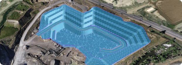
From idea to concept, in minutes
Describe an earthwork idea in any language and shape it into a workable concept, right on your real survey data. Iterate in minutes, then export when you’re ready, all inside Propeller.
Beta spots filled faster than expected and the program is now closed.
Register your interest below and be the first to know when Propeller CAD launches
The blank screen is the hard part
Getting from a rough idea to something you can actually look at and react to takes time, and until it exists, the team has nothing to align around.
Propeller CAD gets a first pass on the screen fast and in context, so the conversation can start.
What we’ve built
Earthwork concepts, right on your survey data
Propeller CAD is built so you can quickly mock, iterate, and concept whenever you need. Describe or sketch a road, ramp, pad, drainage or any concept in plain language, and see it take shape on your real survey data, in the right coordinate system. Start with the context you need, rather than a blank screen.
What you can do with Propeller CAD today
Move from idea to workable concept in minutes
Start with plain language, work on real survey data, and keep refining until the concept is ready for the next step.
01
Describe it in any language
Sketch or type your idea and watch it take shape as a 3D concept.
02
See it on your real survey data
Your first pass is grounded in what’s actually on site.
03
Iterate in the moment
Adjust grades, dimensions, and tie-ins as things change, without starting over.
04
Build in your own rules
Upload your specs or design rules and Propeller CAD works to them.
05
Save and revisit
Keep concepts in your Propeller site list to come back to anytime.
06
Export when you’re ready
Hand off as DXF or TTM when you need it.
What teams are concepting
From simple site access to complex earthworks
Start with an idea, shape it directly on your survey, and explore a workable concept before committing time to detailed design.
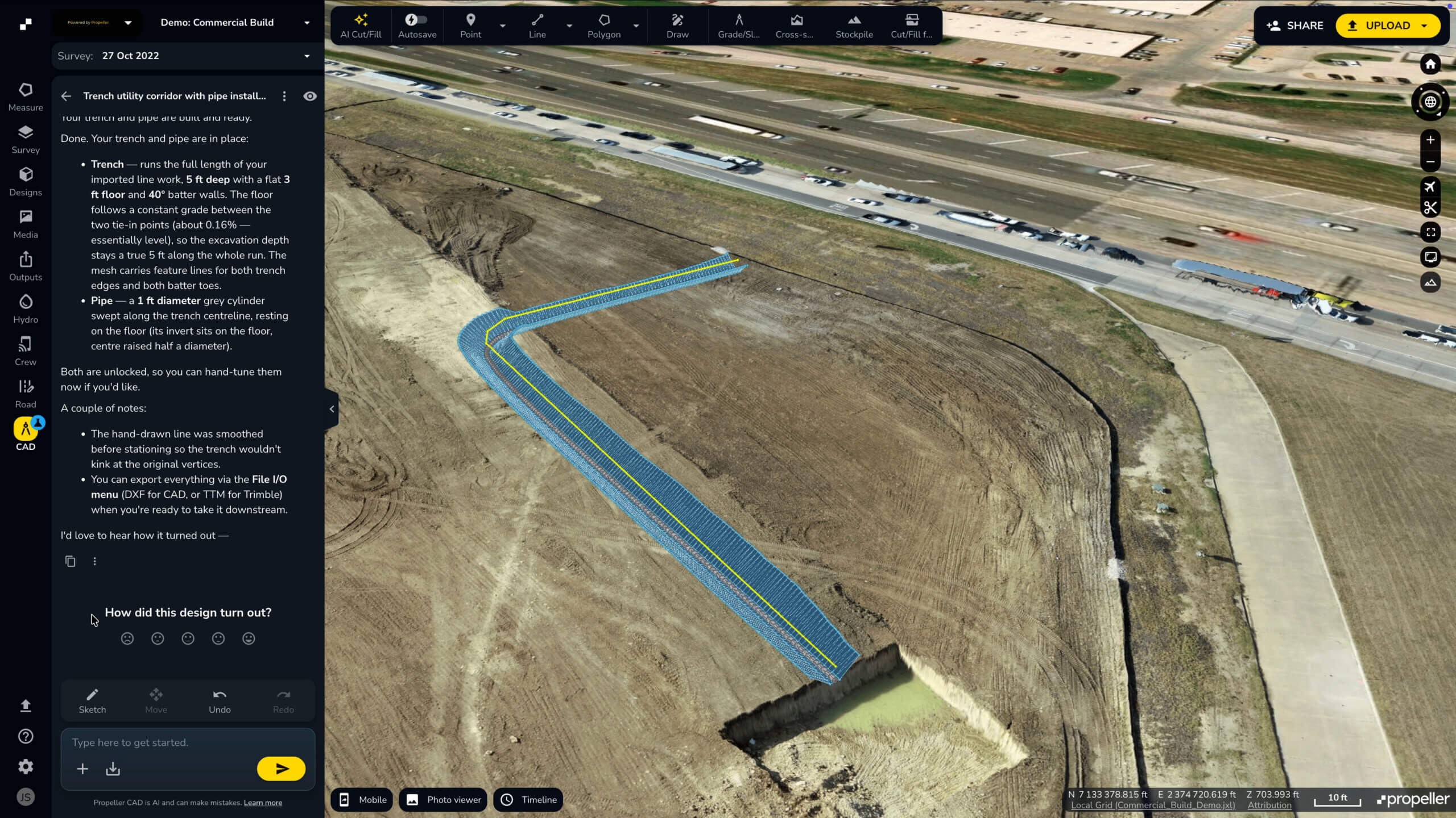
Trench to drainage point
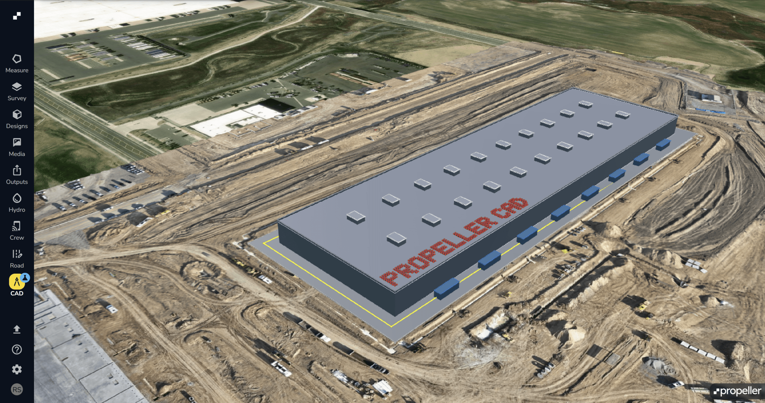
Data center
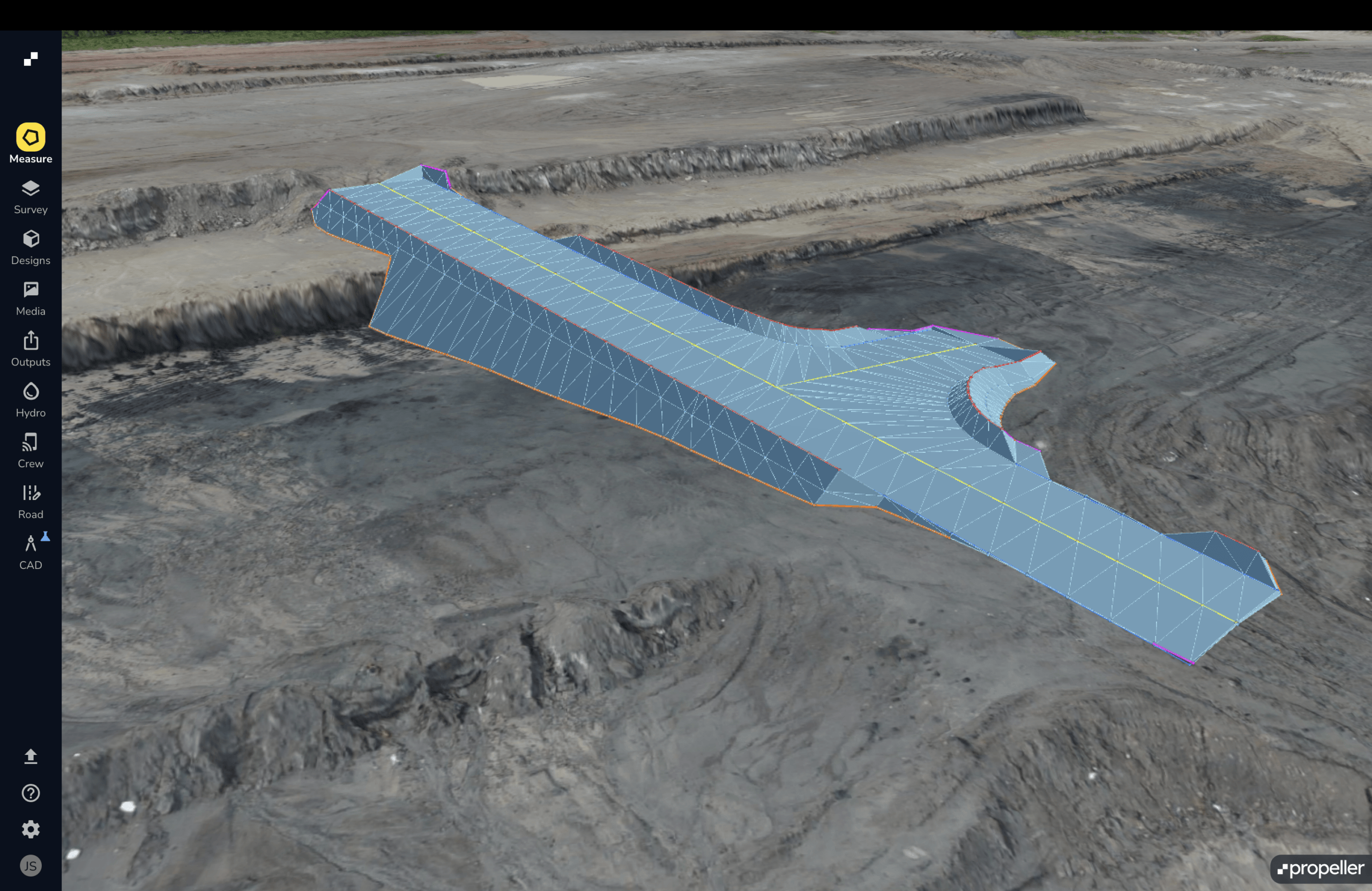
Ramp
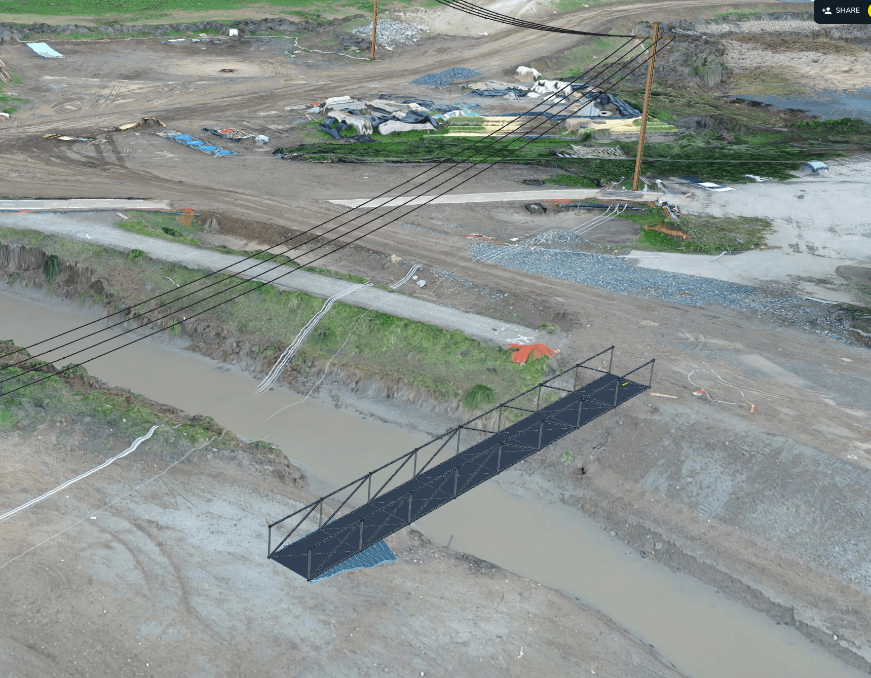
Bridge
What teams are using it for
We’re still learning what people do with it, and that’s part of the point
So far we’ve seen it used for quick concept designs, temporary works, feasibility studies (weighing a couple of options before committing), and communicating a change on site. Your imagination is the limit and this beta program is to test those limits on the platform.
Propeller CAD gives you a concept to work from, and the quality of what you create depends on your inputs and your judgment, just like any design tool. Engineer sign-off stays with a qualified professional, and whether your project needs it is up to you.
How it works
From rough idea to shareable concept.
Step 1
Describe and sketch your idea
A haul road, a pad, a ramp. Describe it in any language, or sketch it, and Propeller CAD generates a 3D concept on your real survey data.
Step 2
Refine and adjust
Tweak grades, dimensions, and tie-ins interactively until the concept fits your site.
Step 3
Export and share
When you’re happy, export as DXF or TTM to take into your next steps.
Propeller CAD is now in beta
Beta spots filled faster than expected and the program is now closed.
Register your interest below and be the first to know when Propeller CAD launches
Propeller CAD
Now you can CAD with AI, right on your real survey data
From idea to concept, in minutes
Describe an earthwork idea in any language and shape it into a workable concept, right on your real survey data. Iterate in minutes, then export when you’re ready, all inside Propeller.
Beta spots filled faster than expected and the program is now closed.
Register your interest below and be the first to know when Propeller CAD launches
The blank screen is the hard part
Getting from a rough idea to something you can actually look at and react to takes time, and until it exists, the team has nothing to align around.
Propeller CAD gets a first pass on the screen fast and in context, so the conversation can start.
What we’ve built
Earthwork concepts, right on your survey data
Propeller CAD is built so you can quickly mock, iterate, and concept whenever you need. Describe or sketch a road, ramp, pad, drainage or any concept in plain language, and see it take shape on your real survey data, in the right coordinate system. Start with the context you need, rather than a blank screen.
What you can do with Propeller CAD today
Move from idea to workable concept in minutes
Start with plain language, work on real survey data, and keep refining until the concept is ready for the next step.
01
Describe it in any language
Sketch or type your idea and watch it take shape as a 3D concept.
02
See it on your real survey data
Your first pass is grounded in what’s actually on site.
03
Iterate in the moment
Adjust grades, dimensions, and tie-ins as things change, without starting over.
04
Build in your own rules
Upload your specs or design rules and Propeller CAD works to them.
05
Save and revisit
Keep concepts in your Propeller site list to come back to anytime.
06
Export when you’re ready
Hand off as DXF or TTM when you need it.
What teams are concepting
From simple site access to complex earthworks
Start with an idea, shape it directly on your survey, and explore a workable concept before committing time to detailed design.
Trench to drainage point
Turn a plain-language request into a connected trench concept that follows the real site surface.
Data centre
Test the position, scale, access, and surrounding earthworks of a proposed facility directly on current survey data.
Ramp
Quickly shape temporary or permanent ramps around existing terrain, benches, and excavations.
Bridge
Place an early bridge concept over the real site to help teams discuss access, alignment, and feasibility.
What teams are using it for
We’re still learning what people do with it, and that’s part of the point
So far we’ve seen it used for quick concept designs, temporary works, feasibility studies (weighing a couple of options before committing), and communicating a change on site. Your imagination is the limit and this beta program is to test those limits on the platform.
Propeller CAD gives you a concept to work from, and the quality of what you create depends on your inputs and your judgment, just like any design tool. Engineer sign-off stays with a qualified professional, and whether your project needs it is up to you.
How it works
From rough idea to shareable concept.
Step 1
Describe and sketch your idea
A haul road, a pad, a ramp. Describe it in any language, or sketch it, and Propeller CAD generates a 3D concept on your real survey data.
Step 2
Refine and adjust
Tweak grades, dimensions, and tie-ins interactively until the concept fits your site.
Step 3
Export and share
When you’re happy, export as DXF or TTM to take into your next steps.
Propeller CAD is now in beta