As 2021 draws to a close, publicly-traded aggregate companies will soon begin their reconciliation process so they can publish their rock inventory assets at the end of the year. Many companies run this calculation on a monthly basis to obtain accurate information on their stockpile tonnage so they can fulfill work orders and remain financially solvent.
But too often large inventory write-offs at the end of the year have been par for the course because of inaccurate monthly stockpile surveying. Either companies don’t possess the material amount they thought they had, or they have to adjust for a discrepancy associated with having too much material. Both of these can mean big dollars to a business when it comes to having a precise handle on total material volume.
For example, if a company is off by 10,000 tons of material on one site, and they carry that average discrepancy across several sites, it becomes very expensive, very quick at $6 to $7 per ton. Even when outrageously high, these write-offs are unfortunately accepted as a cost of doing business.
Time and budget constraints of traditional stockpile surveying
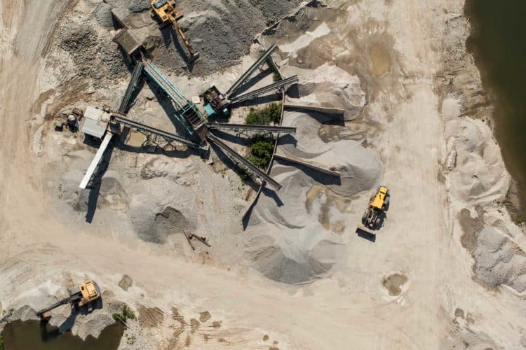
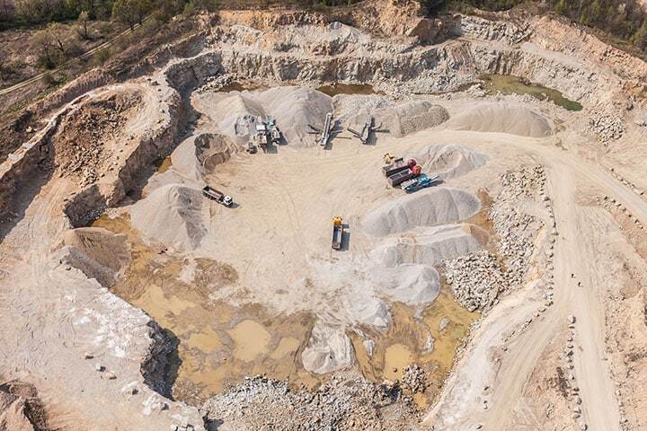
With traditional methods, a quarry or other aggregate site is surveyed by plane in an aerial flyover every six months, and conventional stockpile reconciliation can take several days of work. Typically, a site manager will make a best guess on stockpile volumes using the numbers from the last aerial flyover and from subcontractors who are moving material. Or they may measure the base of a stockpile and estimate the height. With some simple math, they obtain a very rough estimate of the total volume. But with so much speculation and out-of-date information, inaccurate volume data at the end of the year is not surprising.
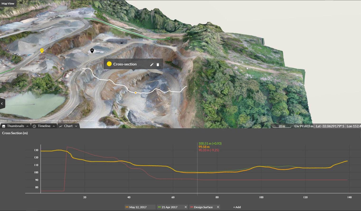
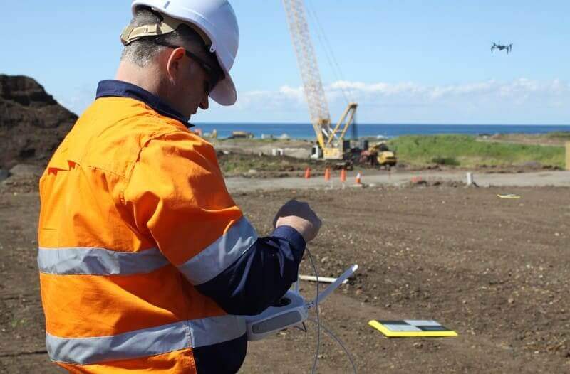
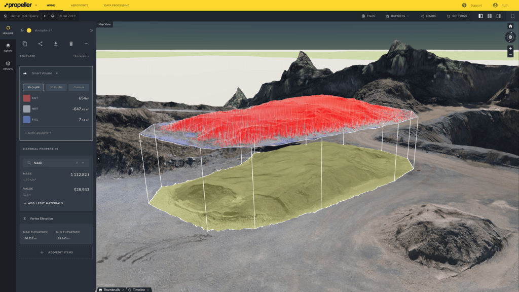
However, by using drones and the Propeller Platform, you can survey your own stockpile volumes more often and with greater accuracy so you can adjust your inventory calculations each month to help mitigate these large discrepancies.
Since drone surveying is significantly faster and easier to do, you can get updated information on your stockpiles as often as you want to fly. Multiple 3D site surveys over time provide a visual timeline of changes and with it you can track progress and productivity, which helps prepare for an accurate end of year stockpile reconciliation.
More accurate year-end stockpile reconciliations with Propeller
Visualization software and drone-captured data goes beyond better numbers. It’s raising the bar on workflows, including reconciliations, by allowing you to measure and manage your site yourself. Additionally, having drone imagery coupled with good ground control and a processing platform like Propeller makes understanding your site data accessible for everyone at your company. The data is so precise that large audit firms even accept it when conducting their reviews.
Drones are less costly and easier to use than traditional surveying equipment—and more accurate than eyeballing stockpile volumes. They put the power of frequent surveying in your hands. And having accurate stockpile numbers every month means greatly reducing future write-offs, saving money and boosting efficiency.