Over the past several years, drones have literally been changing the landscape of earthworks surveying workflows. They provide highly accurate site data and require less time and cost than traditional survey methods. But when it comes to actually launching a drone program on their worksite, many surveyors hesitate, worrying that the process will be too difficult or complex to pay real dividends.
Kicking off any new program can feel overwhelming at first, with so much new information to absorb and so many decisions to make. Drone surveying is no exception—but it’s not as difficult as you may think. In fact, starting a drone surveying program on your worksite is relatively quick and easy, provided you’re equipped with the correct information from the beginning.
Here, we’ll tackle your most common fears head-on, and by the end, we’ll answer the fundamental question: “Is drone surveying difficult to learn and do?”
(Spoiler alert: the answer is no. It just takes a bit of research and planning to get the details right.)
Licensing: a peek behind the curtain
The first step to implementing a drone surveying program on your worksite is to get your pilot(s) up to speed on local airspace regulations and certify their knowledge with a license. You may ask why this is necessary, but it’s important to remember that drones are technically a type of aircraft subject to regulation. They navigate airspace that is shared by manned aircraft, so drone pilots must earn special licensing through a country’s aviation authority before they can fly.
Each country has unique requirements, so do your research and make sure you understand the laws applicable to your worksite. Most often, pilots must understand aeronautical charts, weight restrictions, and weather conditions that could make a flight hazardous.
That may sound like a lot, but earning a commercial drone pilot license is faster and easier than you might think. Here you can read more about the specifics of the test and how long it takes to earn a Part 107 license.

How to fly a drone for surveying
Once you’ve met all the necessary regulatory requirements, you’ll need to select the drone that best suits your needs—and then learn to fly it.
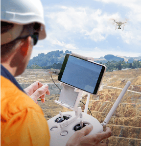
Multicopters, fixed-wing, and VTOL (Vertical Take Off and Landing) drones all have their pros and cons, but for ease of use, multicopters like the Phantom 4 RTK are an ideal entry-level option. Regardless of complexity, drones are generally operated with a remote controller that resembles a component that’s part of a video gaming system.
Except, unlike a video game, the drone flight itself can be almost entirely automated. Apps like GS Pro take all the guesswork out of flying—and, they’re free. Just spend a couple of minutes setting up your drone’s flight path based on the area and features you want to survey, and then hit “Go.” There’s no manual control involved, unless you choose to actively fly.
We recommend automated flight wherever possible, regardless of skill, because steady, consistent flight is so important for producing high-quality photo images. With low-quality images, your data won’t be as accurate, and no one wants that. Automated flights remove the burden of manual control from the pilot and, at the same time, improve survey quality.
Other factors to consider
Now that you’re licensed and have mastered the basic operation of your drone, you’re nearly there! You only have to consider a few other factors before you take flight.
- Light and weather conditions: Is your worksite located in a temperate zone with light winds and pleasant weather, or do you frequently experience adverse weather conditions like high winds, rain, or even snow? The answer will impact how and when you choose to fly your site, so keep an eye on the sky when it’s survey time.
- Obstacles on-site: Your drone can usually detect obstacles in the terrain, like hills, buildings, or trees. However, areas with dense foliage can impact your survey quality. Learn about the best tools for your worksite if you’re in a heavily wooded or crowded urban area.
- Connectivity: The final consideration is whether you’ll be flying in a remote area with patchy WiFi or cell signal, or if it will be easy to keep your drone connected at all times. You may have heard about the choice between RTK and PPK workflows. However, with either one, good connectivity is essential. RTK (real-time kinematic) workflows require a constant connection between the drone and a base station, so remote sites or worksites with lots of obstacles like trees or hills may struggle to use RTK. Fortunately, there’s an alternative. Propeller PPK (post-processing kinematic) does not require your drone to remain in touch with a base during flight, because all the data is processed post-flight.
Which leads to the final step—getting the flight data back in an actionable form.
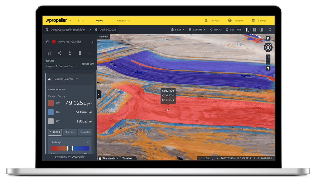
Propeller takes processing off your plate
Flying your drone is only part of the process. Post-flight, there’s one final step: data processing.
Many companies new to drones worry that they’ll spend hours (or even days) processing thousands or millions of data points into a usable format from data they collect from a drone survey flight, but fear not—we’ve got you covered. If you use the Propeller Platform, we will process all your flight data within 24 hours, allowing you to track progress, render accurate measurements, and generate a 3D site map within a day of your flight. No extra data work or even a software downloads required.


