Demand for 3D mapping and modeling is booming, with a projected 300% increase by 2032. This is great news for small contractors — with so much evolution in construction project management software over the last few years, you don’t need a big crew (or a big budget) to reap the benefits.
If you’re a site contractor or project manager responsible for a smaller-scale business, 3D mapping and construction management software like Propeller can help level the playing field. From job walks to as-builts, Propeller gives you the tools to map, measure, and manage your jobsite as well as your big-name competitors — without adding complexity.
In this article, we’ll share how small teams use Propeller to win bids, keep projects on schedule, and avoid rework.
Pre-bid: Smarter bids start with better data
Site visuals go a long way toward helping you stand out and win more work.
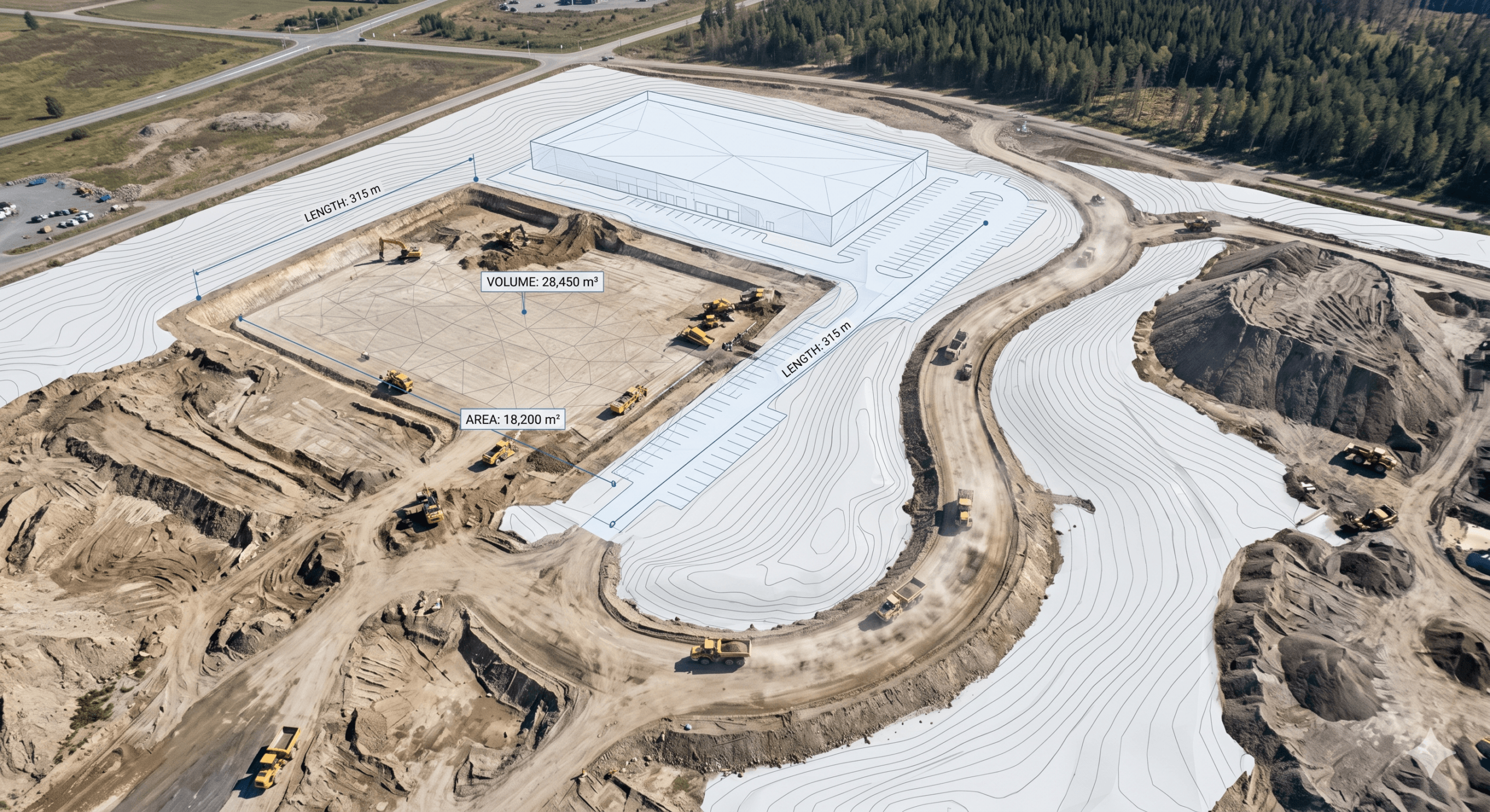
Propeller lets you overlay design PDFs directly on top of pre-bid drone surveys, so you can:
- Quickly identify conflicts between your site design and current ground conditions
- Visualize proposed builds during job walks
- Spot hazards early and prevent utility strikes
With a cloud-based 3D map you can access from anywhere, it’s easy to show GCs or developers exactly where features like parking lots, foundations, or utility lines will go. High-precision survey data from a short drone flight lets you estimate material volumes and labor hours accurately, giving you a competitive edge.
During construction: Stay in control and on budget
Most budgets go sideways as a project progresses and scope or timelines slip.
Propeller offers field management, risk management, and collaboration tools in one easy-to-use platform to protect your bottom line.
- DIY measurements: Propeller helps you track cut/fill and stockpile volumes without waiting on a surveyor, so your sites stay balanced and you always know exactly how much material you’re moving
- Automated documentation: Capture aerial images or on-the-ground photos automatically geotagged to their location on site, giving you visual evidence of what’s getting done and when
- Adapt quickly: Upload design revisions and verify on-site feasibility within minutes, helping you avoid disputes and rework
- Machine tracking: Get real-time surface updates and production data with DirtMate, our machine and progress tracking device — live field reporting with zero crew effort
As-builts: Documentation that protects your work
At project closeout, concrete evidence that you did the work right matters.
Import CSV points from surveyors showing features such as manhole covers and utility installs, and overlay them on your final drone survey to prove everything is where it should be.
You can also export 3D site maps and share them with clients, engineers, or inspectors for cleaner collaboration and fewer disputes. It’s harder to disagree when everyone is looking at the same map.
With an easy way to make measurements directly on the map without tapping a project engineer or surveyor, small contractors can move much faster — proving that you don’t need a large crew, just the right tools.
You don’t need a bigger crew — just better tools
You don’t need a full-time survey team or a room full of data engineers to use your site data wisely.
Steax achieved ROI with Propeller quickly through efficiency gains alone. Owner Robin Stenström can survey a site in ten minutes that would have once taken him days. Today, Robin’s clients share their 3D site maps with other stakeholders, streamlining communication at every step.
Small contractor Dirks even paid for their entire investment in Propeller through a single insight, eliminating a $20k overage.
With tools for collaboration, job costing, and mobile access, you can:
- Save hours per week on measurements and reporting
- Prevent costly rework by catching issues early
- Win more jobs with data-backed bids
- Improve site safety and compliance
- Track progress and share updates in just a few clicks
Deliver bids, progress reports, and proof of work that make you look better than the big guys — without adding headcount.
Ready to see what Propeller can do for you?
Level the playing field on your next job — without adding a single person to your crew.


