Propeller CAD 101: AI-powered earthwork design on real site terrain

Read Time: 3 mins
Quick links
    A blank sheet of paper peeling back to reveal miniature terrain with a yellow-edged haul road and graded pad

    Propeller CAD is an AI-powered concept design tool built into the Propeller platform that generates earthwork designs (haul roads, balanced pads, ramps, trenches, and catchment ponds) directly on real drone survey terrain from plain-language prompts. Designs are editable by describing changes, and finished concepts export as DXF for engineering handoff or TTM for machine control. It’s built for field and project teams who need a working concept on real ground before expensive engineering begins, not a replacement for certified deliverables.
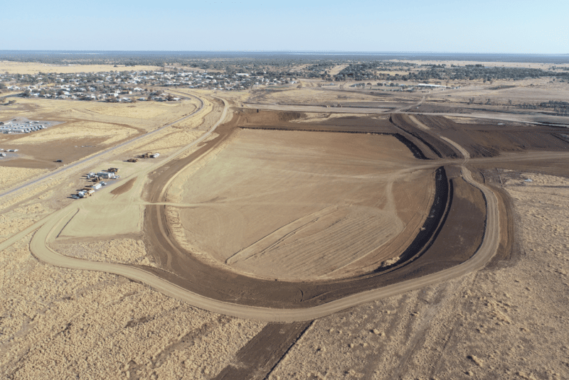
    Generate haul roads, pads, ramps, and drainage concepts in plain language: Directly on your actual drone survey terrain.

    Every earthwork design starts somewhere. Usually that somewhere is a phone call to a CAD operator, a sketch on graph paper, or a few rounds of back-and-forth with an engineering firm before anyone has confirmed whether the concept even works on your actual terrain.

    Propeller CAD changes where that starting point is.

    What Propeller CAD is

    Propeller CAD is an AI-powered concept design tool built directly into the Propeller platform. You describe an earthwork design in plain language (“a haul road from the entrance to the processing pad at 8% grade”) and Propeller CAD generates it on your site’s real drone survey terrain.

    The designs are editable. Describe a change, regenerate, and compare options without redrawing anything from scratch. When a concept is ready to move forward, export it as DXF or TTM for your engineering team to take into their tools. No CAD experience required, no terrain to import. You’re working on your actual survey data from the first prompt.

    What you can design

    Propeller CAD handles the core earthwork design types: all generated on your real survey terrain from a plain-language prompt.

    Haul roads and access tracks
    Graded route from a centreline with defined grade and width parameters.
    Balanced pads
    Cut/fill-aware pad design from a sketched outline on your terrain.
    Ramps
    Access ramps with defined grade and cross-slope.
    Trenches
    Trench lines with defined depth and width.
    Catchment ponds
    Sized to a drainage area or rainfall event.

    All of these generate on your actual drone survey surface. No blank canvas, no terrain import step. You’re designing on real coordinates and real elevations from the first prompt.

    What it is not

    This part matters, and it’s worth being clear about now.

    Use Propeller CAD for:
    Haul road and pad concepts on real terrain
    Iterating design options before costly engineering begins
    Quick-turn concept visuals for stakeholder conversations
    DXF / TTM export for engineering handoff or machine control
    Take to your engineer for:
    Certified or stamped design deliverables
    Legally mandated quantity calculations
    Final earthwork documentation for regulatory approval
    Complex alignment or high-precision output

    The export story

    When a concept is ready to move downstream, you export it in two formats.

    DXF
    The standard format for Civil 3D, 12D, Agtek, and most engineering tools. Hand it to your engineering team and they take it from there.
    TTM
    A terrain model format that feeds directly into machine control systems and GPS data collectors, useful for getting a concept onto the ground before final engineering review.

    You can also attach your company’s design standards as a document in the CAD chat (PDF, CSV, TXT) and Propeller CAD will use them as context while generating. Outputs reflect your specs, not generic defaults.

    2.5 days
    → 10 min
    Time to complete a preliminary haul road design, on real site terrain, from a plain-language prompt.

    Who it’s for

    Propeller CAD is especially useful for teams who need to move fast from concept to something concrete.

    Field and project teams
    Explore a concept quickly without engaging a CAD operator for every iteration. Shape the idea, then hand it off.
    Small contractors without a dedicated CAD workflow
    Get a starting point before handing off to an engineer. Real terrain. Real constraints. Faster first conversation.
    Teams already in Propeller
    Sketch a design concept against your current site surface before a stakeholder conversation, no terrain import, no file wrangling.
    Anyone communicating a design idea
    Show it on real terrain so the team member or owner can actually understand what you’re proposing, not a sketch on a printout.

    How to get access

    Propeller CAD is currently in beta. The team will walk you through it on your own site data. If you’re already a Propeller customer, ask your Customer Success Manager about getting access. The Propeller help center getting started guide is the best place to begin once you have access.

    Quick links

      Related articles

      Product Updates: What Has Propeller Been Up to Lately?

      Since our inception, Propeller has taken a customer-first approach to product development. No one knows…

      Real sites, real results: How earthwork teams are winning with Propeller

      Propeller customers across earthwork, construction, and civil infrastructure are seeing real results from frequent drone…

      Kansas-based Hamm Companies Saves Surveying and Data Processing Time with Propeller

      Founded in 1954, Hamm Companies is a leader in the Midwest in highway construction, aggregates,…

      Ready to learn how Propeller can power up your worksite?

      We’re happy to show you how Propeller can power your worksite, and boost productivity.

      Related articles

      Cross section survey in a matter of minutes using drone data

      With the power of drone-captured data and the Propeller Platform, surveying cross sections becomes as…

      How to Use Drone Data to Improve Landfill Performance

      If you manage a landfill, you may have been wondering how you can use drones…

      How to Collaborate Better Using Drone Data and the Propeller Platform

      Keeping everyone on your worksites up to date with the best and most recent information…